Storms late this evening but the end of the week is drier
By: Emily Kennedy
Posted: Jul 21, 2020 3:03 AM EDT

-
3:22

Calm today, storms return Sunday
-
2:58

Thousands of people across Michiana experienced power outages...
-
1:13

Earl Wigfall holds Detective Trivia Night for Sheriff campaign
-
1:50

Preparations underway for South Bend’s annual St. Patrick’s...
-
0:24

CAVA set to open in Mishawaka
-
1:16

Groundbreaking project underway for housing development
-
0:52

Jefferson Boulevard renamed to kickoff St. Patrick’s Day festivities
-
0:35

Congressman Rudy Yakym on Iran conflict
-
3:22

A look at some of the big concerts coming to St. Joseph County...
-
1:50

Mild Sunday, snow Monday
-
4:37

Morris Performing Arts Center show season starts tonight
-
1:53

Thousands without power due to high wind gusts

ABC57 First Warning Neighborhood Weather
Tuesday, July 21st, 2020
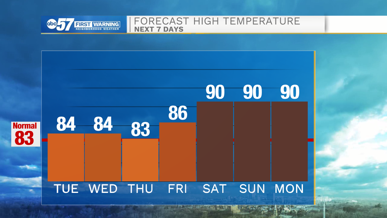
Temperatures remain in the low to mid-80s through this week with some mugginess. Clouds increase this morning with showers/storms arriving after 7pm. Showers/storms become widespread overnight and a shower could linger into Wednesday morning. The rest of the week looks nice and dry. This weekend heats back up! Daytime highs return to the low 90s.
Today: Mostly cloudy. Showers/storms late. High 84.
Tonight: Scattered showers and storms. Low 70.
Wednesday: Early shower possible, mostly cloudy. High 84.
Thursday: Mostly sunny. High 83.
Sign up for the ABC 57 Newsletter