
-
2:48

Storms arrive this evening, Snow Monday morning
-
4:33

Blustery and stormy today
-
0:39

Michiana Home Show continues to bring vendors to South Bend
-
0:58

Cookies and Canvas for the Heart raises awareness for children’s...
-
2:07

Most residents have power restored following high winds
-
0:44

26th annual St. Patrick’s Day Parade takes over Downtown South...
-
2:42

Active weather arrives Sunday
-
3:22

Calm today, storms return Sunday
-
2:58

Thousands of people across Michiana experienced power outages...
-
1:13

Earl Wigfall holds Detective Trivia Night for Sheriff campaign
-
1:50

Preparations underway for South Bend’s annual St. Patrick’s...
-
0:24

CAVA set to open in Mishawaka

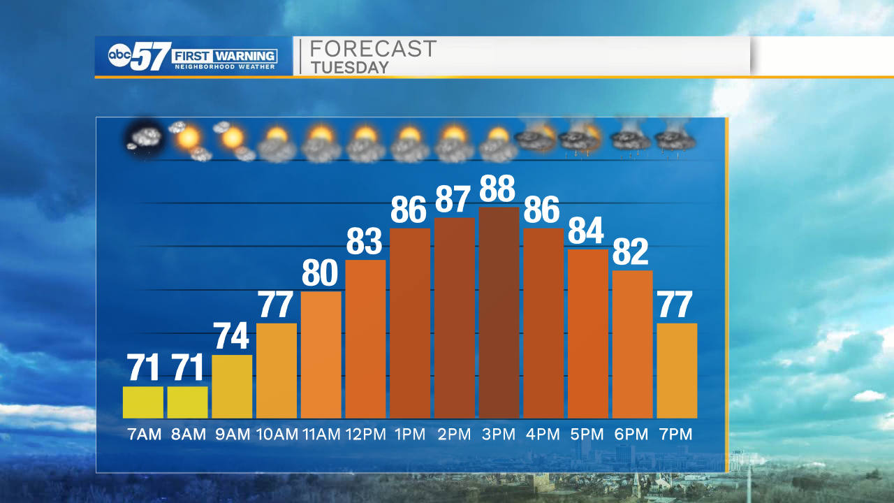
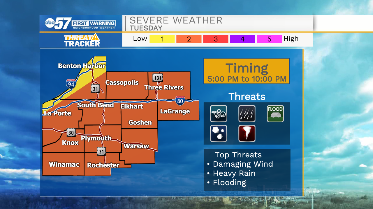
The heat, haze and humidity continue Tuesday. Focus turns to the cold front that will arrive Tuesday evening and the storms and severe potential. Storms will develop into a line that moves across the area, the main threat will be strong wind but heavy rain, hail, flooding and even a tornado are possible. The timing is 5:00 to 10:00 PM with areas north earlier and south later. This is not the best set-up for the strongest storms, but the timing and conditions are more favorable than recent events. There is a temporary break from the heat, Wednesday. Temperatures rise again into the weekend.
Tonight: Partly cloudy. Low 70.
Tuesday: Evening thunderstorms. High 90.
Wednesday: Partly cloudy. High 78.
Thursday: Mostly sunny. High 82
Sign up for the ABC 57 Newsletter