
-
5:34

The Huddle Roundtable: Storylines shaping Notre Dame’s future
-
4:26

Jeremiyah Love’s rise from Notre Dame star to No. 3 NFL Draft...
-
4:53

Looking ahead to Notre Dame’s next football chapter
-
4:54

Coach says spring camp has been a test for the Fighting Irish,...
-
1:17

Mild weekend, stormy Monday
-
0:47

Cooler out the door, mild today
-
1:05

New non-profit campaign aims to educate parents and kids about...
-
0:56

Press conference held regarding the future of Portage Manor
-
0:56

Fans thrilled by Mishawaka meet and greet with Notre Dame football...
-
6:03

Notre Dame unveils ’The Shirt’ ahead of tomorrow’s Blue-Gold...
-
2:31

Berrien County natives crowned World Champions at Axe and Knife...
-
0:37

Shooting in 200 block of Studebaker Street leaves one injured

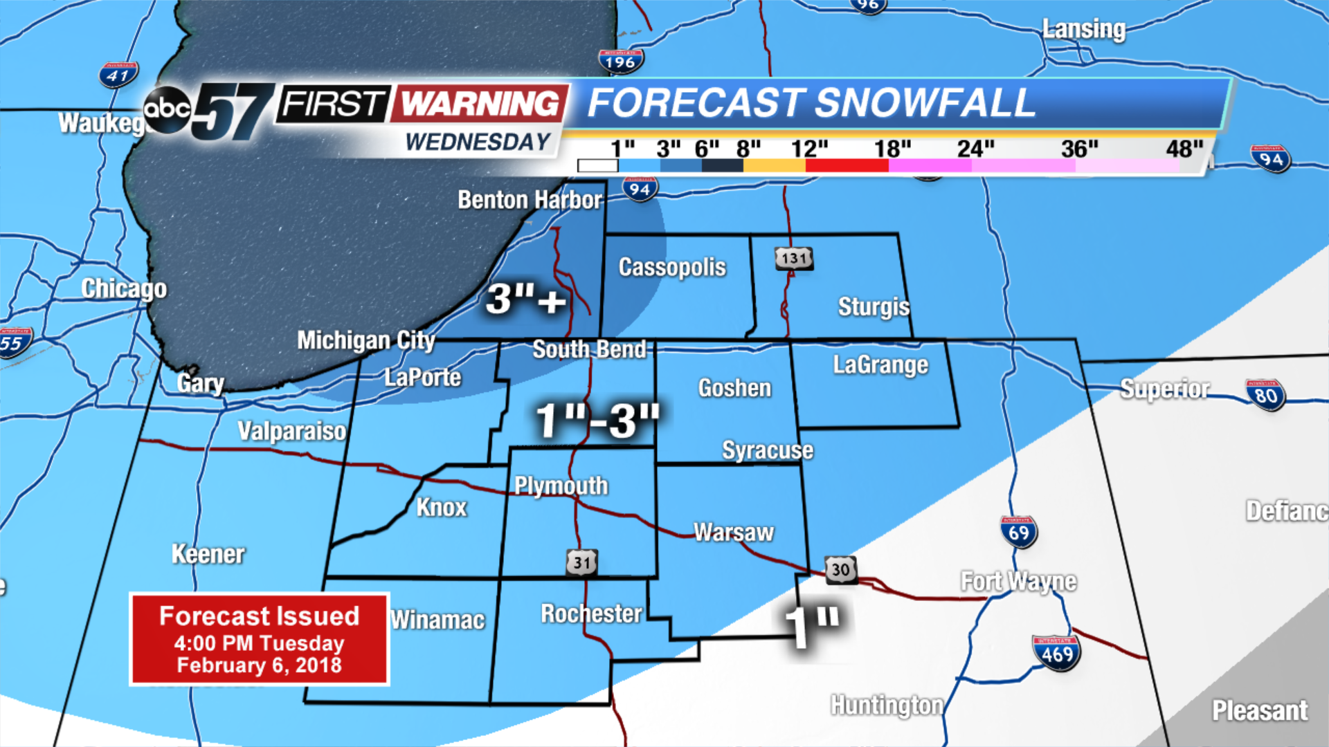
Another round of snow starts after midnight, this will have a bigger impact on travel as it lasts through the morning drive Wednesday
Wednesday will start with widespread snowfall, then transition to scattered lake effect snow showers in the afternoon. Many will see around three inches of accumulation with the highest amounts near the lake. A lull Thursday, before more snow Friday and this weekend. Each round of snow is likely to bring around three inches of snow. The snowy pattern shows signs of breaking next week.
Tonight: Snow starts after midnight, low of 16.
Wednesday: Snow showers, high of 22.
Thursday: Mostly cloudy, chance of snow late, high of 20.
Friday: Snow showers, highs in the upper 20s.
Sign up for the ABC 57 Newsletter