
-
2:34

ABC57’s Tipoff crew with a preview before the matchup between...
-
3:27

ABC57s Summer Horan explore the St.Joe- Notre Dame connection
-
0:32

Downtown South Bend hosted “Fire and Ice“ First Fridays
-
0:53

Third annual Michigan Black Summit kicked off today at Lake Michigan...
-
2:04

Annasue Rocha, Martin’s shooting victim, laid to rest Friday
-
2:10

Wintry mix Saturday then snow overnight, quiet conditions for...
-
0:32

Fatal officer-involved shooting outside Martin’s ruled justified
-
0:26

One suspect captured, one eludes authorities after stolen vehicle...
-
4:15

Boys Scouts of America undergo name change
-
4:27

Connect 574’s second Birthday Bash raising funds for Boy and...
-
1:45

Sigma Gamma Rho’s seeks donations for ’Project Cradle Care’...
-
1:44

Near freezing Friday with wintry weather on Saturday

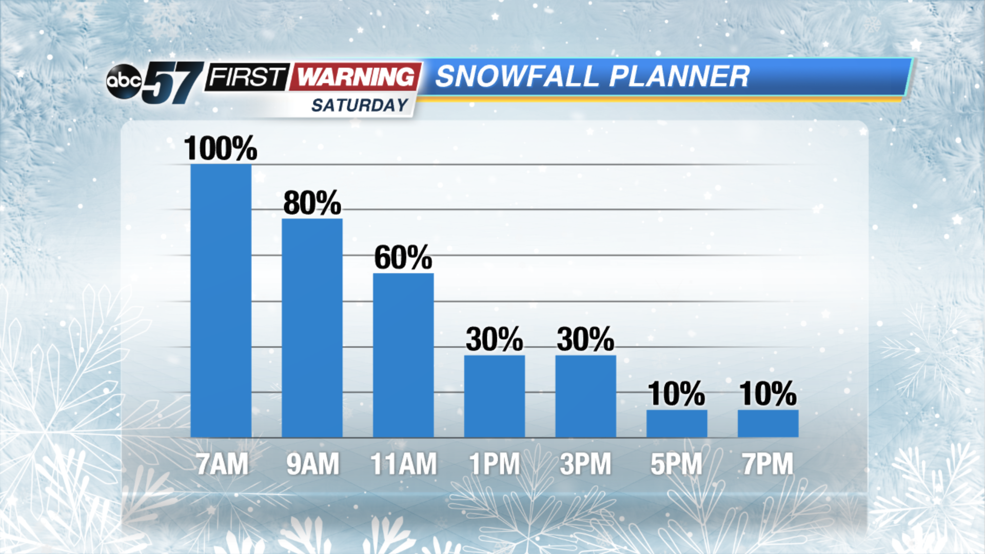
Snow showers begin by late Friday evening, ramping up after midnight. Widespread moderate to heavy snow will last through Saturday morning. By daylight at least three inches of snow is likely for much of the area.
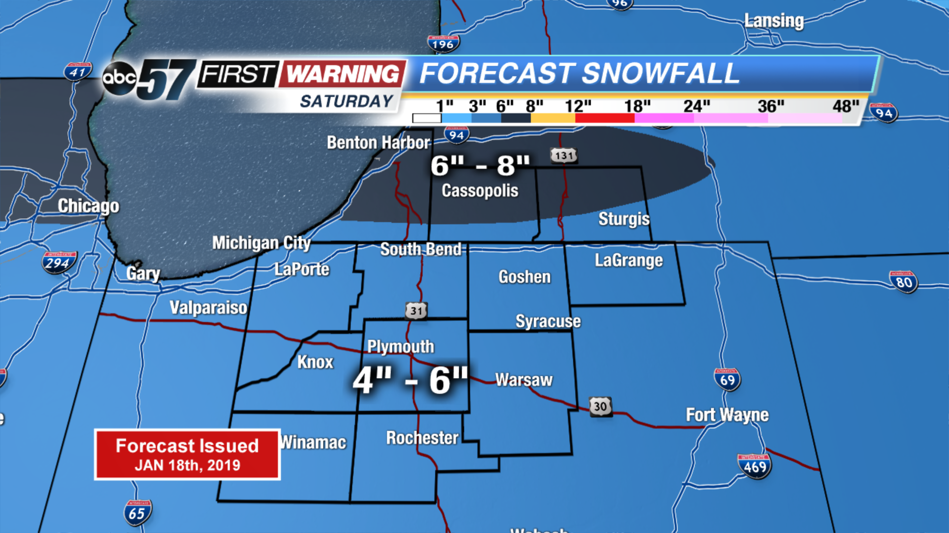
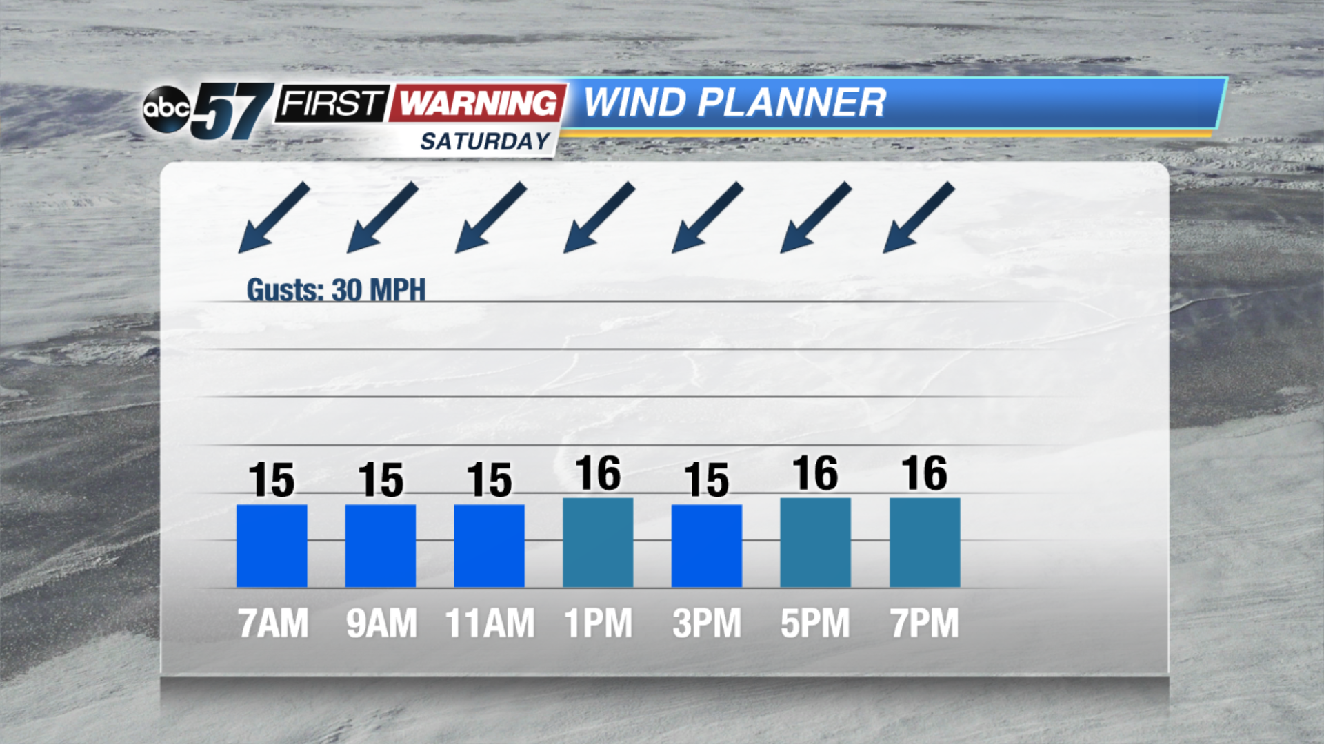
Snow and blowing snow will make for an impactful weather day across Michiana. Snow lasts through at least noon Saturday, tapering off through the early afternoon. Even after the snow is done falling, blowing and drifting, especially on north-south roads will continue, an east wind will gust up to 30 mph. Temperatures tank into Sunday, lows nearing or dropping below zero and highs in the teens.
Tonight: Increasing snow showers, low of 22.
Saturday: Snowy, heavy at times and breezy, high of 24.
Sunday: Partly cloudy, very cold, high of 16.
Monday: Mostly sunny, high of 14.