Snowy pattern begins with lake effect Thursday
Posted: Dec 6, 2017 4:21 PM EDT | Updated: Dec 6, 2017 5:22 PM EDT

-
2:13

Dense fog this morning, more rain on the way tonight
-
2:26

Mike Braun celebrates primary success
-
2:39

Tornadoes touch down, leave extensive damage at FedEx facility
-
2:12

St. Joseph County Commission primary results
-
1:00

Storms are done, fair Wednesday, rain Thursday
-
2:02

District 10 Senator David Niezgodski provides statement on recent...
-
1:01

Fire at Ramona Roller Rink and Miniature Golf Course, believed...
-
1:43

Indiana’s 3rd Congressional District primary
-
2:35

Tornado Watch issued for Michiana this afternoon
-
0:38

Former assistant theater director charged with Child Seduction...
-
2:49

Upgrading Tuesday’s severe storm threat
-
2:15

Concerns for rise in gun violence after five-year-old injured...

Lake effect snow showers begin early Thursday morning and last through midday. Final totals of one to three inches are likely in the lake effect zone from South Bend – Elkhart and northward. The amount of snow may not be overwhelming but most of it falls during the morning commute. Snow ends Thursday afternoon, sunshine returns Friday before more widespread snow Saturday.
Tonight: Mostly cloudy, breezy, snow after 3 AM, low 24.
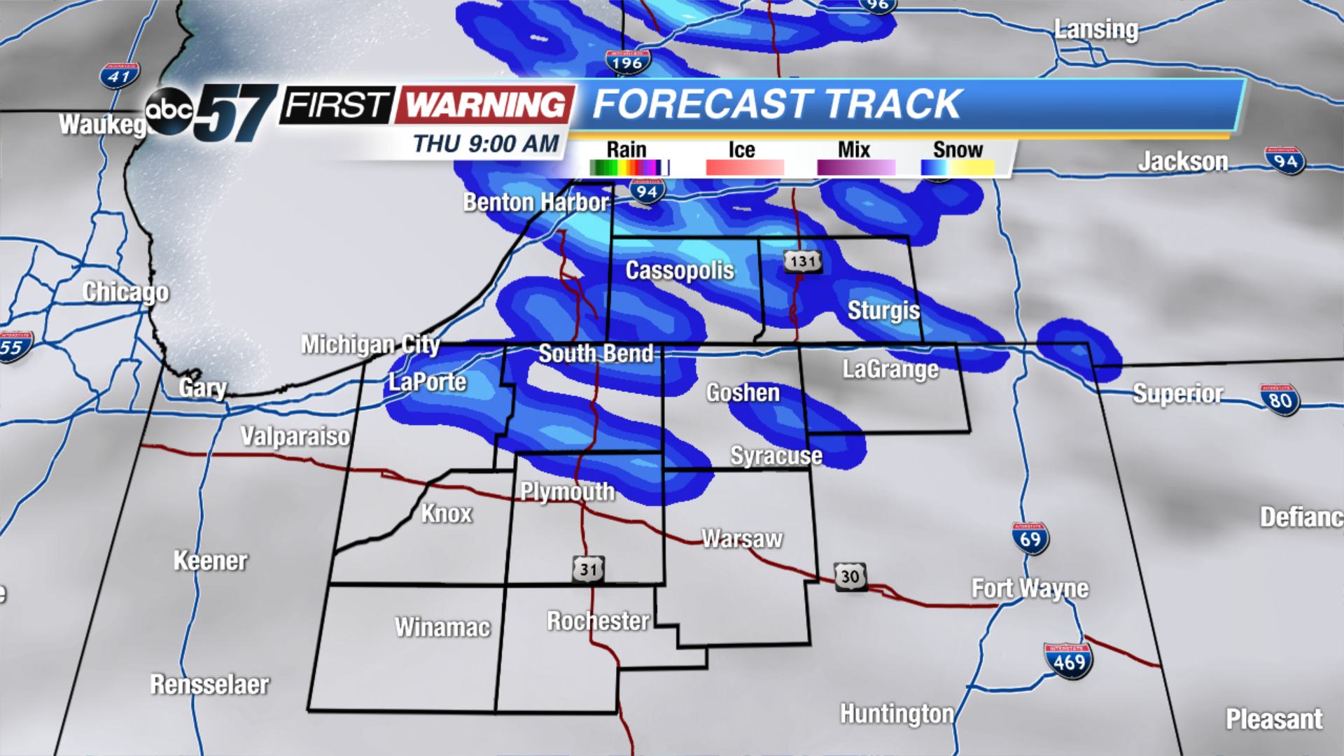 Lake effect snow lasts through Thursday morning
Thursday: Lake effect snow showers, high of 28.
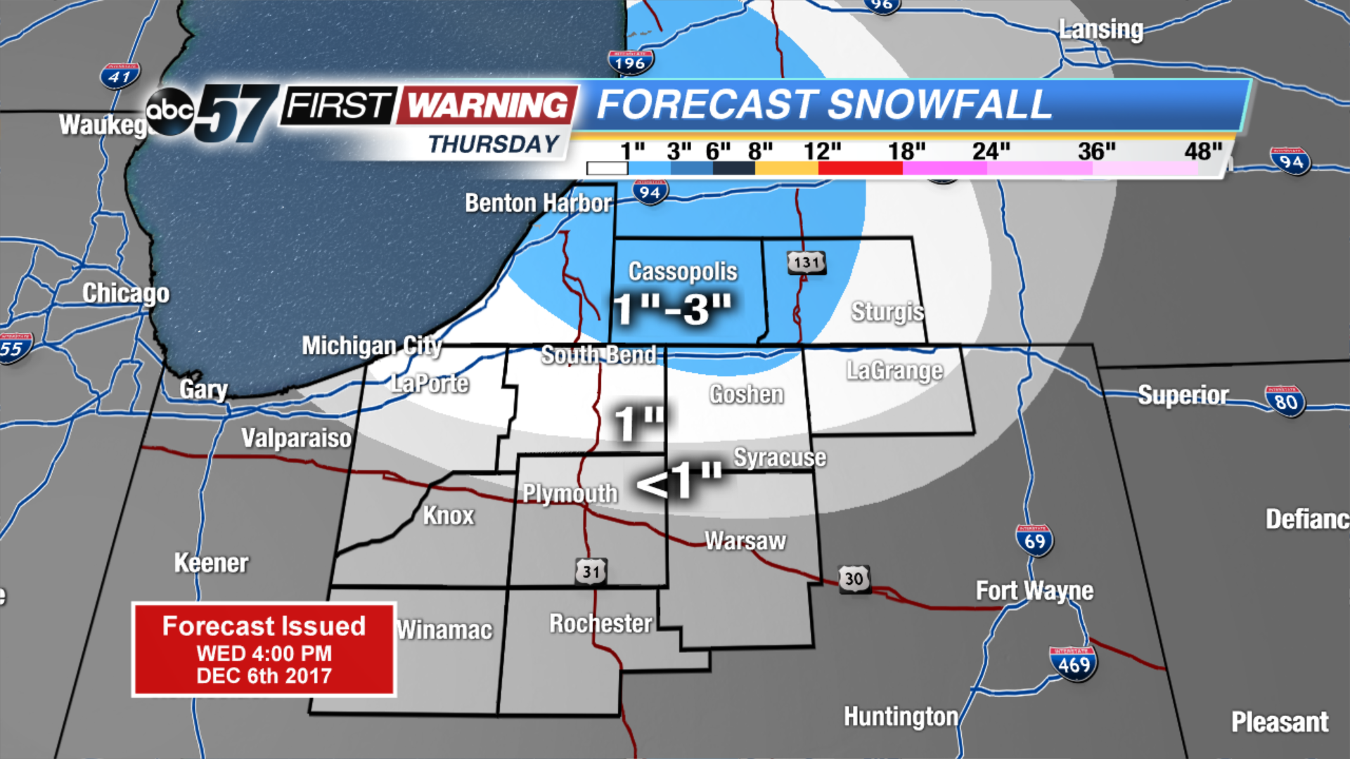 Up to 1
Up to 1
Up to 1
Friday: Mostly sunny, high of 30.
Saturday: Snow showers, highs near 30.
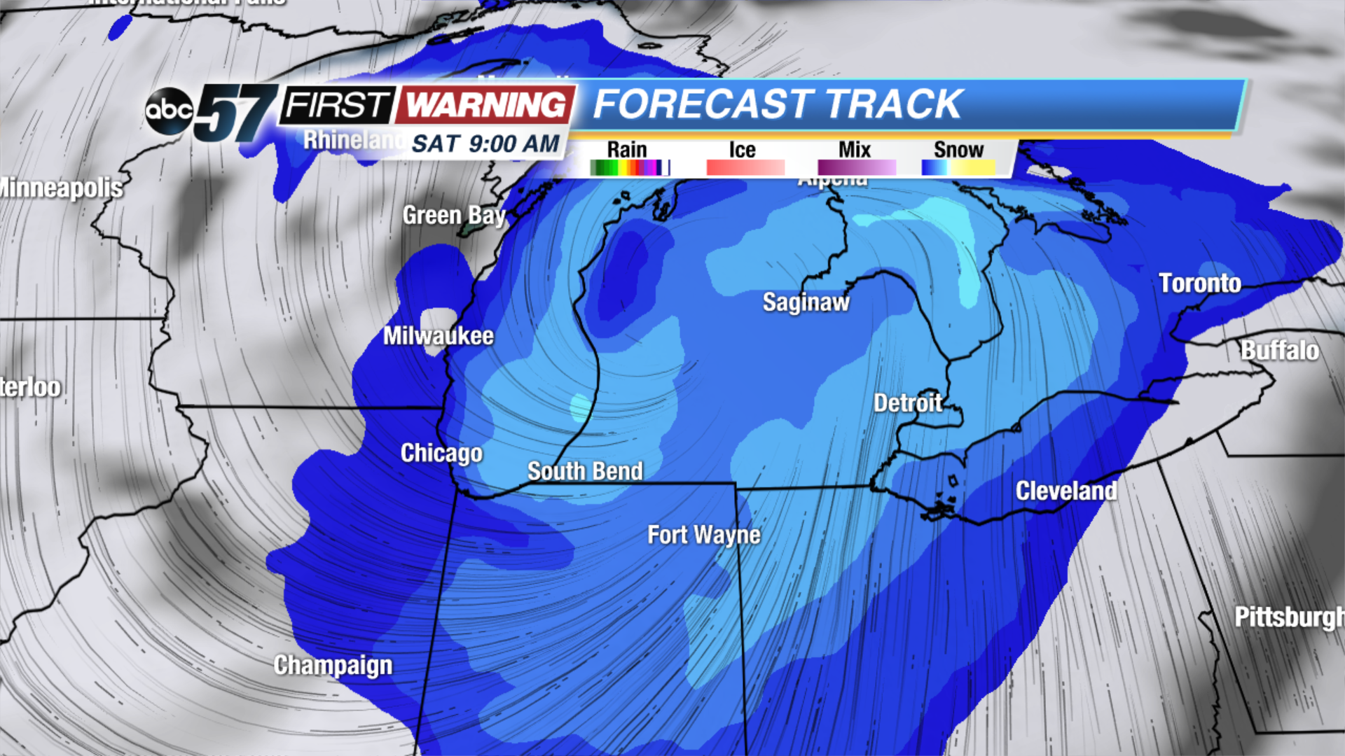 More widespread snow expected Saturday morning
Sign up for the ABC 57Newsletter