Snowy and extreme cold pattern sticks around through next week

-
0:30

Prayer vigil held for domestic violence victim in South Bend
-
1:10

Bristol Town Council voting in favor tonight for the annexation...
-
0:52

Official ribbon cutting for The Delta neighborhood in Elkhart
-
1:08

Traveling or booking a trip soon? Here’s what to know
-
0:27

Elkhart Police Department investigating a hit and run on Cassopolis...
-
2:40

Recovery efforts continue after EF-1 tornado devastated Edwardsburg
-
1:22

The March rollercoaster continues
-
0:55

Mishawaka High School Theatre presents ’Chicago! Teen’
-
19:10

How public records requests increase government transparency
-
2:25

Local chef showcasing her food at Pacers game
-
3:46

Local farmers concerned war with Iran will impact fertilizer
-
2:56

The partial government shutdown is impacting travel across the...

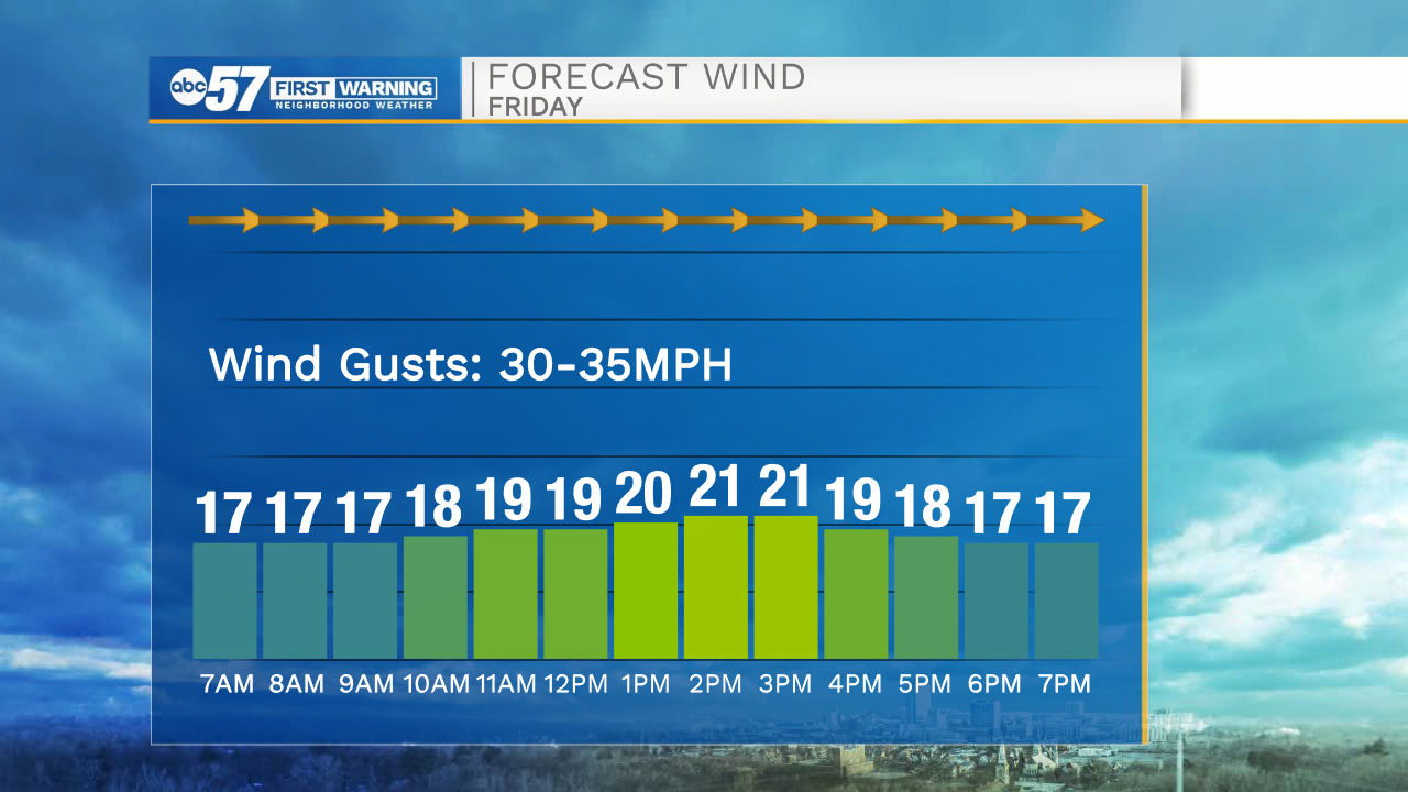
Temperatures this morning continue to drop into the teens with wind chills nearing the negatives. Road conditions this morning are very slick due to ice and snow pack. We are also tracking gusty winds into the 30-40mph range. Winds look to stay on the stronger side into the afternoon. High temperatures today will only top out in the upper teens. Another round of snow moves into Michiana Saturday evening, bringing chances for a few additional inches of snow in some areas. The snow and cold pattern will continue into next week. Low temperatures will mostly stay in the single digits with high temperatures in the teens.
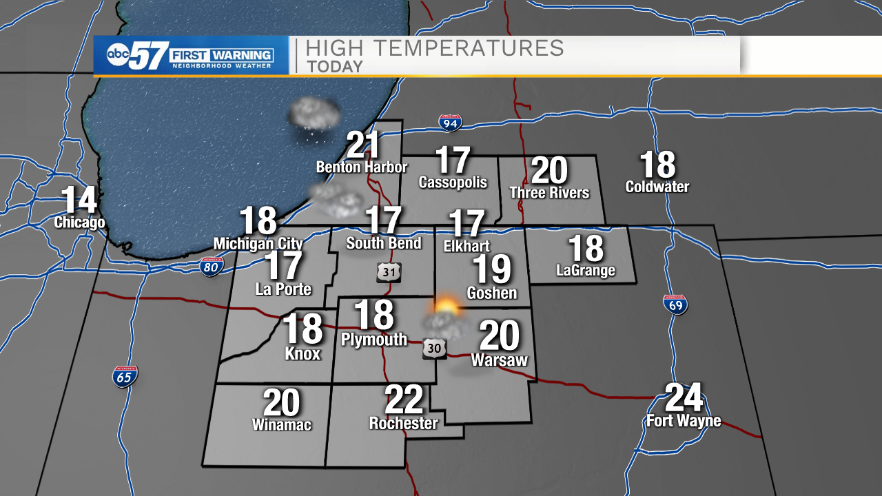
Today: Cloudy and breezy. High 17.
Tonight: Cloudy. Low 8.
Tomorrow: Evening snow showers. High 15.
Sunday: Snow showers. High 12.