
-
1:48

Scattered showers this evening, Much cooler overnight
-
1:50

Showers and storms this afternoon
-
0:20

One person injured in shooting
-
0:36

Eddies Circuit Robotics holds competition Saturday
-
0:32

21st annual Nappanee Model Train Show
-
0:38

Local boys basketball team headed to IHSAA state finals
-
3:49

Midwest Meowfest brings kitten advocacy to attendees, new homes...
-
1:52

Mild tonight, showers tomorrow
-
1:43

Pleasant to start the weekend
-
3:06

Pulaski County weighs stricter solar rules amid resident concerns
-
0:40

Marian High School hosts World Down Syndrome Awareness Walk
-
2:33

South Bend leaders call for an end to gun violence

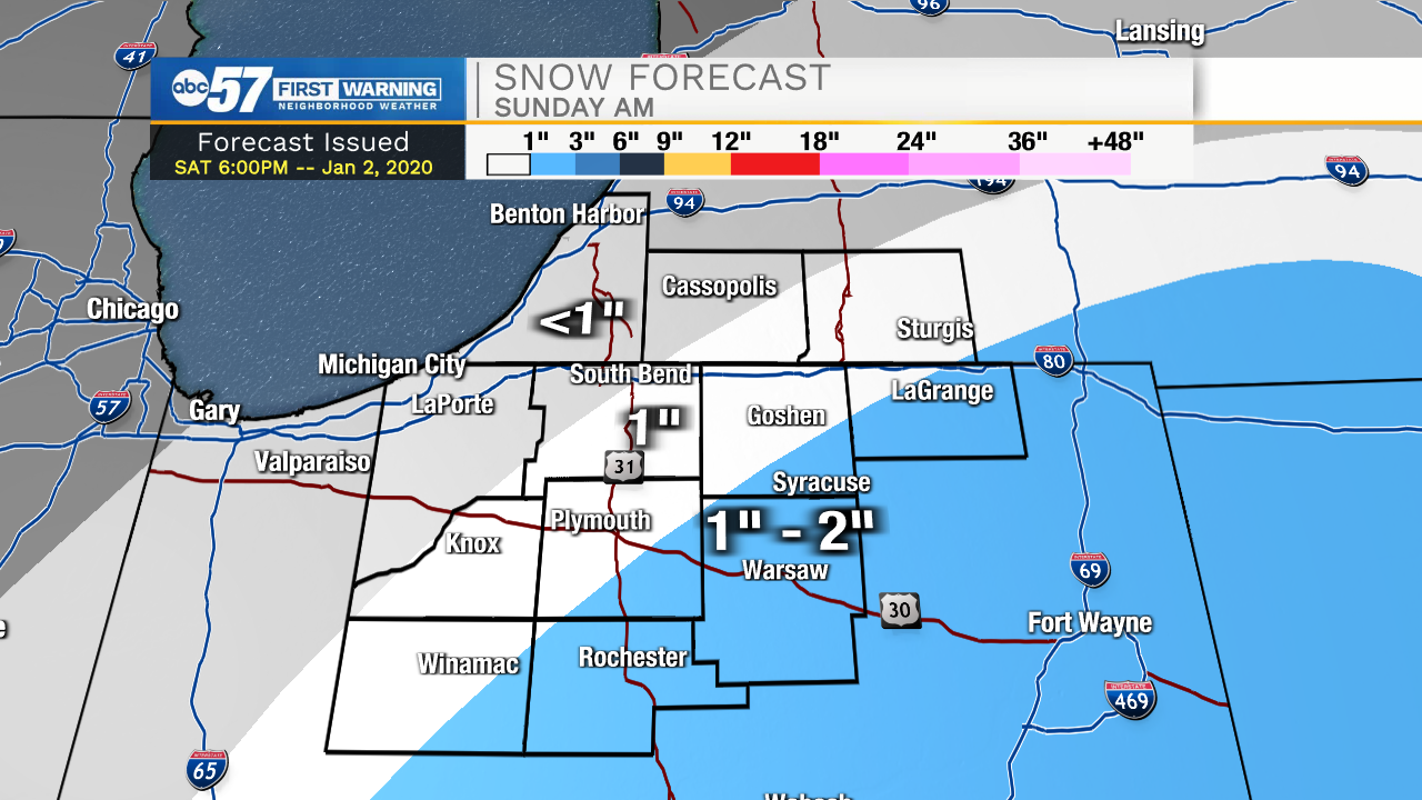
Light rain showers look to develop later this evening. The rain will turn over to snow during the early morning tomorrow. Snow accumulation will be around 1-2 inches for our far southern counties. A dusting to an inch is possible for the rest of the Michiana area. Expect a few slick spots on the roadways tomorrow morning. High temperatures during the afternoon will top out in the mid 30s. Dry weather is in the forecast for Monday and Tuesday, but then snow chances return on Wednesday. High temperatures this week will remain steady in the mid to upper 30s.
Tonight: Snow showers. Low 30.
Tomorrow: Snow showers. High 36.
Monday: Mostly cloudy. High 38.
Tuesday: Partly cloudy. High 38.
Sign up for the ABC 57 Newsletter