


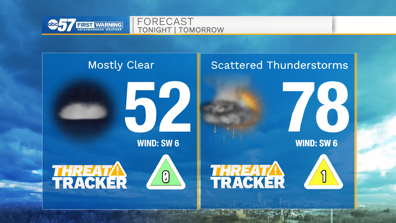
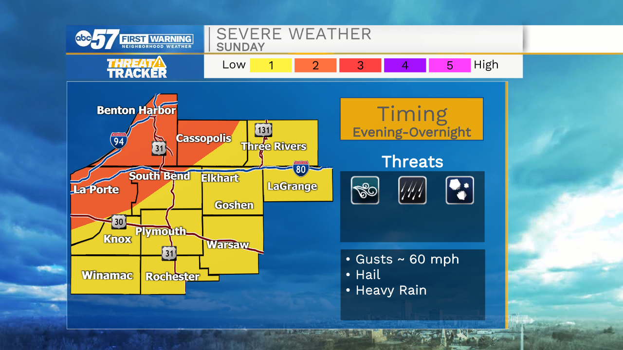
Clear skies and dry weather will remain in place through the rest of the evening. Tomorrow morning around 4am showers and storms will move in out of the northwest. Widespread rain is expected for everyone in Michiana. Rain chances diminish by midday and then pick back up during the late afternoon and evening. A few storms tomorrow night could be on the strong to low end severe side, with all modes of severe weather possible. Labor Day will be cloudy with isolated rain and storm chances as well. Temperatures will be in the mid 70s.
Better rain chances return to the forecast on Tuesday and will stick around through Wednesday. We finally start to see rain showers and thunderstorms clear out Thursday afternoon and evening. Temperatures next week look to stay in the low to mid 70s. Dry weather is still in the forecast for next weekend.
Tonight: Scattered showers and storms. Low 52.
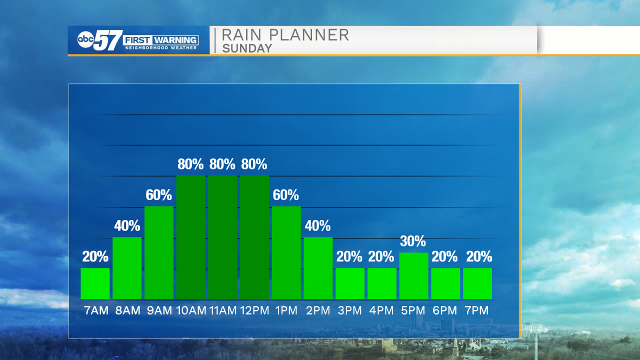
Tomorrow: Scattered showers and storms. High 78.
Labor Day: Isolated showers and storms. High 76.
Tuesday: Scattered showers and storms. High 73.