Round of light snow tonight before we turn extremely quiet
By: Tyler Sebree
Posted: Dec 15, 2019 5:25 PM EDT
-
1:56
Week wraps up mostly dry, but rainy Easter weekend in store
-
3:09
City of South Bend shares plans of ’Madison Lifestyle District’...
-
2:09
Michigan State Trooper opens fire on suspect in Benton Harbor
-
4:10
Palisades to restart with $1.5B federal loan
-
1:21
’Spring into Action for Kids’ at Middlebury Food Pantry
-
1:09
Fair until Saturday, showers on either side of Easter
-
1:19
Baby box named after late Congresswoman Jackie Walorski
-
1:46
County assessor holds town hall in New Carlisle Township
-
2:02
Mishawaka HS hosts college signing day for student athletes!
-
3:51
The Easter Egg-Straordinaire returns to Linton’s Enchanted...
-
2:07
Police investigating bomb threats made against Brandywine and...
-
1:52
Cloudy, breezy Wednesday morning; improvements this afternoon
FIRST WARNING NEIGHBORHOOD WX FORECAST
Sunday, December 15th, 2019
A round of light snow is on the way for tonight with areas along and south of U.S. 30 having the best chance at seeing upwards of an inch of snowfall by early Monday morning. Beyond this there really isn't much to talk about in the forecast.
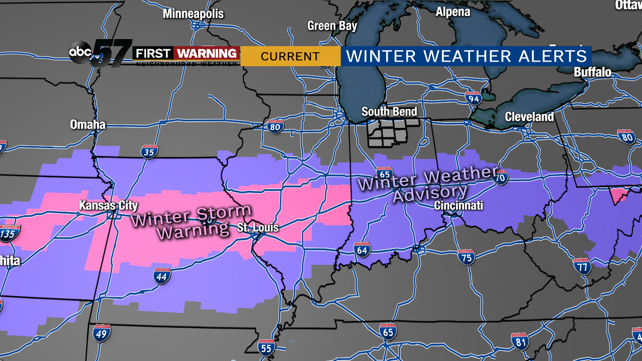
Things are looking rather quiet and dry all the way through Christmas Day as it looks now. No one day has more than a 20% chance of precipitation. We even have several days with a fair amount of sunshine in the forecast! What makes the dry pattern even better is temperatures are going to warm to above normal levels by Friday and beyond. Highs each day beginning next Friday will reach the 40s. We may even flirt with 50° depending on how things wind up developing.
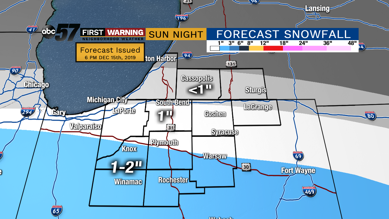
Tonight: Cloudy with light snow. Low of 24.
Monday: Mostly cloudy. High of 35.
Tuesday: Mostly cloudy during the morning with clearing by afternoon. High of 32.
Wednesday: Mostly cloudy skies, especially in lake effect zones. High of 25.
Sign up for the ABC 57Newsletter