
-
1:52

Storms possible overnight, strong storms by Tuesday evening
-
3:48

New partnership aims to help fight food insecurity across Elkhart...
-
2:00

A sunny Monday ahead, rainy almost every other day this week
-
2:59

Dusty May leads Michigan back to Final Four with dominant win...
-
0:37

Vendors and cosplayers showcase art at South Bend Anime Fest
-
3:06

Palm Sunday procession in South Bend unites faiths in call to...
-
0:48

2026 Auto Show brings crowd to Century Center Sunday
-
2:34

Warm to start the week, Rainy week ahead
-
2:44

Warmer, breezier, and cloudier than yesterday
-
0:46

Crowds gather for Fins and Feathers Fest at La Porte City Fairgrounds
-
0:46

Paramount School of Excellence hosts teacher fair
-
2:30

Voting advocacy, peaceful demonstrations and donations: South...

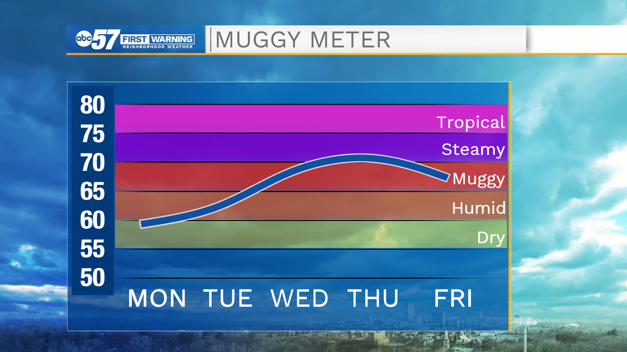
The humidity starts to rise Tuesday and temperatures rise into the upper 80s. The first peak in the mugginess Wednesday evening brings a chance of scattered storms into Thursday morning and a short-lived break in the heat. The storm severe threat is very low. The real hot weather starts Friday and lasts through the weekend, highs in the 90s and a heat index in the mid to upper 90s.
Tonight: Clear. Low 60.
Tuesday: Mostly sunny. High 87.
Wednesday: Partly cloudy, afternoon/evening thunderstorms. High 88.
Thursday: Morning showers evening, partly cloudy. High of 86.
Sign up for the ABC 57 Newsletter