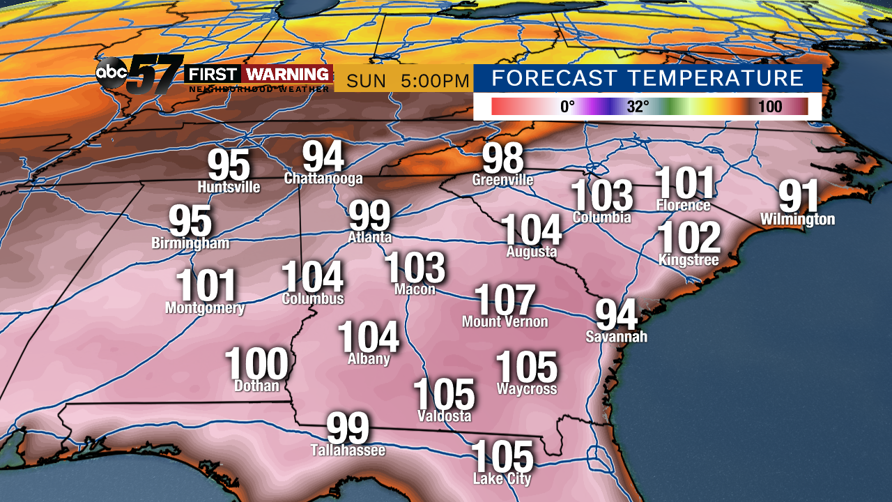
A big-time heatwave is set to impact the Southeast into early June. Most locations in states like Georgia, South Carolina, North Carolina, Florida, and Alabama will see highs in the 90s and even the 100s for more than a week straight. Many daily record highs will be broken; some all-time record highs for the month of May could fall as well.
 Potential Highs for Memorial Day Weekend.
Some cities could see actual air temperatures push 105° or hotter through Memorial Day weekend. Put simply, it's the kind of heat that just doesn't happen all that often. That is especially true for late May. It will be a dangerous stretch of weather for that part of the country. It's all due to the "ring of fire" weather pattern that will set up shop across the eastern half of the country. A dominant area of high pressure will anchor itself in the Southeast and provide an extended period of heat and dry weather. Meanwhile, areas across the middle of the country will see round after round of rain and thunderstorms as precipitation travels around the high like a ring.
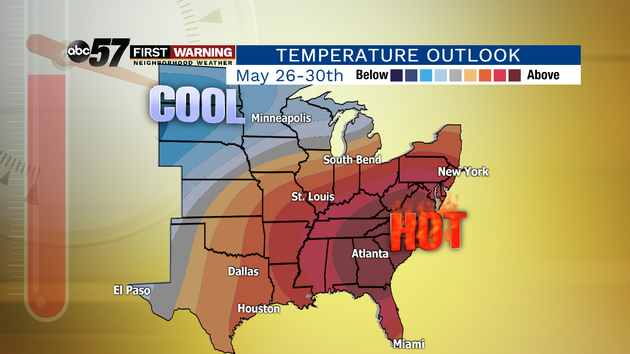 Temperature outlook for the last week of May.
CPC
Temperature outlook for the last week of May.
CPC
While it won't be oppressively hot in Michiana, this type of pattern should deliver highs in the 70s and 80s through at least the end of May. A day in the 60s is possible around Memorial Day itself, but we will be seeing typical warmth and humidity for the most part.
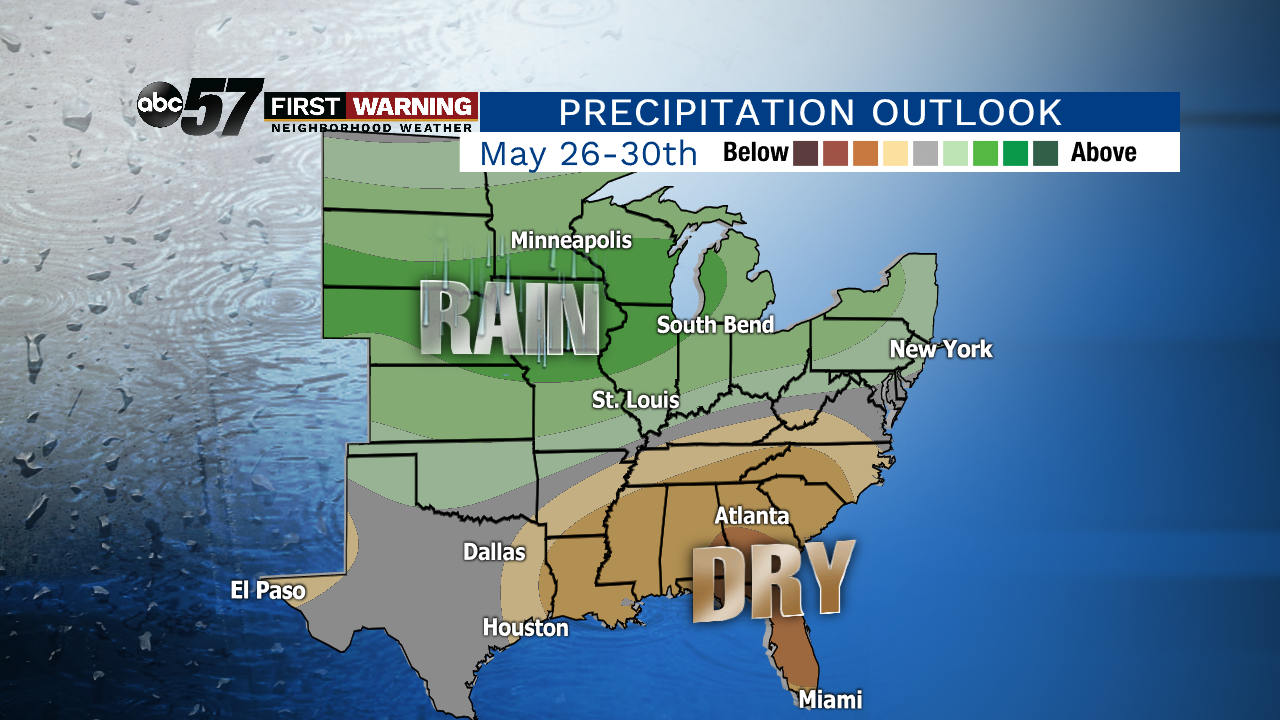 Precipitation outlook for the last week of May favors rainier than normal conditions in green.
CPC
Precipitation outlook for the last week of May favors rainier than normal conditions in green.
CPC
Let's switch gears and break down the rain and thunderstorm chances in this "ring of fire" pattern. As is typically the case with these setups during the late spring and summer months, Michiana and surrounding areas will be in a location that favors rounds of rain and storms. Will it rain every single day? Probably not. Will any one day be a total washout? Not likely. Are showers and storms possible at just about any point over the next 1-2 weeks? Yes.
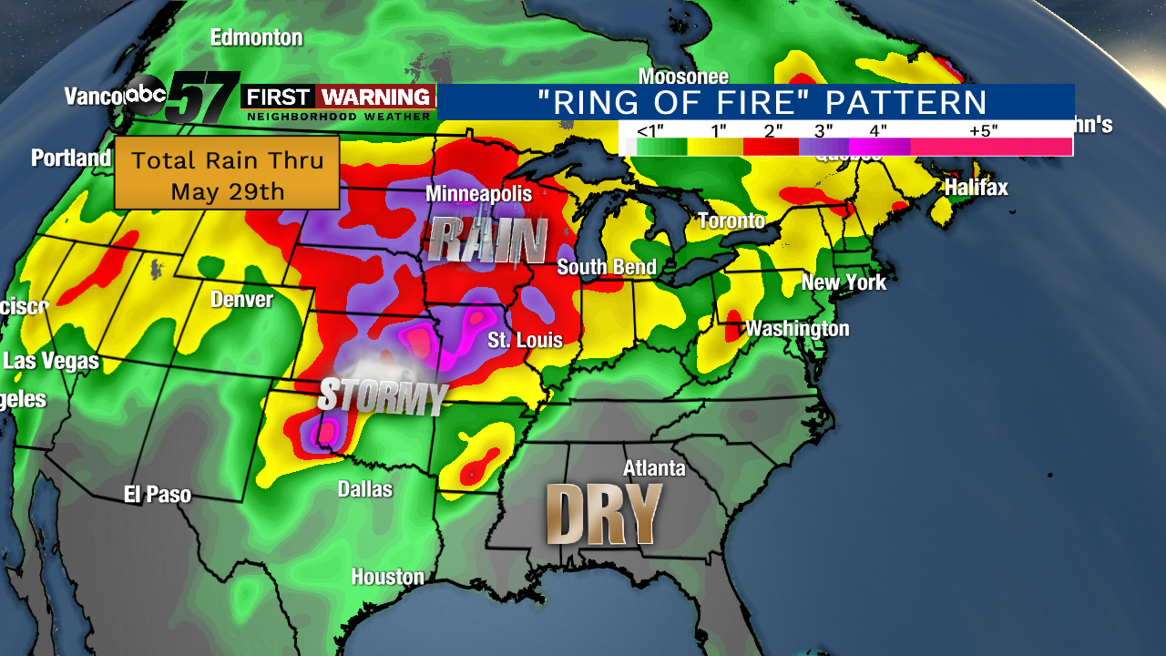 Active pattern with plenty of rain and storms thru the end of May across the Plains, Midwest and Great Lakes.
The absolute heaviest of the rain thru the end of May will fall just to our west across the Plains and Midwest. Those locations will be most impacted by the rounds of rain and thunderstorms in this particular "ring of fire" setup. However, the Great Lakes, including Michiana, will still see several waves of showers and storms thru early June. A day or two could even feature heavy rain, or even a severe threat depending on how things evolve on any given day. Predicting exactly when the rounds of showers and storms will move through in these types of setups is extremely difficult until you're 1-2 days out. Therefore, we don't suggest canceling any holiday weekend plans despite the chances for showers and storms. There are signs the pattern may break at least somewhat once we get into the first week of June.


