-
1:38

Community tornado shelters open in rural counties ahead of storm...
-
2:21

Microsoft breaks ground on new Data Center in La Porte, Indiana
-
3:43

Demolition underway to make room for Colfax Corner development
-
5:20

CARE University helping support college students day to day
-
5:34

Suspect dead after officer-involved shooting on South Bend’s...
-
1:45

The rain and storm threat clear this evening
-
2:32

Some optimism that the risk for severe weather is slightly decreasing
-
1:07

What’s expected from the Fed’s interest rate decision Wednesday
-
1:42

City of South Bend supporting those in opioid addiction recovery...
-
2:30

Round one of storms arriving soon
-
2:10

Be weather aware today, Dangerous storms this evening
-
3:04

Victim’s family advocates for Facebook Marketplace safety after...

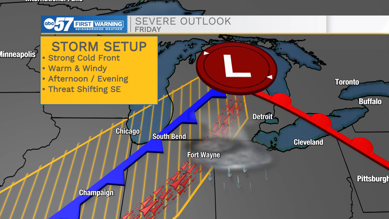
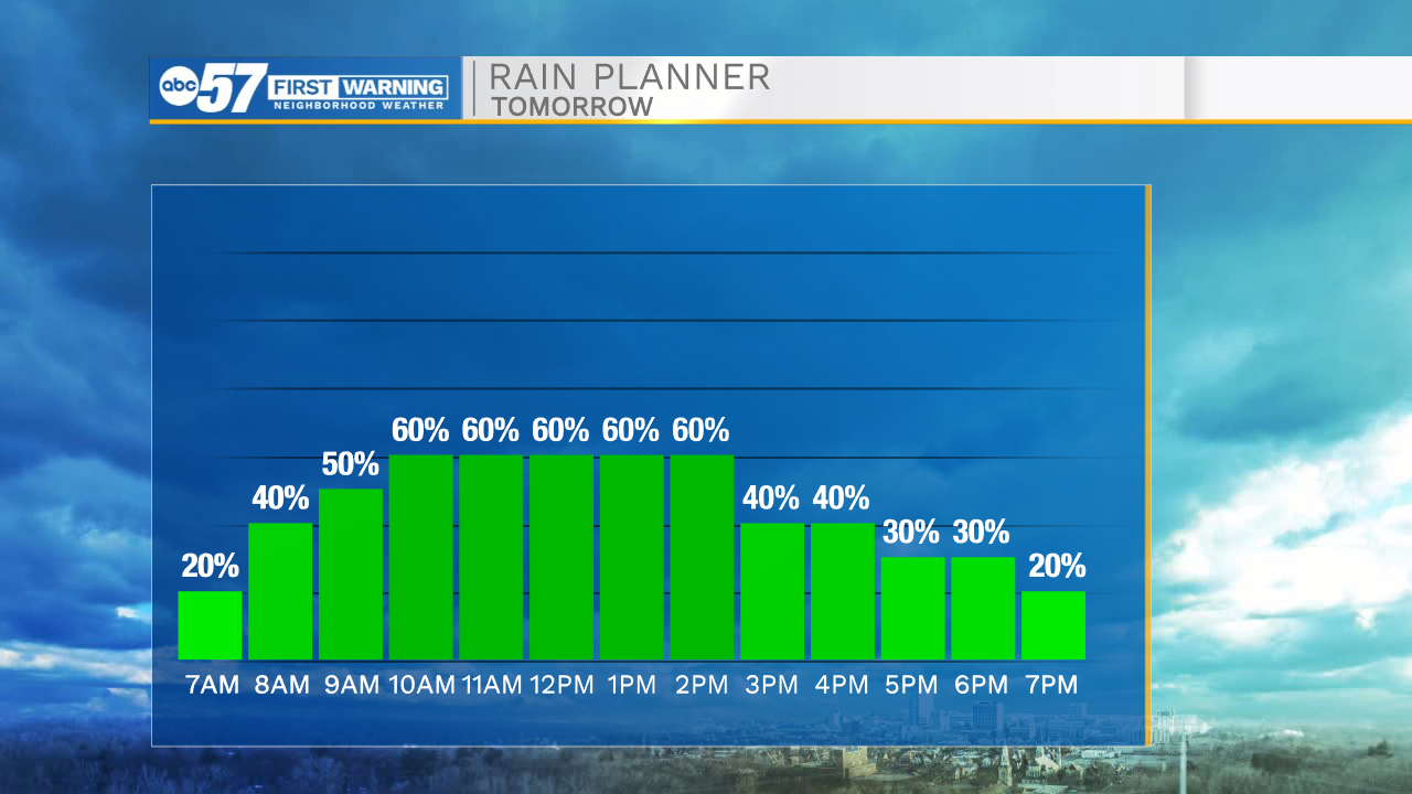
The first change in the forecast is the timing of rain Wednesday, showers are trending earlier, midday to mid-afternoon light rain is likely. The rain tapers-off by the late afternoon. Temperatures warm into the 80s Thursday and Friday along with some humidity. A cold front closes on the area Friday afternoon / evening. The second change in the forecast is the front may reach Michiana as storm begin to pop in the late afternoon. This could change the severe outlook, increasing the storm threat from South Bend to Fort Wayne. Focus will remain on Friday. But the Tuesday update is the storm threat looks lower, than Monday.
Tonight: Mostly cloudy. Rain showers late. Low 52.
Wednesday: Rain showers. High 68.
Thursday: Partly cloudy. High 82.
Friday: Breezy, PM T-Storms. High 85