-
2:13

More strong storms likely this evening
-
2:15

The ingredients for severe weather
-
2:14

Why summer travel prices may spike due to the ongoing war in...
-
1:49

Heavy rain, high winds, and hail are main severe concerns today
-
1:26

Amidst several rounds of storms, some could be severe today
-
0:34

South Bend Community Review Board hosts open discussion on youth...
-
2:19

INDOT walks through a proposed diverging diamond intersection...
-
1:08

Notre Dame’s Leonard Moore highlights student success and raises...
-
1:05

Mayflower Bridge set to close beginning April 6
-
0:21

Colfax Avenue eastbound lane closed for water and sewer work
-
0:46

Madison Street closed for lifestyle district project
-
4:11

Non-profit organization provides deep dive into Blackstone, a...

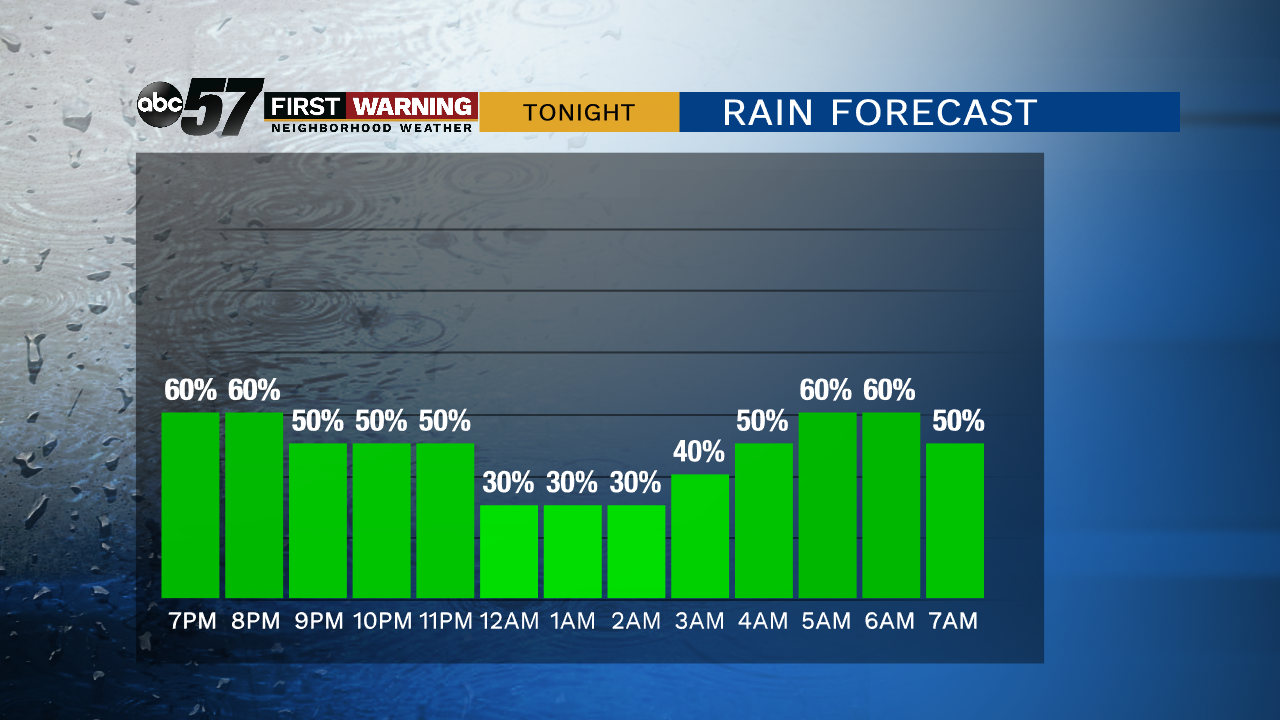
Scattered showers with thunder possible continues Monday night into Tuesday morning before clearing. Total rainfall up to one inch is possible with downpours. The severe threat is low but a few wind gusts are also possible.
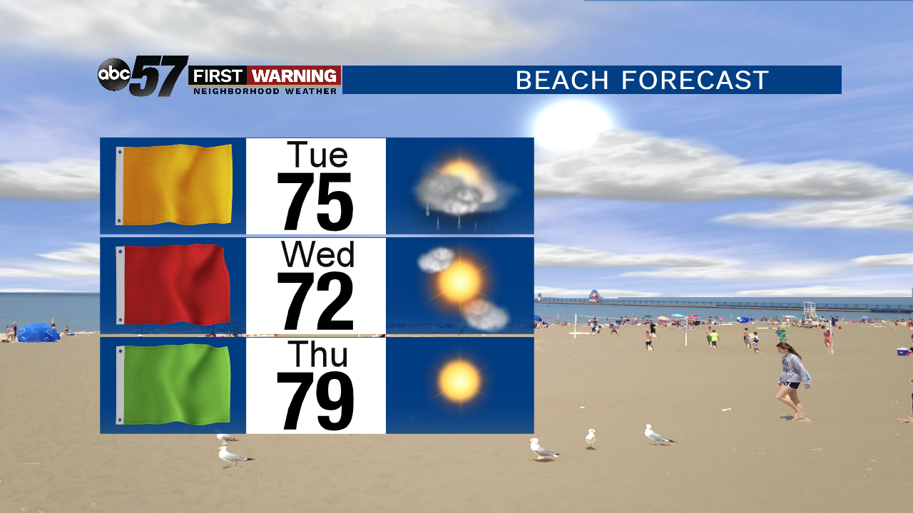
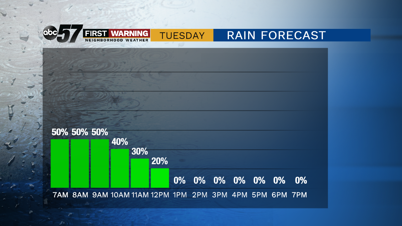
A few rain showers linger through early Tuesday before gradual clearing in the afternoon. The rest of the week is mostly mild and fair, sunny and highs in the 70s. A weak wave could bring a chance of rain to start the Labor Day Weekend, Friday night. The rest of the holiday weekend looks fair with highs warming towards 80 by Monday.
Tonight: Cloudy with on-and-off showers and storms, low of 66.
Tuesday: Mostly cloudy with AM showers, then clearing, high of 78.
Wednesday: Mostly sunny and breezy, high of 76.
Thursday: Mostly sunny, high of 78.