


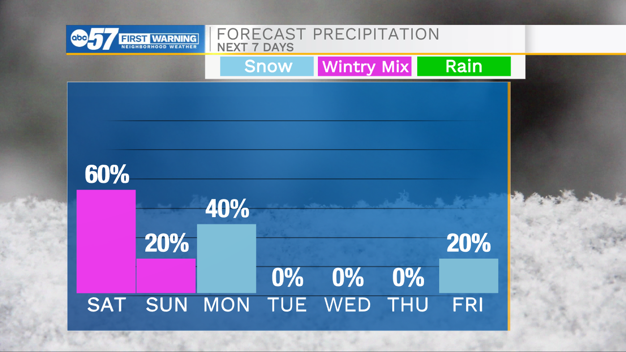
This morning is bitter cold with feel like temperatures in the negatives. Temperatures will warm into the lower 30s this afternoon as strong winds move into Michiana. Winds will gust into the 30mph range today. This southernly air will also contain some moisture that will help to develop rain showers and mixed wintry precip. Rain will move in from the west by mid-afternoon. With the already cold ground temperatures mixed with rain/freezing rain, slick spots are likely for most of Michiana. Freezing rain accumulations look low, with most places seeing less than 0.1 inches, but it won’t take much to cause problems on the roadways. The mixed wintry precip will remain with us through the overnight, so slick roadways are possible through tomorrow morning. Monday, another round of extreme cold and lake effect snow will move into Michiana. Temperatures will drop into the teens again throughout most of the area. Finally, the middle part of next week looks dry and warmer with highs in the 30s. This will give us a much needed break from the bad winter weather.
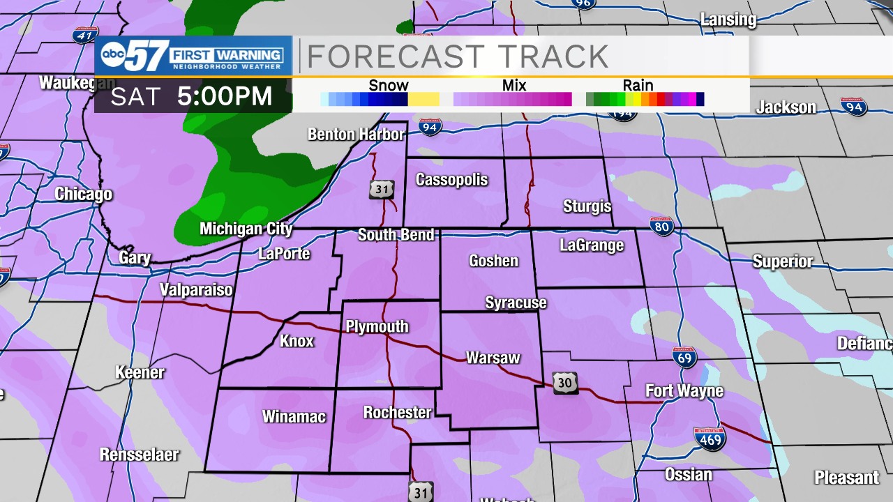
Today: Rain/freezing rain. High 31.
Tonight: Mixed wintry precip. Low 30.
Tomorrow: Mostly cloudy. High 33.
Monday: Lake effect snow. High 19.