
-
1:44

Warming up through Wednesday
-
2:34

From Niles to South Bend: Jays 2 Keeps the Spirit Alive for basketball...
-
0:46

44th annual Tri Kappa Antique Show boosts charities and scholarships
-
1:48

Scattered showers this evening, Much cooler overnight
-
1:50

Showers and storms this afternoon
-
0:20

One person injured in shooting
-
0:36

Eddies Circuit Robotics holds competition Saturday
-
0:32

21st annual Nappanee Model Train Show
-
0:38

Local boys basketball team headed to IHSAA state finals
-
3:49

Midwest Meowfest brings kitten advocacy to attendees, new homes...
-
1:52

Mild tonight, showers tomorrow
-
1:43

Pleasant to start the weekend

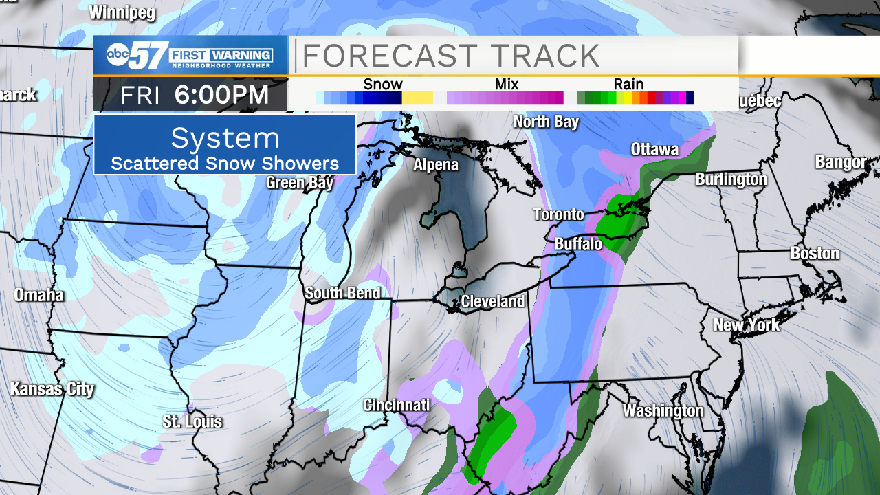
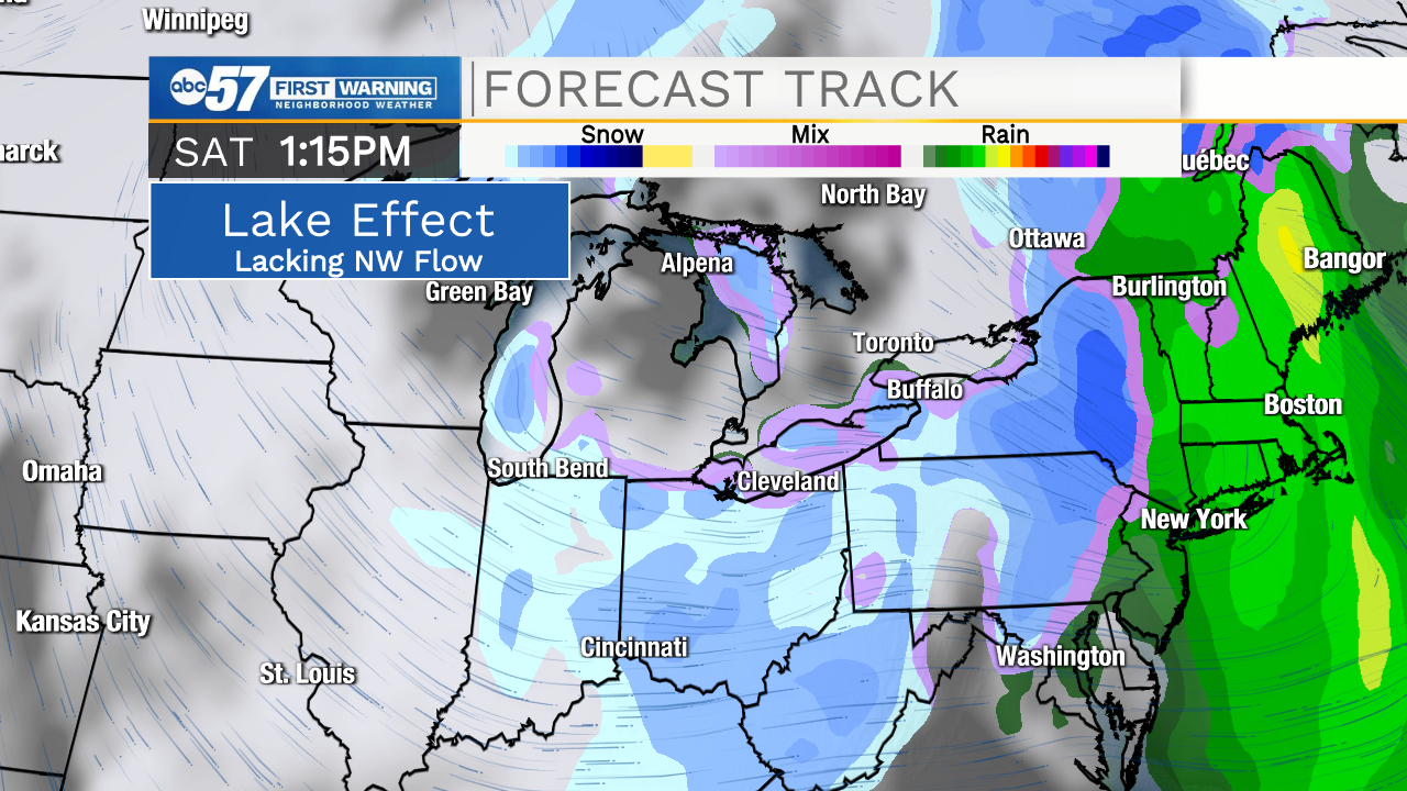
Clouds struggle to break again Tuesday, as the temperature also strain to warm above freezing. Temperatures warm midweek into the 40s ahead of our next storm system that will bring rain/snow showers Thursday evening. There is a chance of snow this weekend, Friday through Sunday morning. At this time a broad scattering of snow showers is likely. That does not mean there will be a lot of snow. The setup also lacks a strong northwest flow on the back side to crank up lake effect snow. The third strike is the lack of bitter cold, highs remain close to 30 this weekend. This forecast could change but as of Monday we are still waiting for any sign of significant winter weather.
Tonight: Cloudy, freezing fog/drizzle possible. Low 24
Tuesday: Mostly cloudy. Low 36
Wednesday: Partly cloudy. High 40.
Thursday: Mostly cloudy. High 40.