
-
3:37

South Bend Cubs explain weekend washout
-
4:02

Early voting is underway as Indiana prepare for its May 5 primary...
-
3:27

Tax-related scams to watch out for
-
0:09

Crews repair weekend washout under Coloma train track
-
0:58

Chilly and sunny Tuesday ahead
-
0:41

Elkhart police investigating Monday night shooting
-
3:47

Elkhart Police Department accepting applications to Citizens...
-
0:52

A slight warm-up but chilly weather still dominates
-
1:09

Bitterly cold out the door
-
3:03

Looking to younger generations to keep Dyngus Day thriving
-
3:06

Even as rivers recede, Marshall County still dealing with flooding
-
3:29

Michigan fans gather in Indianapolis ahead of National Championship...

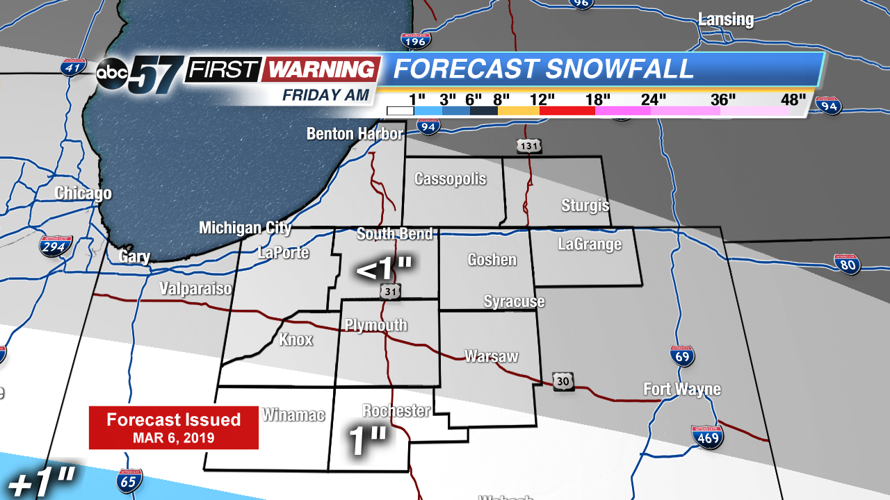
A steady warm-up continues to end the week. Highs warm into the 30s Thursday, near 40 Friday and push 50 by late Saturday. Light snow is possible Friday morning, most the accumulation will range to around an inch at most. The main focus is still on the weekend storm. Rain starts Saturday afternoon and the wind gusts up to 40 mph through Sunday as temperatures fall.
Tonight: Partly cloudy, low of 16.
Thursday: Partly cloudy, high of 30.
Friday: AM light snow, mostly cloudy, high of 38.
Saturday: Rain starts in the afternoon, breezy, high of 48.
Sign up for the ABC 57 Newsletter