One more day of 90s, showers and storm Friday
Posted: Aug 26, 2020 5:17 PM EST

-
1:52

Dreary and soggy weather amidst warming temperatures this weekend
-
1:47

A Christmas Potluck at Fairview Grange #2177
-
0:50

Staying gray and mild
-
1:19

A dreary holiday expected for Michiana
-
2:49

Lightshow of a lifetime: Dowagiac community goes above and beyond...
-
0:47

Christmas Delight in Osceola
-
6:34

ABC57 News Investigates: A year in review
-
2:19

A gray Christmas tomorrow, rain showers return by the weekend
-
0:47

Local bank matches Red Kettle donations to Salvation Army on...
-
2:44

American Airlines temporarily grounds flights morning of Christmas...
-
2:01

Does Santa experience turbulence?
-
0:47

Angels in the Attic helps hundreds of families in need this Christmas

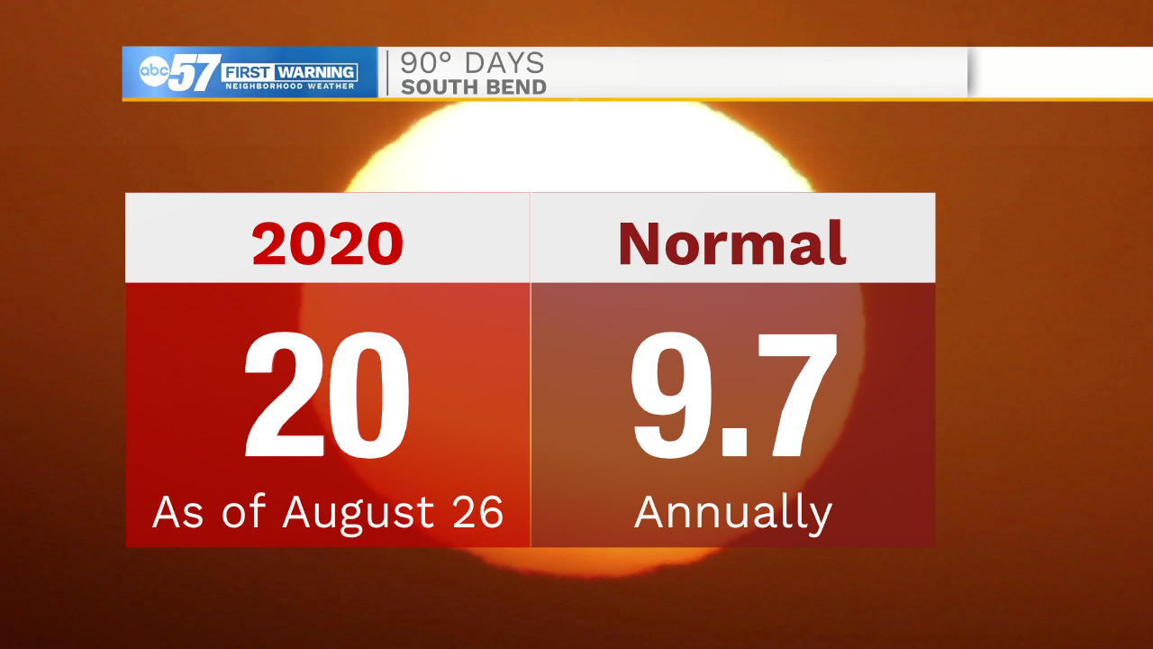
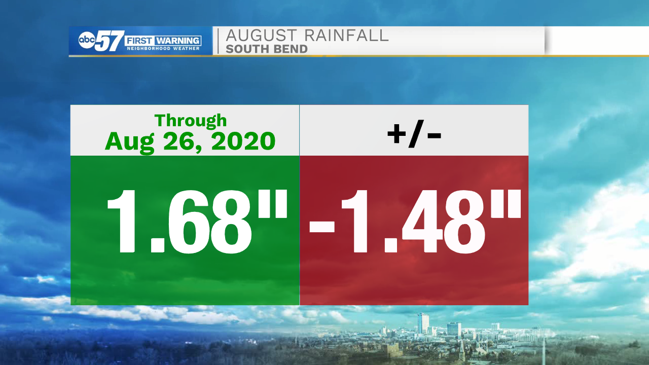
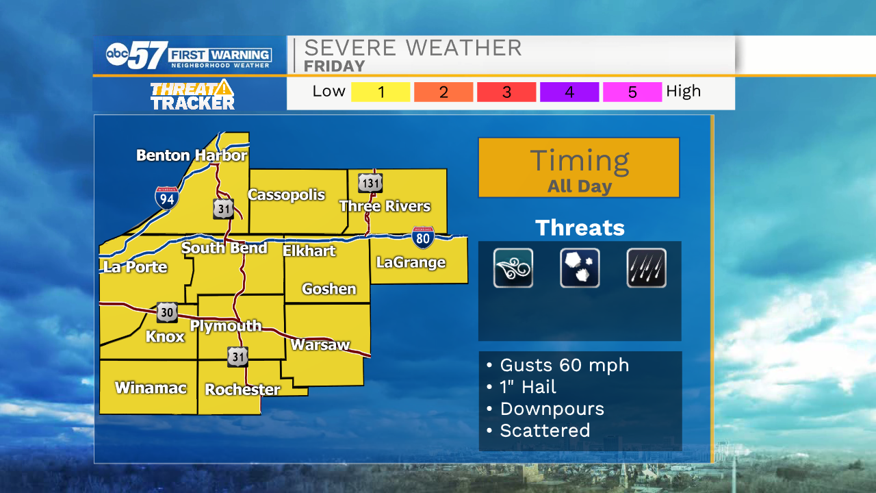
90 degree heat lasts through Thursday. Friday is the day of change with an approaching cold front. That front, along with an added boost from the remnants of Hurricane Laura to the south will cause scattered showers and thunderstorms. The storm threat starts early Friday morning and lasts through the evening. The severe threat is very conditional as how morning storms develop could influence or inhibit afternoon storms. The front clear Friday night and the weekend is mild and dry.
Tonight: Mostly clear. Low 72.
Thursday: Hot and mostly sunny. High 92.
Friday: Scattered showers / storms. High 88.
Saturday: Mostly sunny. High 78.
Sign up for the ABC 57Newsletter