No sign of winter, heavy rain biggest threat this week
By:
Tom Coomes
Posted: Jan 5, 2020 6:31 PM EDT

-
2:10

Cool, but calm, today
-
1:23

City of South Bend presents an ’Age-Friendly Plan’ to better...
-
0:54

South Bend Venues Parks and Arts hosts ’Adult Recess’
-
2:27

Why Aneyas Williams turned down the transfer portal and stayed...
-
2:21

Bourbon community rallies around Triton boys’ basketball team...
-
5:02

Dave Matthews shares details about LLC bankruptcy filings
-
1:00

Warming up this weekend before more storms next week
-
1:46

A chilly and calm start to the weekend
-
1:00

NIPSCO workers rally in South Bend for new contract
-
1:53

Severe weather threat is over, MUCH colder Friday
-
3:43

South Bend Mayor James Mueller delivers 2026 State of the City...
-
0:52

Family and friends of Adrian Cruz voice frustration in sentencing...

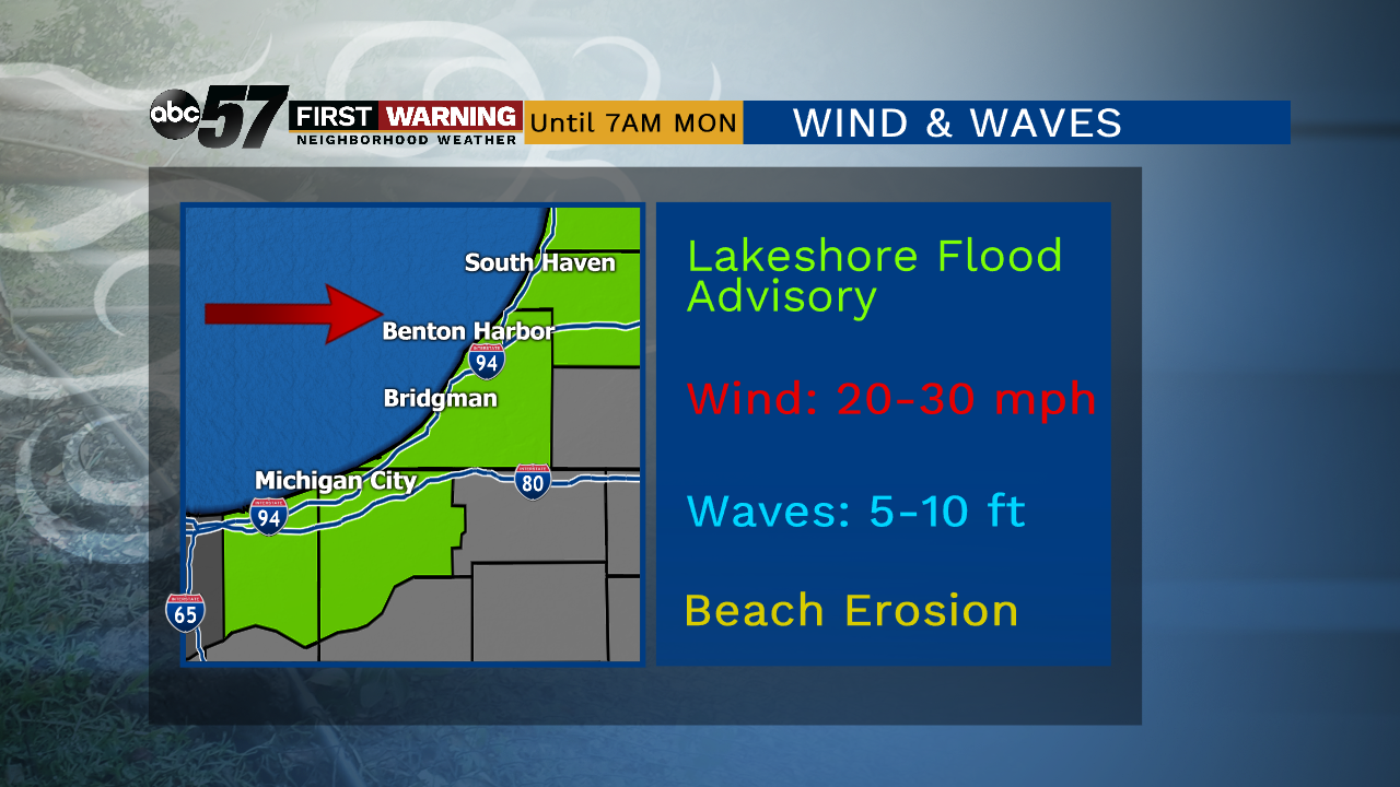
Breezy conditions continue through the evening, waves peak as the wind turns westerly on Lake Michigan. Wind and waves subside Monday.
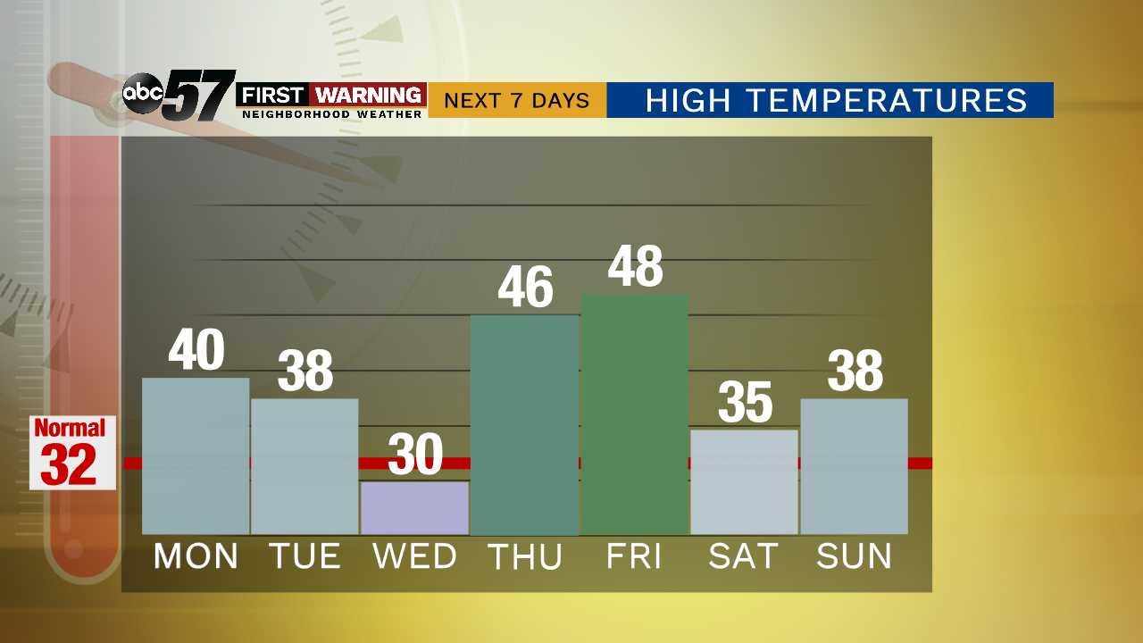
Skies clear and the wind calms to start the week. The first full week of January is far from winter-like. Highs hang close to 40 with little chance of snow. A weak system brushes the area Tuesday with minimum impact. Temperatures spike Thursday and Friday and rain is likely. Minor flooding may be the biggest threat with early estimates of more than two inches possible, widespread rain to end the week.
Tonight: Partly cloudy. Low of 28.
Monday: Mostly sunny. High of 40.
Tuesday: Mostly cloudy High of 38.
Wednesday: Partly cloudy. High of 30
Sign up for the ABC 57 Newsletter