No break from the extreme heat or storm chances yet

-
1:08

Storms start this afternoon
-
0:56

Calm morning, storms tonight
-
2:43

South Bend residents see future plans for former Drewry’s Brewery
-
2:45

Damage assessment continues in Elkhart County following EF-2...
-
0:44

Indiana and Illinois set record for tornadoes
-
1:27

Community Build underway at Kathryn Park
-
2:34

Day two of searching for a missing child continues
-
3:47

The Elkhart community is searching for answers after a 2-year-old...
-
1:04

Overall pleasant for Michiana
-
1:52

South Bend Common Council issues an official apology to residents...
-
0:54

Slightly cool out the door
-
1:54

Suspect identified, charged in fatal hit-and-run of Timothy Johnson

ABC57 First Warning Neighborhood Weather Forecast
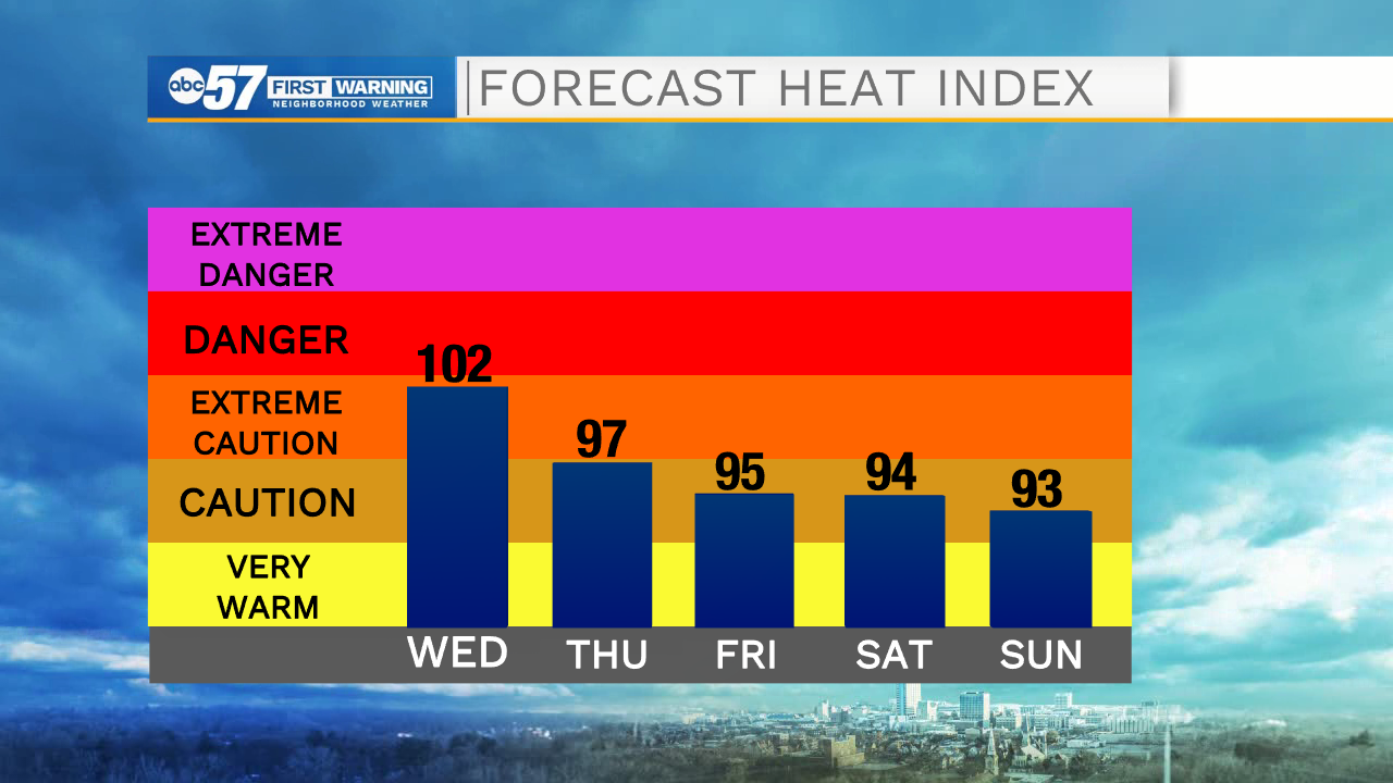
Wednesday, August 25th, 2021
The extreme heat continues today. We top out in the low 90s today & Thursday with heat index value near 100F. Storm chances continue today into the weekend as well. Morning showers are moving out right now but another round moves in later this evening. Scattered storms are possible again Thursday and Friday. Rain looks less likely on Saturday but another round will move through on Sunday. The heat continues into the weekend. We finally see relief from a cold front on Monday.
Today: Hot and humid. Scattered thunderstorms. High 93.
Tonight: Mostly cloudy, chance of storms. Low 72.
Thursday: Hot and humid. Isolated PM thunderstorms. High 90.
Friday: Hot and humid. Scattered thunderstorms. High 88.