
-
0:48

Cool conditions continue this weekend
-
0:37

Two injured in single-vehicle crash, passenger ejected from vehicle
-
0:51

Cooling and drying through morning
-
0:47

Severe threat over
-
2:22

Notre Dame and Villanova to open 2026-27 basketball season in...
-
2:41

It’s about to get more expensive to use the Toll Road
-
1:01

South Bend Mayor Mueller builds on last year’s clean-up efforts
-
1:29

A principal puckers-up for a good cause
-
0:55

Karl King Tower not designated ’Chronic Problem Property’...
-
1:22

AHEPA Senior Living brings high-demand units for low-income seniors
-
1:55

Dangerous storms to our west not weakening much
-
1:57

Sen. Rogers responds to ’RINO’ attacks ahead of May primary

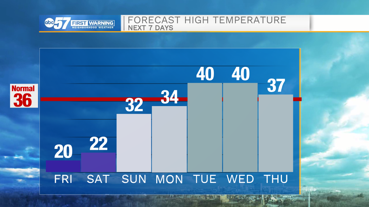
The cold continues to end the week, a few flurries and light snow showers are possible downwind of Lake Michigan, little accumulation is expected except due west of the lake what an inch or two is possible through Saturday morning. Temperatures drop again Friday night into the single digits, but the end of the deep freeze is nearing an end. Snow is likely Sunday evening, a quick burst of wet snow could bring up to three inches, ending early Monday morning. Rain or sleet could also mix with snow, keeping snow totals down, but still have a slick impact for the Monday morning drive.
Tonight: Mostly cloudy. Low 12.
Friday: Mostly to partly cloudy. High 20.
Saturday: Mostly sunny. High 22.
Sunday: Evening snow showers. High 32.
Sign up for the ABC 57 Newsletter