
-
3:49

Asking for Accountability: Michiana Elected Officials on on-going...
-
3:37

South Bend Cubs explain weekend washout
-
4:02

Early voting is underway as Indiana prepare for its May 5 primary...
-
3:27

Tax-related scams to watch out for
-
0:09

Crews repair weekend washout under Coloma train track
-
0:58

Chilly and sunny Tuesday ahead
-
0:41

Elkhart police investigating Monday night shooting
-
3:47

Elkhart Police Department accepting applications to Citizens...
-
0:52

A slight warm-up but chilly weather still dominates
-
1:09

Bitterly cold out the door
-
3:03

Looking to younger generations to keep Dyngus Day thriving
-
3:06

Even as rivers recede, Marshall County still dealing with flooding

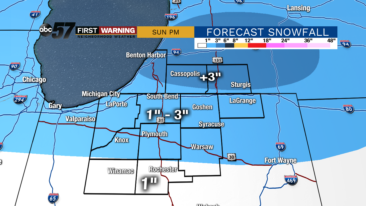
A few flurries are possible tonight under mostly cloudy skies. Saturday should be quiet and mostly cloudy before our next system arrives on Sunday. Precipitation will start out as snow before switching to a rain/snow mix in the afternoon and evening. Minor accumulations are possible, but travel impacts should be on the lower end of the spectrum. We’ll be cloudy to start the work week before another storm system moves in for Wednesday and Thursday. Temperatures will remain close to the seasonal norm for the next week or so.
Tonight: Mostly cloudy. A few flurries possible. Low of 21.
Saturday: Mostly cloudy. High 33.
Sunday: Mostly cloudy, snow changes to a wintry mix in the afternoon. High of 35.
Monday: Cloudy. High: 35
Sign up for the ABC 57 Newsletter