-
1:42

Cold start to the day followed by warm and sunny stretch
-
3:08

Chicago celebrates hometown pontiff
-
1:05

St.Pius Parish held a special mass Thursday for Pope Leo
-
1:17

Local catholic students react the new pope
-
3:57

80th anniversary of Victory in Europe Day
-
2:13

This week’s ABC57 Cub Reporter is Isaac Castillo
-
1:52

Catholic Theological Seminary reacts to news of new Pope
-
0:59

Govenor Braun keynote speaker at RV industry power breakfast...
-
5:51

Two New Prairie school buses carrying sports team involved in...
-
1:00

Frosty Friday morning, then a weekend warm-up
-
9:48

Power Worries
-
2:51

One year later, many still reliving Colon tornado

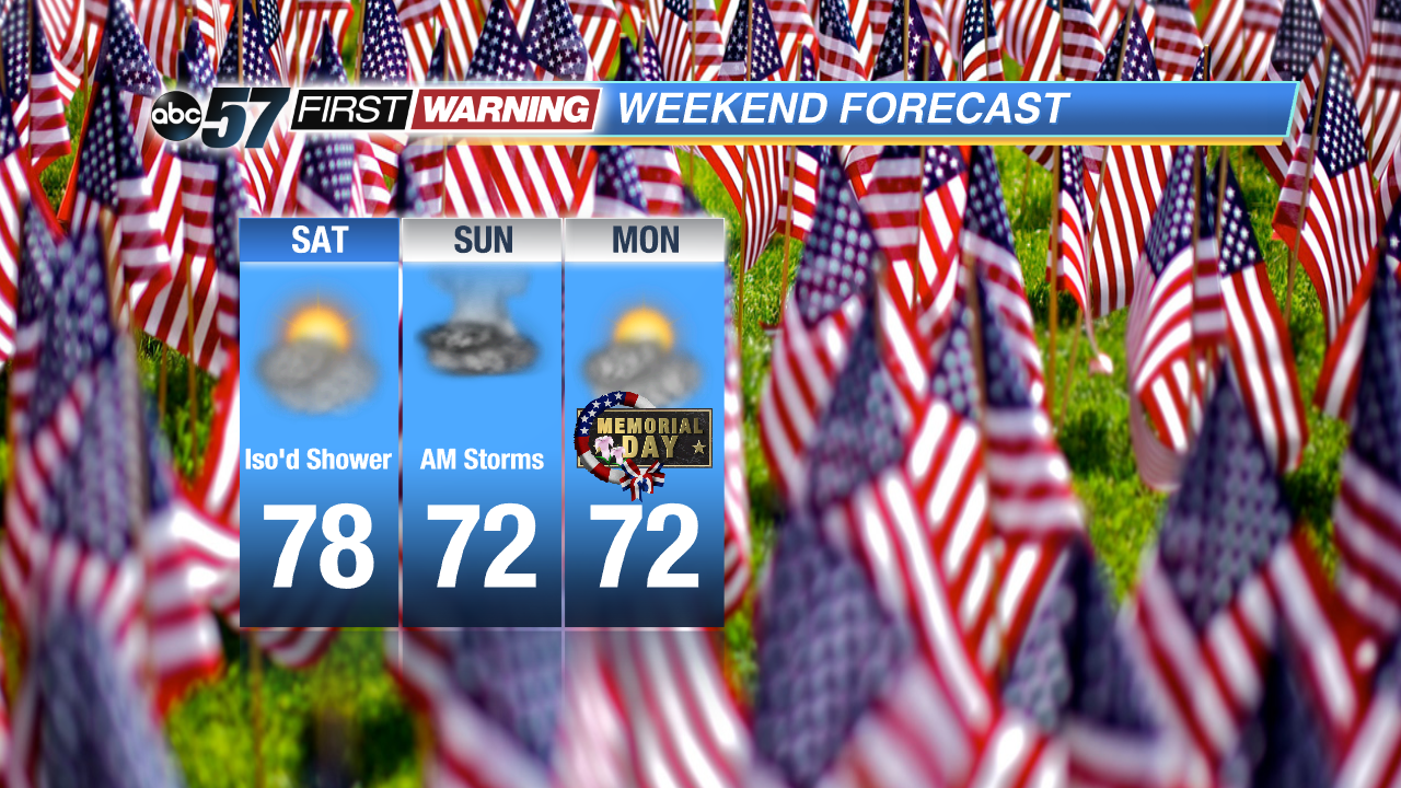
A milder and drier start to the Memorial Day Weekend. Even with the threat of rain, the holiday weekend is far from a washout. Friday will be fair and mild with highs in the mid-70s before a round for showers and storms Friday night into early Saturday. Saturday looks warm and dry before another round of showers and storms Sunday morning. The cycle continues, gradually drying into Monday before another round of showers and storms Monday night.
**Storms Friday evening could be strong to severe with heavy downpours, gusty wind and lightning.
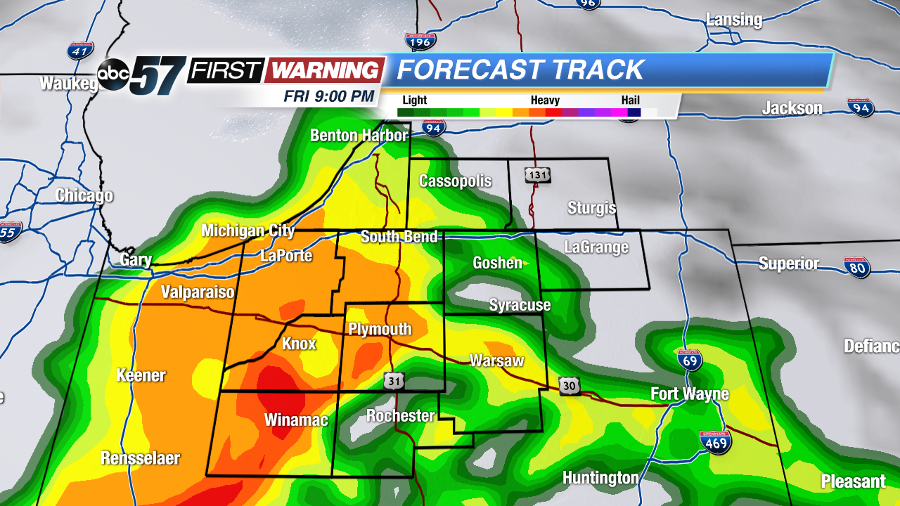
Friday: Partly cloudy, high 74, showers and storms late.
Saturday: Partly cloudy, high 78
Sunday: AM Showers, then partly cloudy, highs in the low 70s.
Memorial Day: Partly cloudy highs in the low 70s, chance of rain late.