
-
1:55

’Water shut off notices’ return in Benton Harbor
-
0:57

Indiana Lt. Gov. Suzanne Crouch makes local campaign stop
-
3:55

Deliberation about changes to Indiana’s high school graduation...
-
1:44

Temperatures rise and fall to end the week, rain Friday
-
3:19

National College Decision Day is pushed back this year
-
5:25

Michigan State Representative Joey Andrews joins ABC57
-
1:29

A new chapter for the Cass District Library Edwardsburg Branch
-
1:59

Few showers this morning, then quiet again today
-
2:23

PGA and Whirlpool prepare for one last KitchenAid Senior Championship...
-
1:49

Occupants identified in deadly plane crash near Bristol
-
2:44

The new plan to transform much of Potawatomi Park in South Bend
-
2:49

Parts of Michiana to be pestered soon

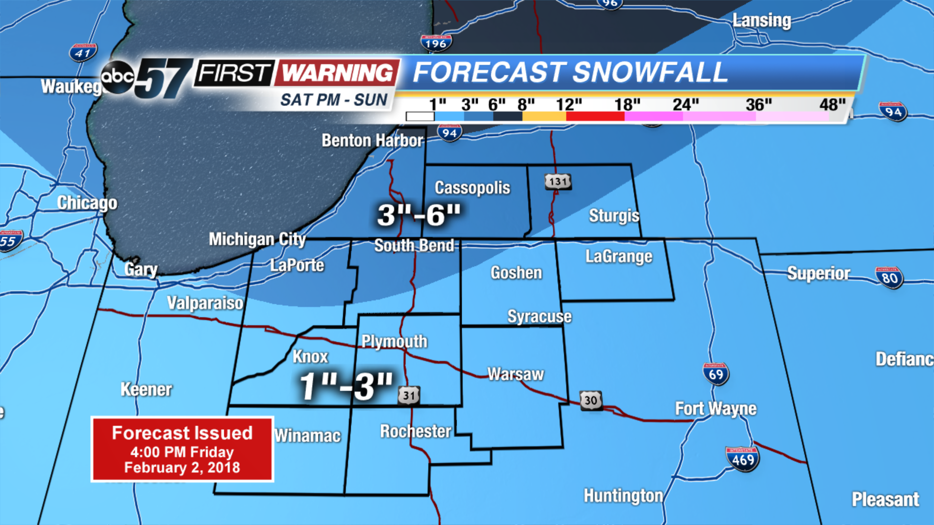
Temperatures warm through Saturday, highs may break the freezing mark ahead of our next round of snow. A storm system will bring a burst of snow Saturday night and light snow will continue through the first half of Sunday, with some lake enhanced snow showers. Many will see up to three inches of snow with amounts as high as six possible. Bitter cold continues next week, with more snow in forecast.
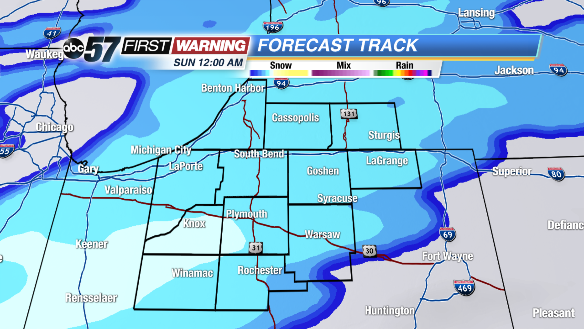
Tonight: Partly Cloudy, low of 14.
Saturday: Snow by the afternoon, high of 32.
Sunday: Snow showers through midday, temperatures fall from 30.
Monday: Mostly sunny, highs near 20.
Sign up for the ABC 57Newsletter