
-
0:57

Sunny and windy today
-
5:10

Pop-Up Kitty Cafe coming to Michigan City
-
2:51

Nappanee will soon be home to the World’s Largest Cabinet
-
0:38

Drying out and warming up
-
1:15

Cold and bleak weather to start off the day
-
3:49

Asking for Accountability: Michiana Elected Officials on on-going...
-
3:37

South Bend Cubs explain weekend washout
-
4:02

Early voting is underway as Indiana prepare for its May 5 primary...
-
3:27

Tax-related scams to watch out for
-
0:09

Crews repair weekend washout under Coloma train track
-
0:58

Chilly and sunny Tuesday ahead
-
0:41

Elkhart police investigating Monday night shooting

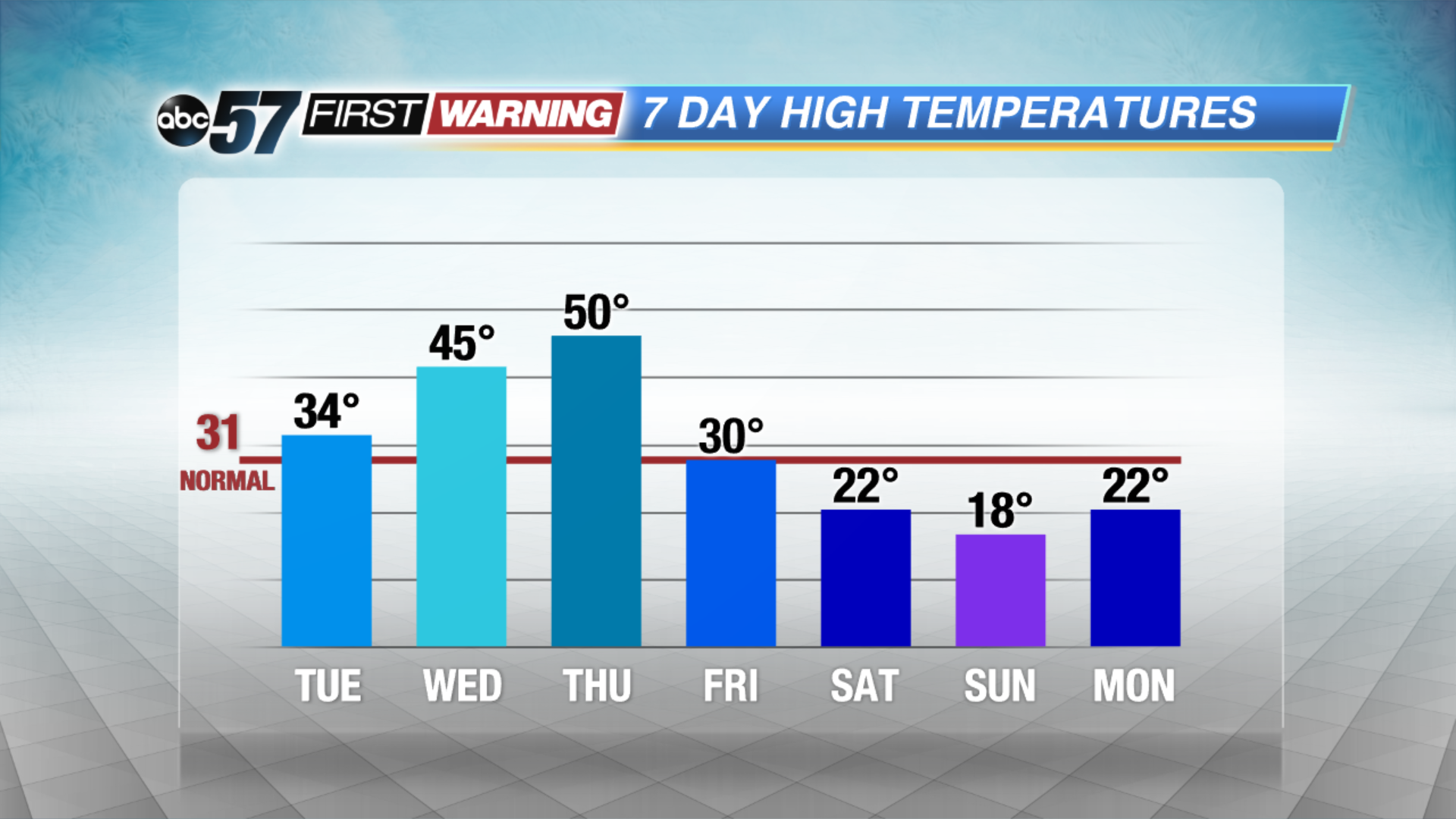
A mid-winter warm-up this week will bring a new set of hazards. The freeze-thaw cycle increases the chance of black ice, fog and potholes, mostly in the morning hours. Highs will rise from just above freezing Tuesday to possibly the 50s on Thursday. We’ll watch for a potential snow-maker later this week before another crash in temperatures this weekend.
Tonight: Partly cloudy with morning fog developing, low 22.
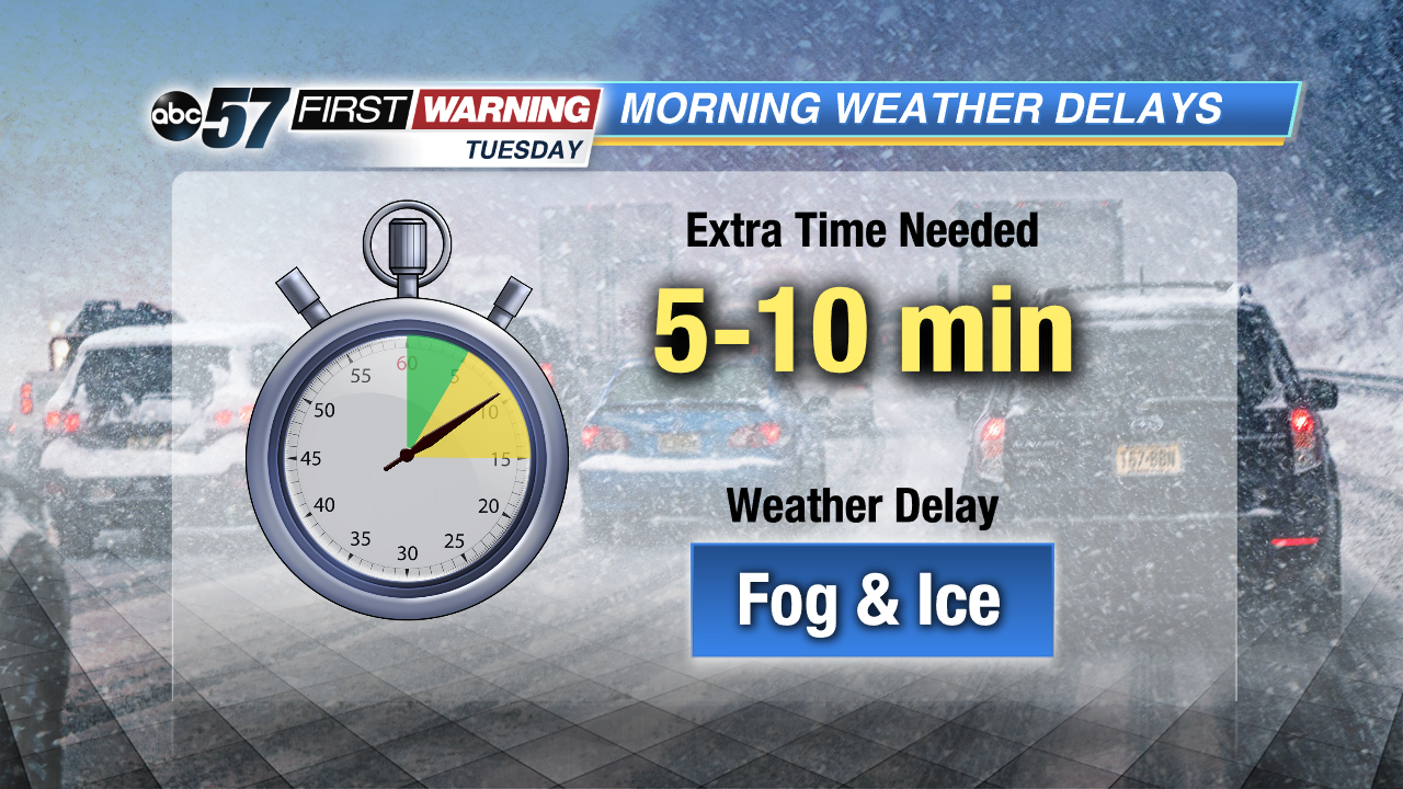 Watch for fog and black ice in the morning
Tuesday: Partly cloudy, high of 34.
Wednesday: Fog and drizzle, high of 45.
Thursday: Rain and fog, highs near 50.
 A quick thaw will melt a lot but not all of our snow pack.
Sign up for the ABC 57 Newsletter