Meteotsunamis: a forgotten, dangerous and possibly deadly hazard


Did you know tsunamis can occur on the Great Lakes, including Lake Michigan? Not only do they occur, but they happen more often than you probably think.
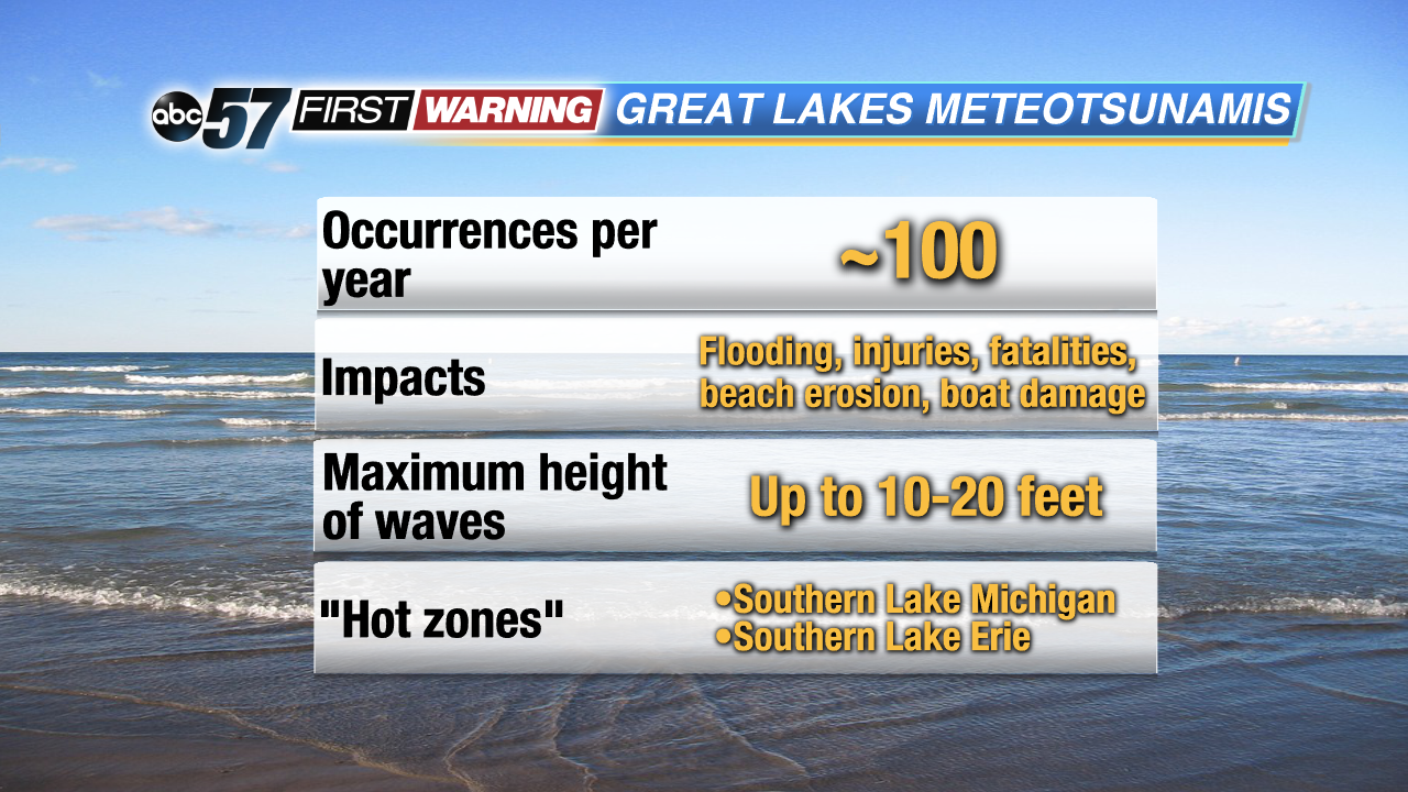
Eric Anderson, a physical oceanographer who specializes in meteotsunamis with NOAA's Great Lakes Environmental Research Laboratory, tells ABC 57 News that meteotsunamis "cause a number of things; fatalities to swimmers that have been in the lake. People that have been on the pier, or on a break wall have been washed into the water. Flooding events [and] damage due to flooding. [They push] debris from the lake up onto shore, sometimes into cottages or houses on the shoreline, [thus] swamping marinas and even capsizing boats."
Something else to keep in mind is that there are two distinct types of dangerous waves on the Great Lakes (see video above). There are meteotsunamis and seiches. According to NOAA, they are often grouped together in the same category. However, they differ in a few ways. Seiches are standing waves generated by winds crossing over a lake. They have a period of at least three hours. Think of a bathtub when the water at one end is high and the water level at the other end goes down. These occur slowly and can cause flooding on the side of the lake where the water rises.
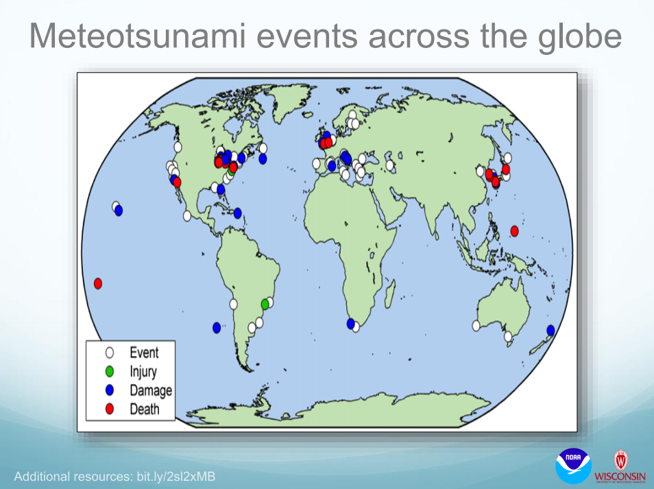 Meteotsunami events across the globe.
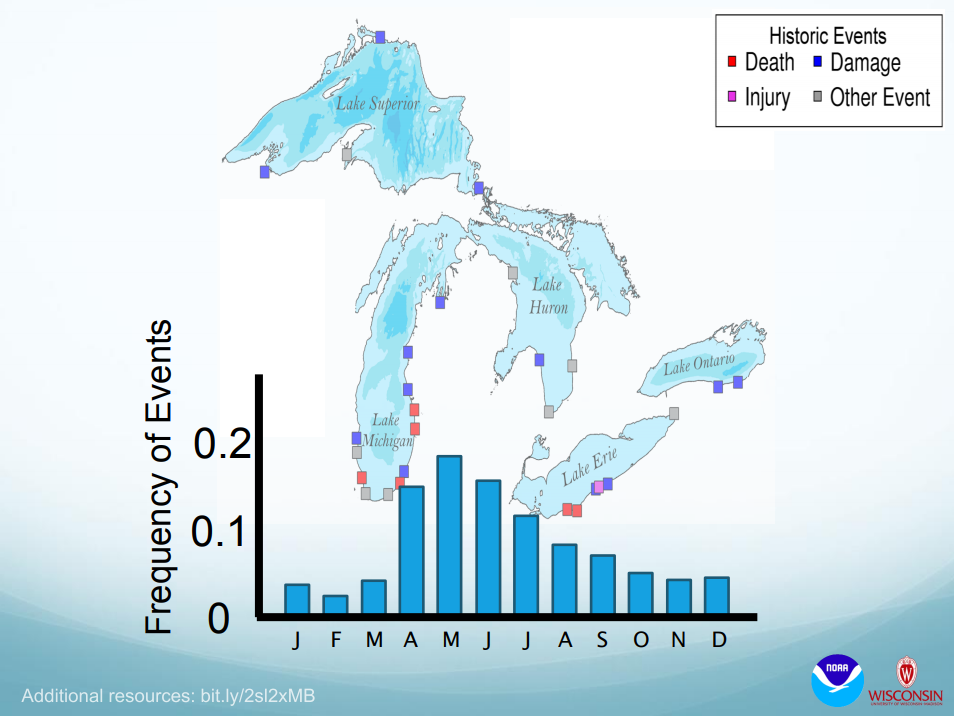 Past historic meteotsunami events and their frequency by month.
"Southern Lake Michigan and Southern Lake Erie seem to be the hotspots for meteotsunami activity," Anderson says. He went on to say that "most meteotsunamis, historically, have happened in the late spring and early summer...peaking in May, starting in April and ending in late June, maybe early July."
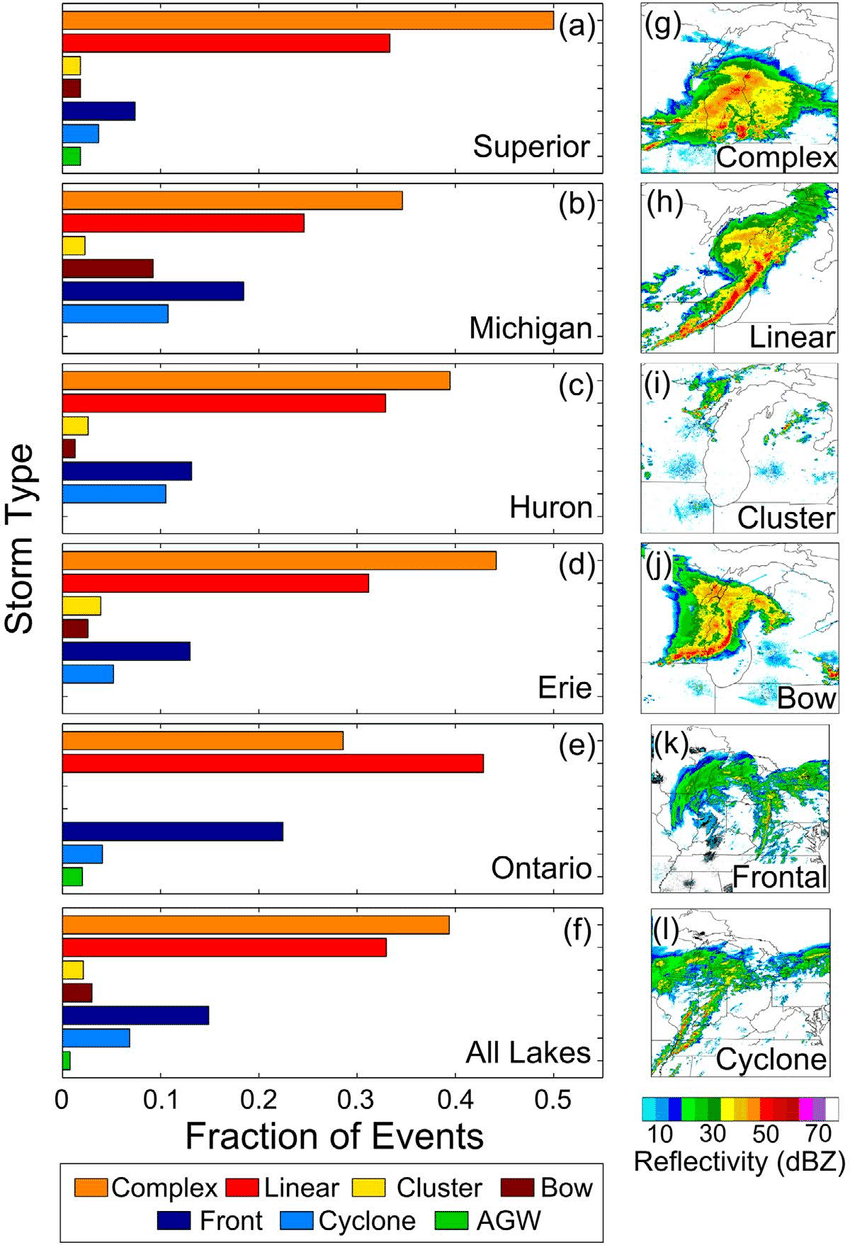 Meteotsunami occurrences on the Great Lakes based on what type of storm or system moves through.
•Storms: complexes, lines of storms, clusters of storms, bow echoes
•Systems: strong cold fronts, strong low pressure cyclones
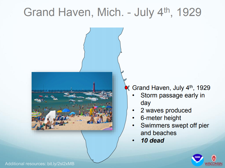 An example of a deadly meteotsunami in Grand Haven, Michigan.
"That's certainly enough to be dangerous," Anderson says. "I'll also mention that even a relatively short wave, maybe one that's only a foot tall, [can be dangerous]. Imagine that these meteotsunamis are about a kilometer long. A foot of water [tall] by a kilometer [long] is a lot of water to move in and out over, say, 20 minutes. And that's when it can be really dangerous."
Several incidents have been documented in the Great Lakes of meteotsunamis that have caused extensive damage, injured someone or killed someone. One example is the Grand Haven meteotsunami of 1929. A storm passed early in the day, producing two waves after the storm passed. The waves were nearly 20 feet tall, and swept swimmers off the pier and beaches seemingly out of nowhere. In the end, 10 people lost their lives.
And, while they may be difficult to accurately predict at this juncture, Anderson says that in the next few years, NOAA should have the ability to issue something along the lines of a "meteotsunami watch" if conditions seem supportive of meteotsunami development. He says it would be similar to tornado watches in the sense that they would be issued hours or even a day ahead of time depending on the situation.