Major early season snow event drops well over a foot in spots
Here we are not even halfway through November, yet we're dealing with a complete winter wonderland outside.
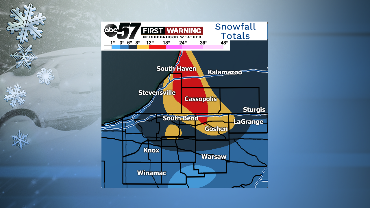
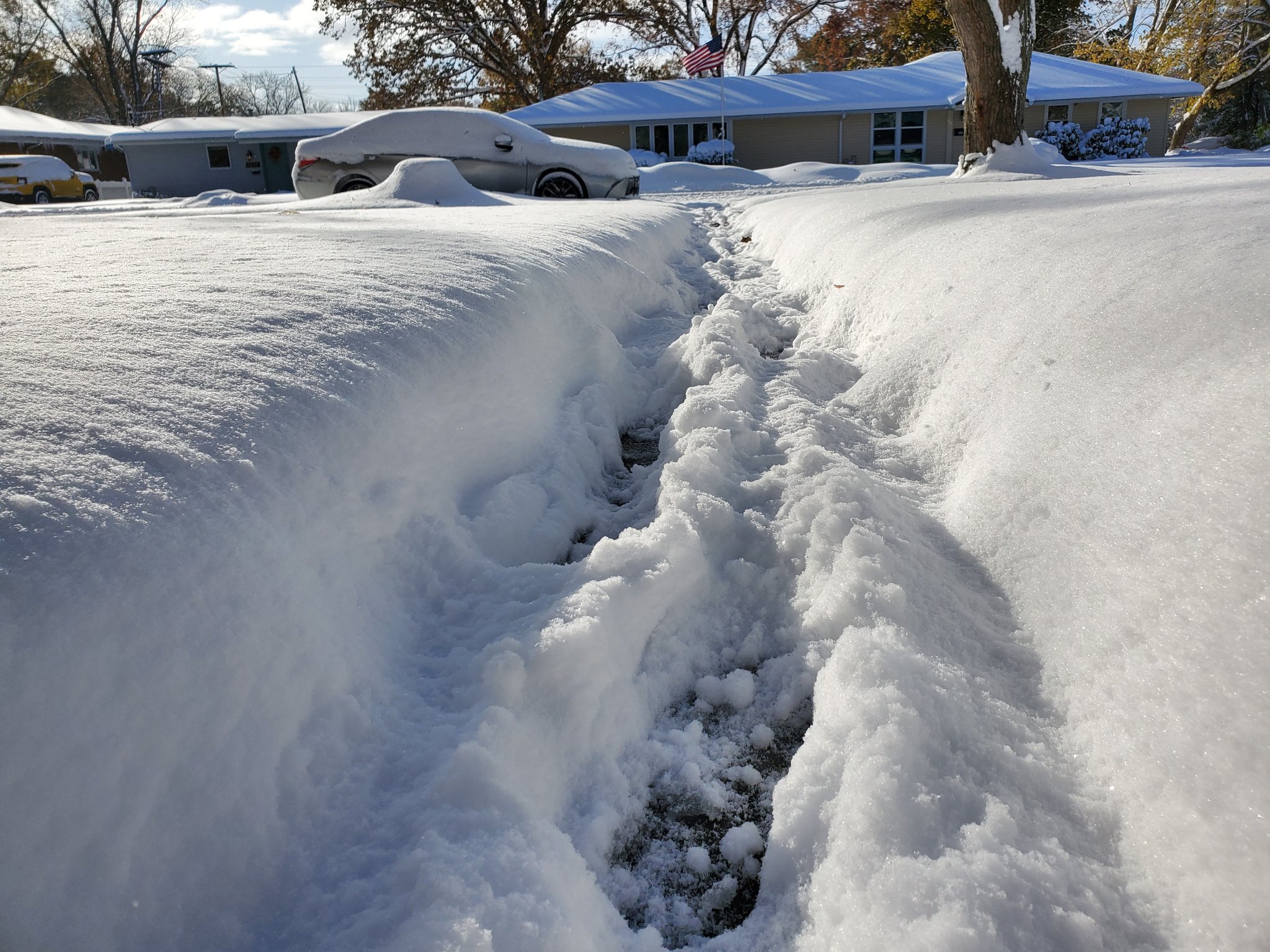
Anywhere from a few inches to upwards of a foot and a half of snow fell across Michiana between Monday morning and Tuesday afternoon.
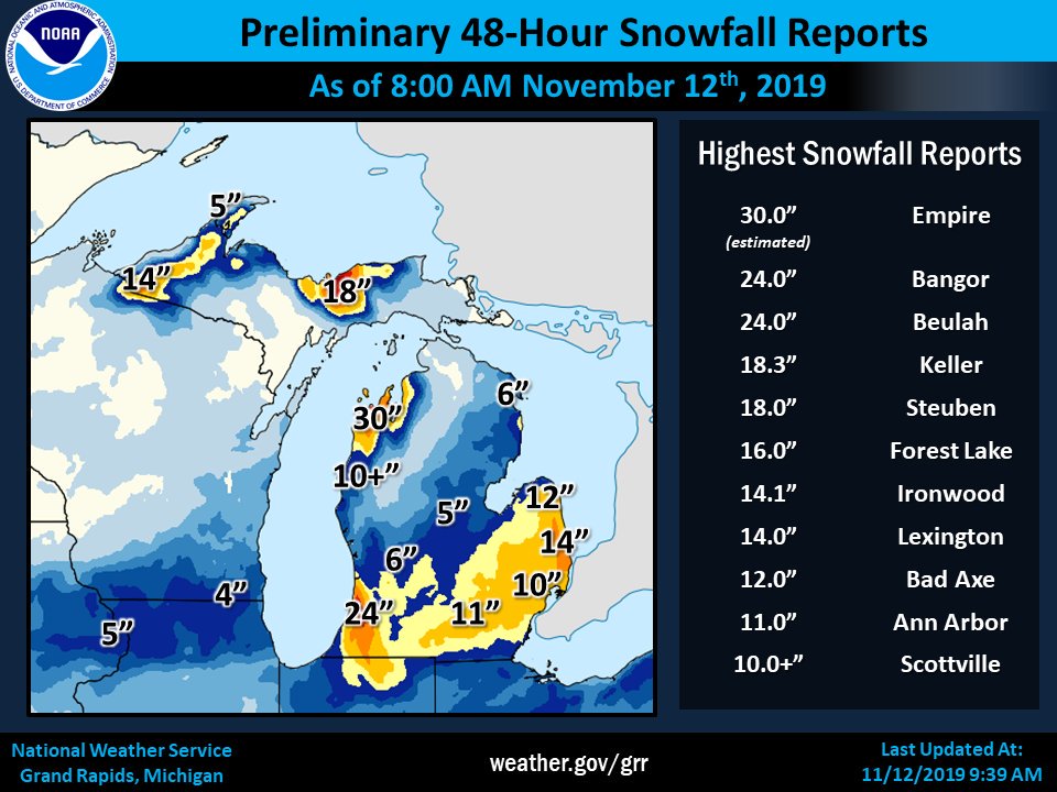 Heavy lake effect snow and system snow fell across parts of Michigan and northern Indiana Monday into Tuesday.
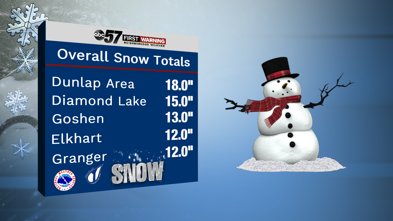
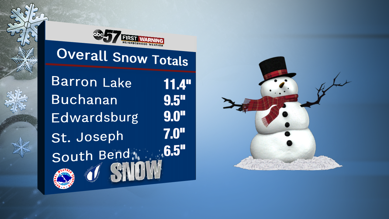
Since most of our snow fell in the form of lake effect, totals varied greatly from location to location. Of course, this is always true with lake effect snow bands.
EXTREME SNOW RATES:
— Tyler Sebree (@TylerABC57) November 12, 2019
Honestly this is some of the heaviest snow I've ever witnessed in this lake effect band in Elkhart. ❄❄❄#INwx#MIwxpic.twitter.com/lQvscMJVly
That's why most cities have multiple different snow reports. For example, there was a report of 13" of snow just two miles away from a report of 10.6" of snow near Goshen.
Snowfall rates upwards of 1-3" per hour were reported, creating whiteout conditions at times and very difficult travel.
 Over a foot of snow in Elkhart.
To put the event into perspective, many cities saw their biggest 48-hour snowfall since the infamous snowstorm of 2015 that dumped well over a foot of snow on most of Michiana.
