Light morning snow then flurries possible
By: Emily Kennedy
Posted: Jan 26, 2021 2:57 AM EDT

-
3:43

South Bend Mayor James Mueller delivers 2026 State of the City...
-
0:52

Family and friends of Adrian Cruz voice frustration in sentencing...
-
2:13

Potawatomi Zoo prepares for opening day with new attractions
-
2:54

Local expert weighs in on landmark social media decisions
-
1:33

Round one of storms moving east, Round two arriving soon
-
2:38

Bourbon residents recall tornado as severe weather strikes again
-
1:34

Tornado threat decreasing, but severe weather still expected...
-
1:42

Damaging winds and hail move in this evening
-
2:51

Severe weather expected in Michiana later today
-
2:15

Severe weather likely for portions of Michiana later today
-
2:34

Open House for a new pedestrian bridge leaves Riverside Residents...
-
2:16

Notre Dame’s CJ Carr embraces growing expectations while leading...

ABC57 First Warning Neighborhood Weather Forecast
Tuesday, January 26th, 2020
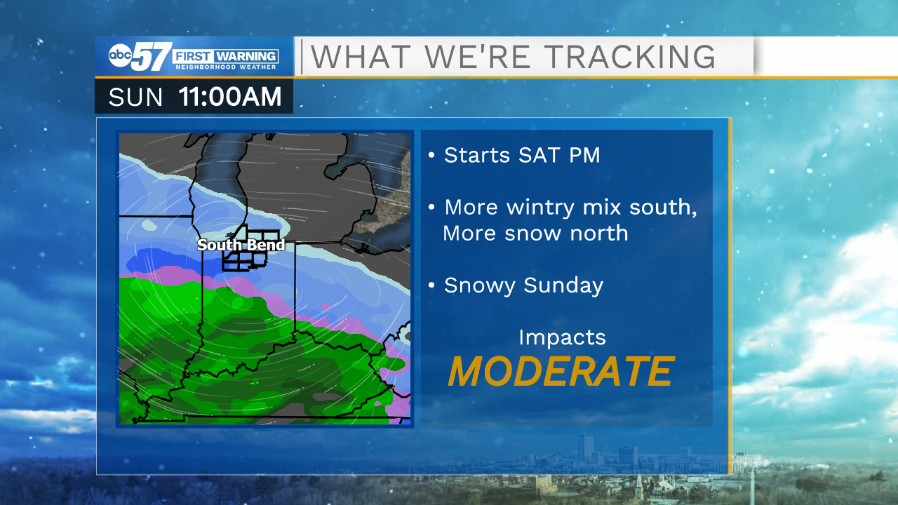
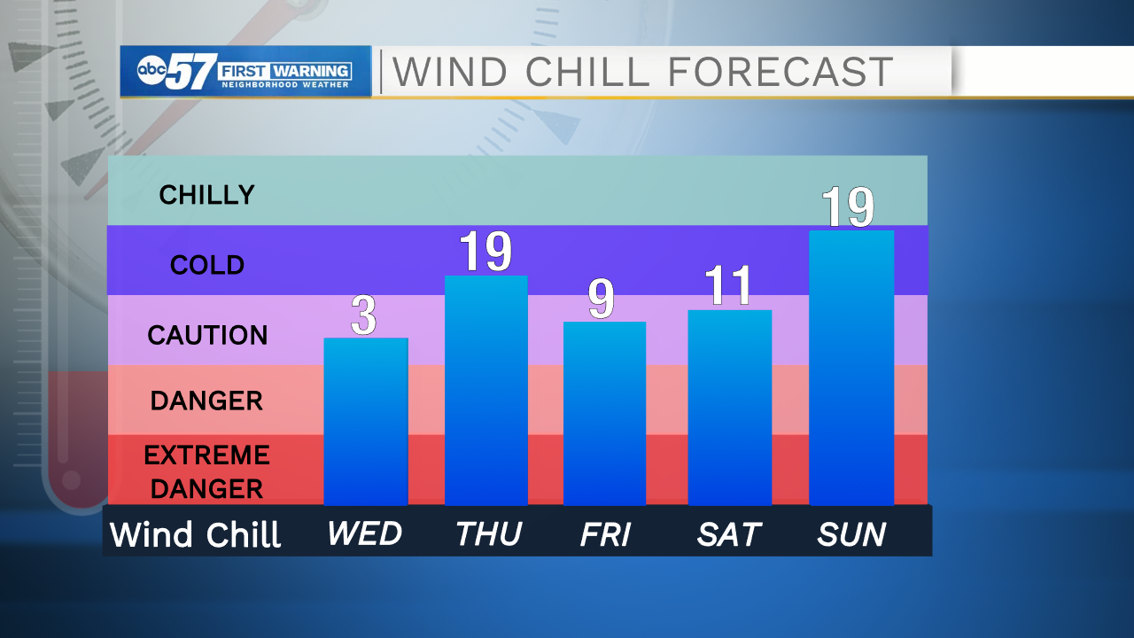
Snow showers persist through Tuesday morning but there's little additional accumulation, flurries are possible into the afternoon and evening. Temperatures drop for the rest of the week with daytime highs not even making it out of the 20s. Overnight lows sink to the teens as well. We will get to see some sunshine though for Thursday and Friday. We are watching for potential lake effect snow west of US-31 Thursday morning. Saturday and Sunday look to be another round of snow / wintry mix.
Today: Scattered snow showers. High 29.
Tonight: Mostly cloudy. Low 18.
Wednesday: Mostly cloudy High 26.
Thursday: AM flurries, partly cloudy. High 27.
Sign up for the ABC 57 Newsletter