Isolated storms this evening, humidity on the rise

-
4:11

Non-profit organization provides deep dive into Blackstone, a...
-
1:52

Storms possible overnight, strong storms by Tuesday evening
-
3:48

New partnership aims to help fight food insecurity across Elkhart...
-
2:00

A sunny Monday ahead, rainy almost every other day this week
-
2:59

Dusty May leads Michigan back to Final Four with dominant win...
-
0:37

Vendors and cosplayers showcase art at South Bend Anime Fest
-
3:06

Palm Sunday procession in South Bend unites faiths in call to...
-
0:48

2026 Auto Show brings crowd to Century Center Sunday
-
2:34

Warm to start the week, Rainy week ahead
-
2:44

Warmer, breezier, and cloudier than yesterday
-
0:46

Crowds gather for Fins and Feathers Fest at La Porte City Fairgrounds
-
0:46

Paramount School of Excellence hosts teacher fair

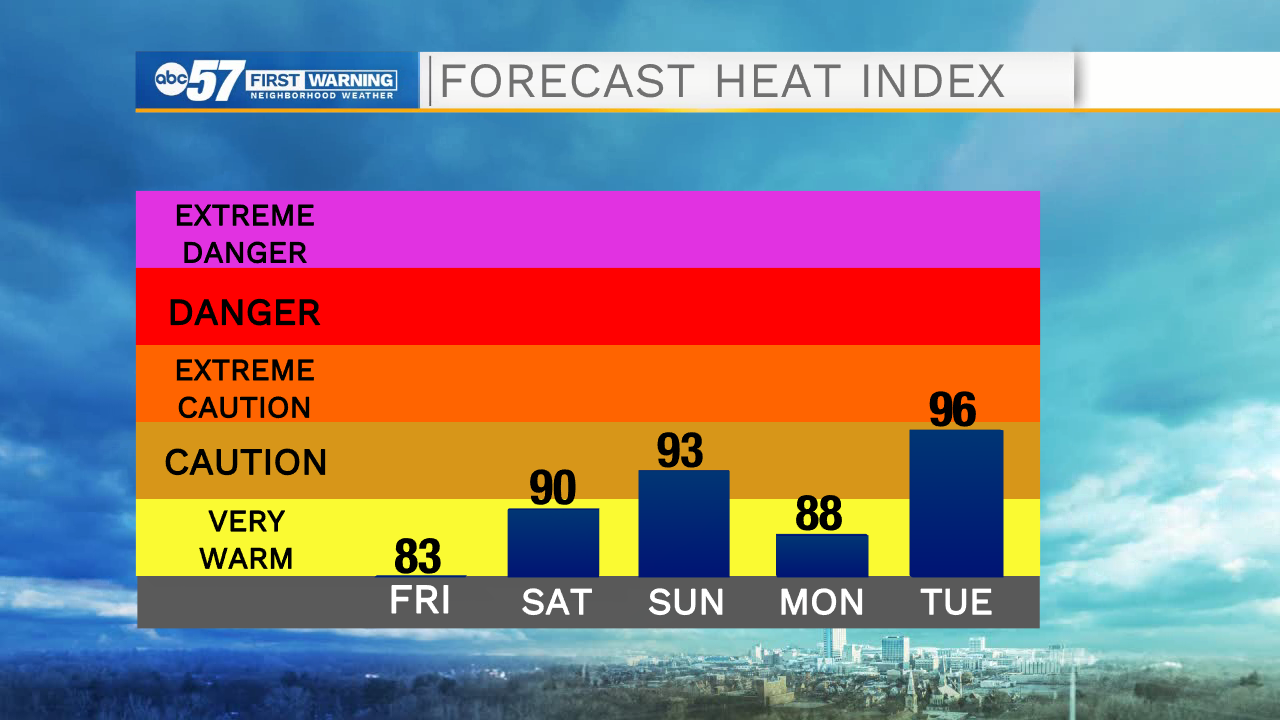
ABC57 First Warning Neighborhood Weather Forecast
Friday, August 6th, 2021
A few more clouds move in this afternoon with isolated thunderstorms during the evening. A strong to severe storm cannot be ruled out. Scattered thunderstorms last overnight and may linger into the early hours of Saturday.
The rest of Saturday is dry and partly cloudy. Humidity rises again this weekend and it turns hot for Sunday. More scattered storms move in on Monday, some of which could be strong to severe. Next week in general is hotter and muggy with more storm chances.
Today: Partly to mostly cloudy, isolated evening storms. High 83.
Tonight: Scattered thunderstorms. Low 68.
Saturday: AM shower/storm possible. Partly cloudy. High 86.
Sunday: Partly cloudy. High 90.