-
2:44

Warmer, breezier, and cloudier than yesterday
-
0:46

Crowds gather for Fins and Feathers Fest at La Porte City Fairgrounds
-
0:46

Paramount School of Excellence hosts teacher fair
-
2:30

Voting advocacy, peaceful demonstrations and donations: South...
-
2:04

Warming to start the week, Showers and storms by Tuesday
-
2:10

Cool, but calm, today
-
1:23

City of South Bend presents an ’Age-Friendly Plan’ to better...
-
0:54

South Bend Venues Parks and Arts hosts ’Adult Recess’
-
2:27

Why Aneyas Williams turned down the transfer portal and stayed...
-
2:21

Bourbon community rallies around Triton boys’ basketball team...
-
5:02

Dave Matthews shares details about LLC bankruptcy filings
-
1:00

Warming up this weekend before more storms next week

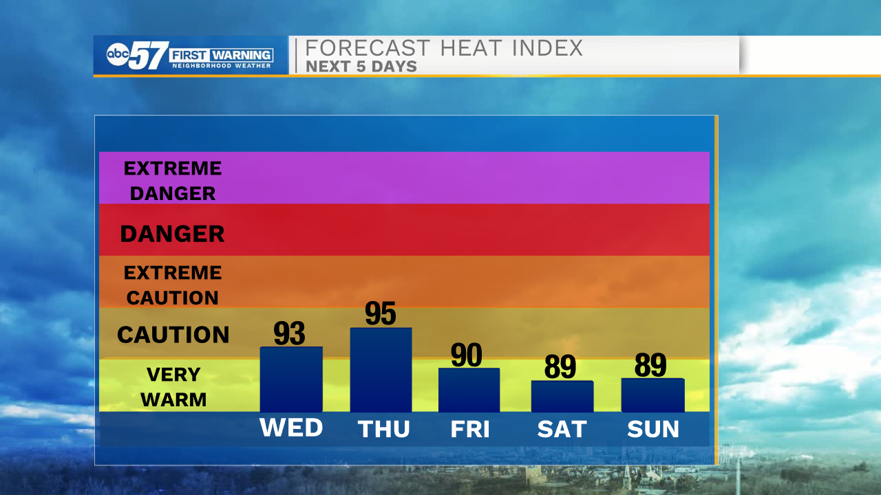
ABC57 First Warning Neighborhood Weather
Wednesday, July 8th, 2020
More sunny, hot and humid weather today and tomorrow. Heat indices could reach the upper 90s! Isolated showers and storms are possible again for both days, after midday. A system moves in Thursday night, bringing widespread scattered showers and storms that will last into Friday. This will finally knock down the heat and humidity some for Saturday. Sunday is still in the 80s but more wet weather is expected after midday. Next week starts to warm right back up with 90s possible by next Wednesday.
Today: Mostly sunny, hot and humid. PM isolated showers/storms. High 94.
Tonight: Partly cloudy. Low 73.
Thursday: Partly sunny, hot and humid. PM isolated showers/storms. High 94.
Friday: Scattered thunderstorms. High 87.