High humidity and more storms Wednesday

-
2:12

Quiet today, storm threat tomorrow and Wednesday
-
3:50

Plymouth community hosts 5K in the fight against ALS
-
2:10

Sunny Monday ahead, but showers and thunderstorms later this...
-
2:10

Plymouth High School hosts ’Steps for Stegs’
-
2:05

Drier but cooler to wrap up the weekend
-
6:23

ABC57’s Arts and Acts: Local dance stars shine at A&A Ballet...
-
2:49

St. Adalbert Church celebrates Cinco De Mayo, announces fundraising...
-
0:40

Congressman Rudy Yakym awards local high school artists
-
2:06

Thundershowers tonight, a cooldown tomorrow following cold front
-
0:52

Bethel University celebrates 77th commencement
-
1:36

Beautiful start to the weekend despite morning fog
-
1:03

’Pedals and Petals’ in downtown South Bend

Update: Storms likely overnight along and north of the Toll Rd. Heavy rain the biggest threat.
Extremely humid overnight, this could fuel a few evening showers but the focus will be on storms, starting Wednesday morning. Storms could be strong to severe Wednesday.
 Wednesday storm threat lasts all day for round 1 and round 2.
Wednesday will likely start and end with storms, a one-two punch that will likely bring heavy rain and possible flooding and severe weather. The high humidity is the fuel for storms, after round one Wednesday morning, temperatures warm into the low 90s, the heat index will be closer to 95. Round two of storms is likely Wednesday night, once again heavy rain, flooding and severe weather is possible. Depending on how things play out, Wednesday night’s storms could be bigger threat. The humidity drops and milder weather returns for the weekend.
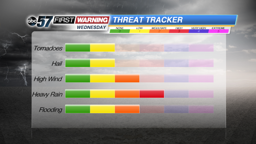 Heavy rain and flooding look to be the most likely and widespread threat for most.
Tonight: Humid, spotty evening showers, scattered AM storms, low 70.
Wednesday: AM scattered storms, hot and humid, high 90, another round of storms late.
Thursday: AM Showers, mostly cloudy, high 84.
Friday: Mostly sunny, highs near 80.
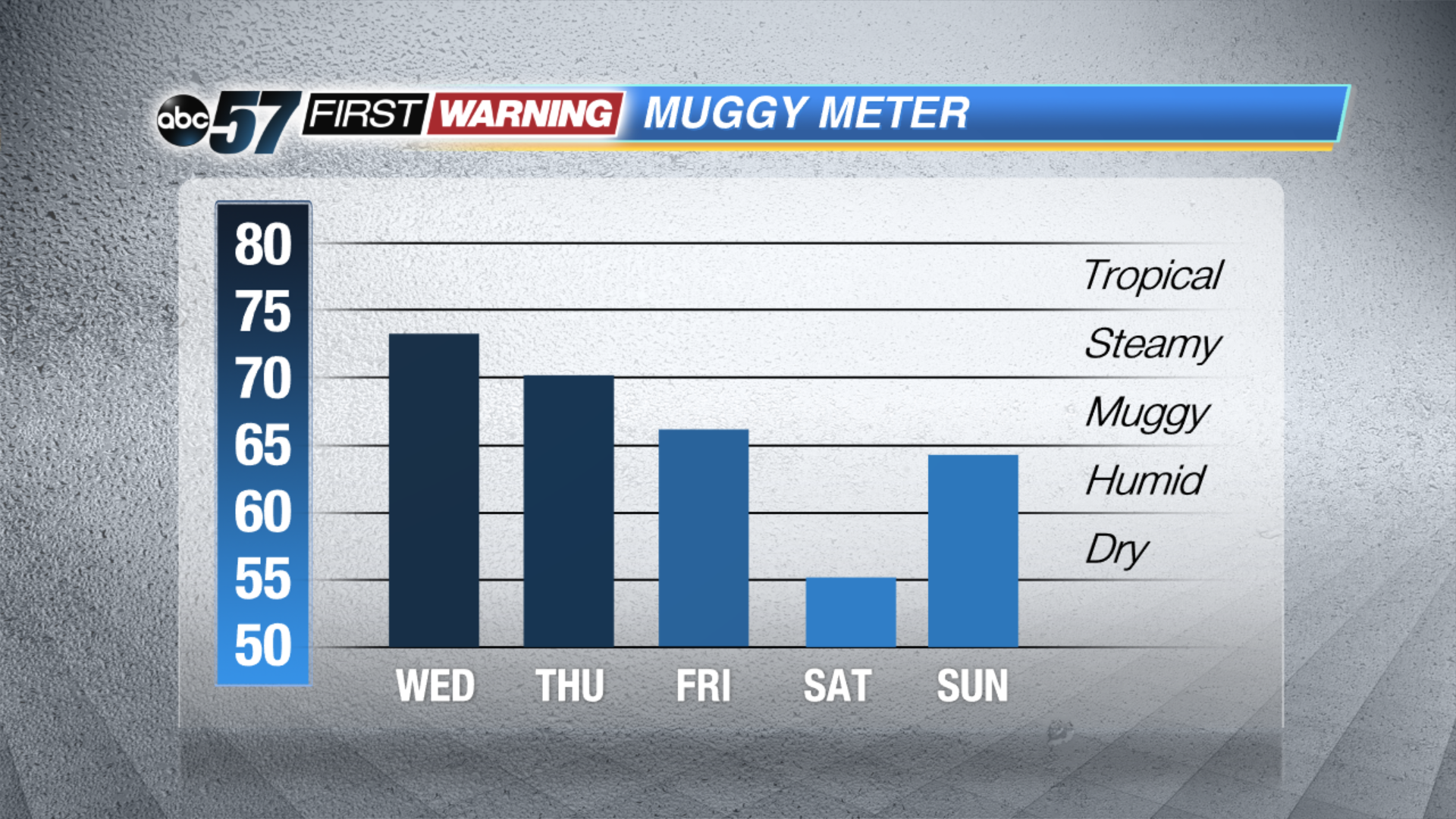 The humidity won't break until late Thursday, early Friday.