
-
1:27

Updated Tornado Survey- June 1, 2026
-
1:13

Severe Weather possible midweek
-
1:07

Quiet Monday, Stormy Midweek
-
2:52

GhostLight Theater presents Next to Normal Performance for Benton...
-
2:40

Car Show raises funds for Deputy Jon Samuelson
-
0:47

Nappanee became Candyland Saturday
-
2:01

The Juneteenth Cultural Alliance hosts Juneteenth celebrations...
-
1:11

Morning rain, breezy afternoon
-
0:53

Showers out the door
-
0:38

Two injured in overnight shooting
-
2:52

Cleanup efforts continue in Kouts after EF-3 Tornado
-
2:04

Michiana PrideFest celebrates its 5th year with a sports theme

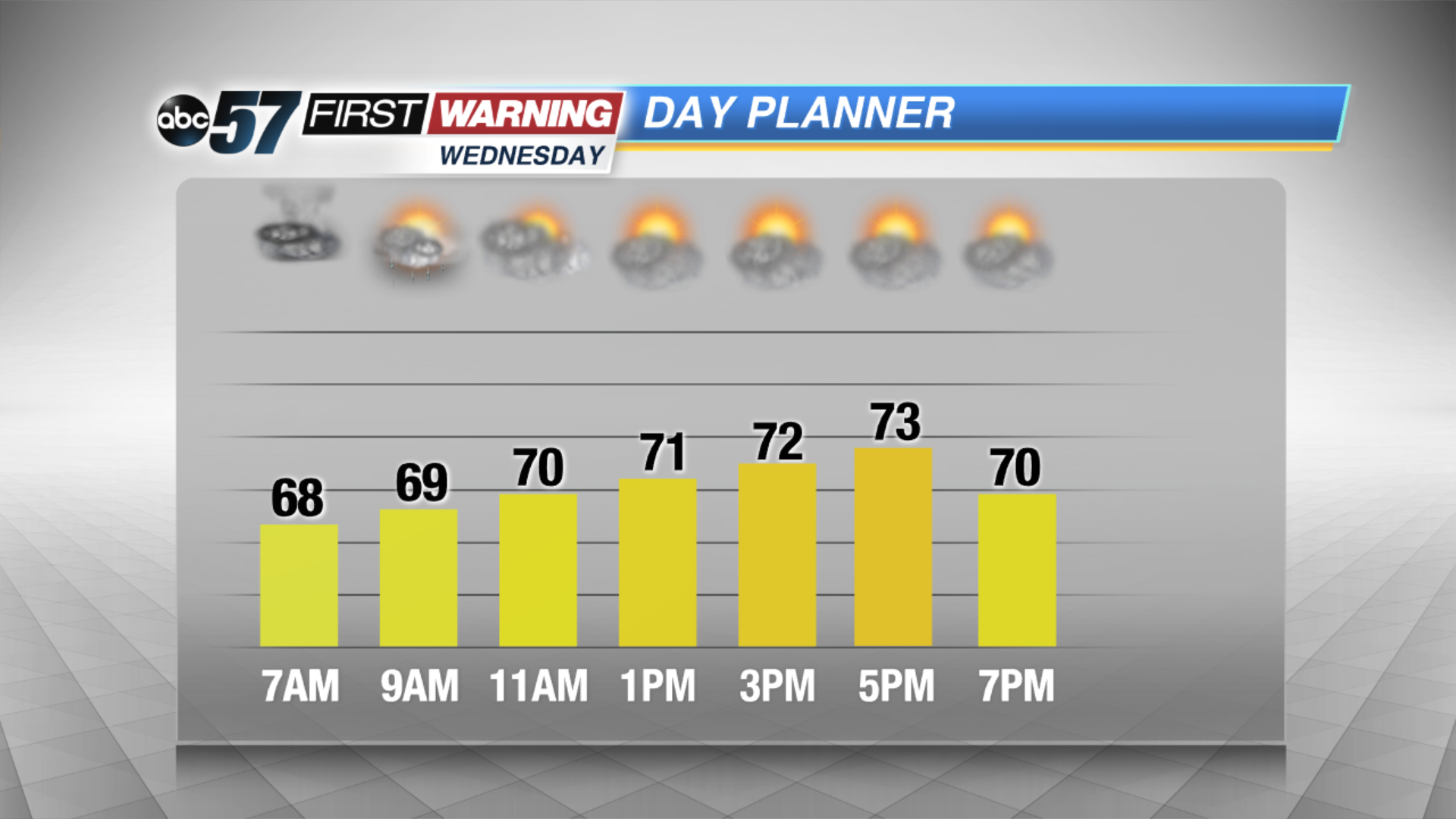
Scattered showers and storms Tuesday night will continue the threat of heavy rain and flooding through Wednesday morning. The humidity lasts for one more night.
The forecast trends drier and less humid Wednesday afternoon and Thursday, skies start to break and the humidity drops through midweek. Friday another round of showers and storms will bring the potential for more heavy rain and possible flooding. This weekend will not be as hot with highs in the 70s.
Tonight: Scattered showers and storms, low of 68.
Wednesday: Morning showers and storms, high of 74.
Thursday: Partly cloudy, high of 80.
Friday: Scattered showers and storms, high of 76.
Sign up for the ABC 57 Newsletter