
-
0:36

Eddies Circuit Robotics holds competition Saturday
-
0:32

21st annual Nappanee Model Train Show
-
0:38

Local boys basketball team headed to IHSAA state finals
-
3:49

Midwest Meowfest brings kitten advocacy to attendees, new homes...
-
1:52

Mild tonight, showers tomorrow
-
1:43

Pleasant to start the weekend
-
3:06

Pulaski County weighs stricter solar rules amid resident concerns
-
0:40

Marian High School hosts World Down Syndrome Awareness Walk
-
2:33

South Bend leaders call for an end to gun violence
-
2:01

Tae Johnson, Notre Dame secondary stands out as Irish open spring...
-
2:21

Backup quarterback competition, position battles highlight Notre...
-
2:25

A new Pathway to the Golden Dome

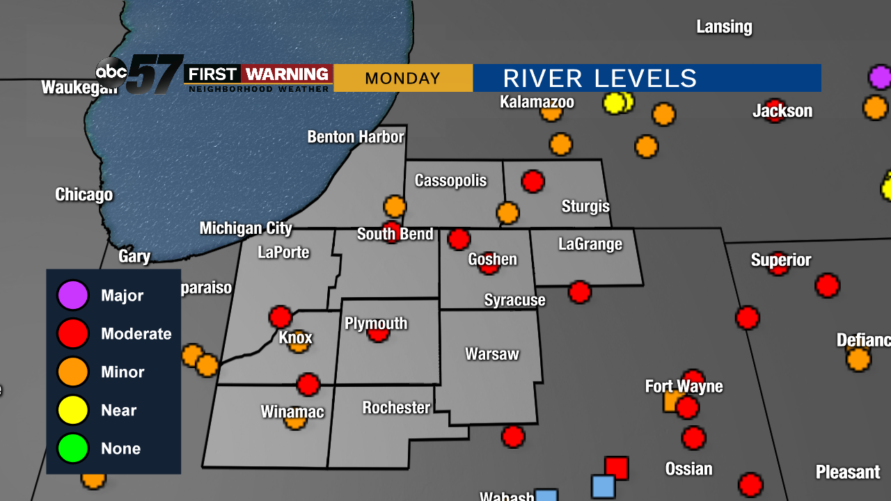
Steady rain, heavy at times, lasts through Saturday afternoon. Upwards for three inches of rain is likely, causing standing water and flooding. Temperatures fall from near 50 in the morning to the mid-30s by the afternoon. A wintry mix / freeze is the concern by early Sunday as temps fall into the mid-20s. Rivers rise quickly, peaking Monday in moderate flood stage.
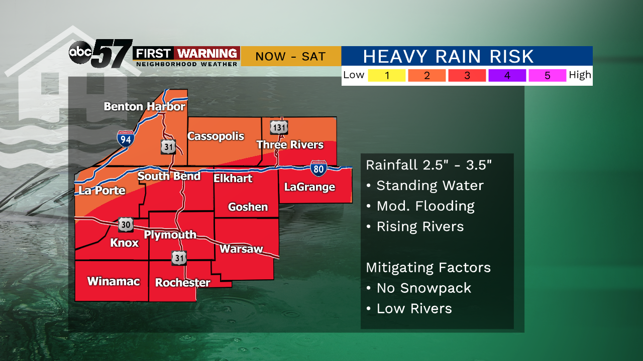
Tonight: Heavy rain, flooding possible, temperatures hold close to 50.
Saturday: Heavy rain, flooding possible, breezy, temperatures fall to 35.
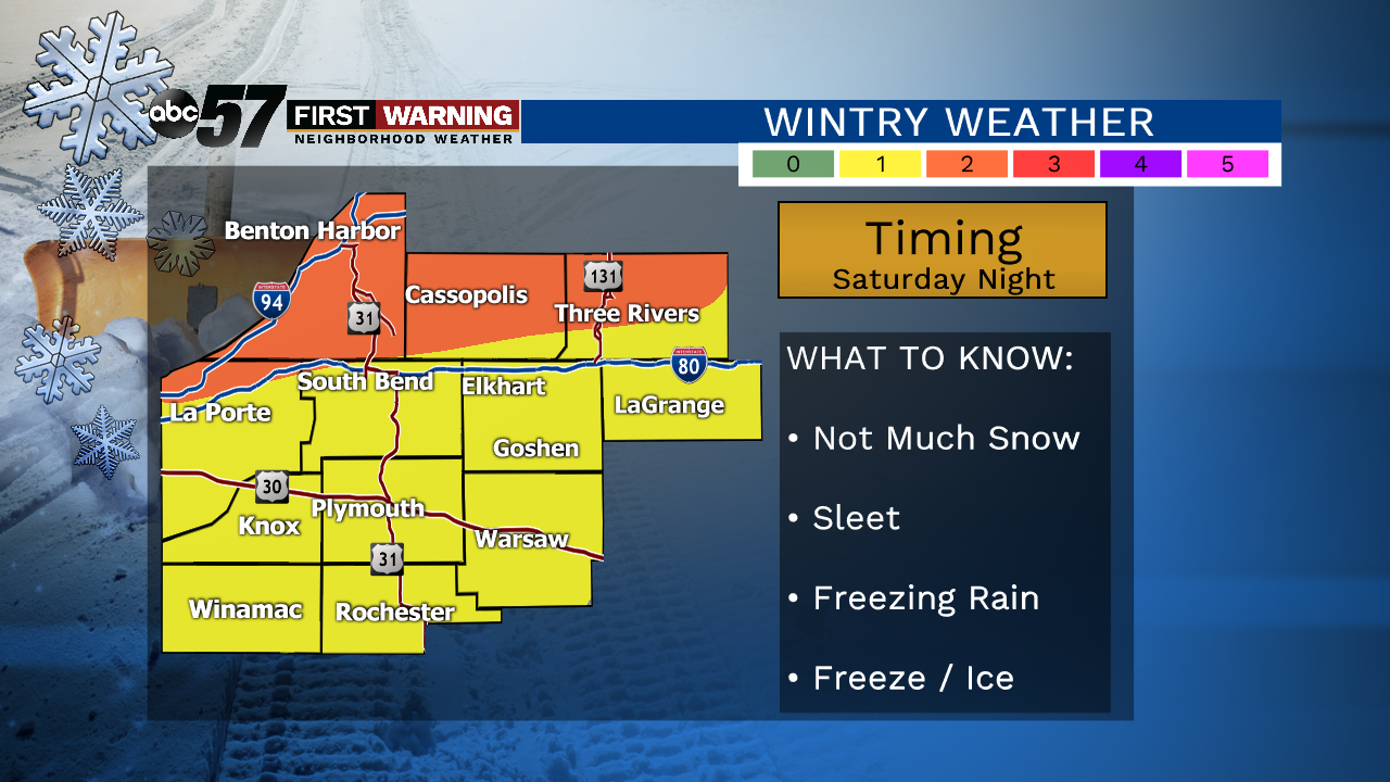
Saturday Night: Sleet possible, standing water will freeze, low 25.
Sunday: Mostly cloudy. High of 34.
Monday: Mostly cloudy. High of 40.
Sign up for the ABC 57 Newsletter