
-
0:52

Official ribbon cutting for The Delta neighborhood in Elkhart
-
1:08

Traveling or booking a trip soon? Here’s what to know
-
2:40

Recovery efforts continue after EF-1 tornado devastated Edwardsburg
-
1:22

The March rollercoaster continues
-
0:55

Mishawaka High School Theatre presents ’Chicago! Teen’
-
19:10

How public records requests increase government transparency
-
2:25

Local chef showcasing her food at Pacers game
-
3:46

Local farmers concerned war with Iran will impact fertilizer
-
2:56

The partial government shutdown is impacting travel across the...
-
1:33

Cool out the door, Mild by afternoon
-
1:50

Top Ten Snow Year 2025-26
-
1:17

South Bend Cubs unveil fan-focused upgrades ahead of Opening...

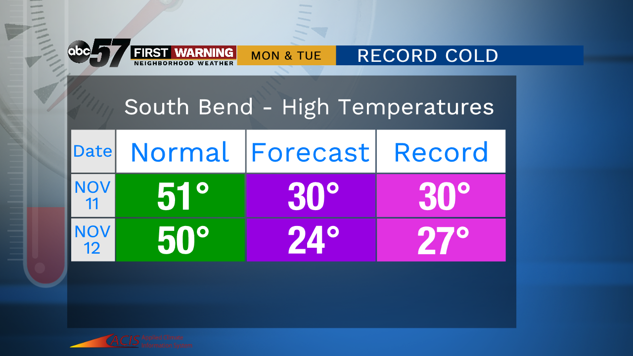
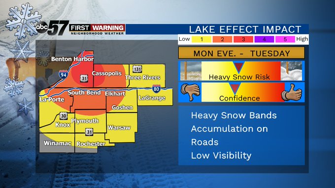
The weekend is fair and relatively mild by comparison to next with highs in the 40s. A cold front will move through early Monday morning, dropping temperatures and bringing widespread wintry mix and snow to the region. After the system snow, lake effect is likely to ramp-up Monday night into Tuesday morning. The record cold water temperature give the potential for significant snowfall.
Tonight: Partly to mostly cloudy. Low of 24.
Saturday: Partly cloudy. High of 42.
Sunday: Mostly cloudy. High of 44.
Monday: Snow showers. High of 30.
Tuesday: Lake effect snow: High of 24.
Sign up for the ABC 57 Newsletter