
-
4:24

Michiana Crime Stoppers shredding event
-
1:16

’IvyCares’ program setting students up for success in and...
-
1:45

Windy and wet this weekend, but unseasonable warmth as well
-
3:13

Local players react to $3 million investment in Byer Softball...
-
0:32

Layoffs at Whirlpool could affect workers in Benton Harbor
-
1:03

Annual District Sisterhood Conference at Ivy Tech empowers students
-
1:49

Back home in downtown South Bend, YMCA to open new location
-
2:16

This week’s ABC57 Cub Reporter is Nicholas Zentz
-
3:05

Amazon Web Services invests $11 billion to build data center...
-
4:05

Riley High School student center stage at the NFL Draft
-
1:35

Rain, wind, and milder temperatures forecast this weekend
-
2:49

Joe Alt expected to be drafted in the first round of NFL Draft

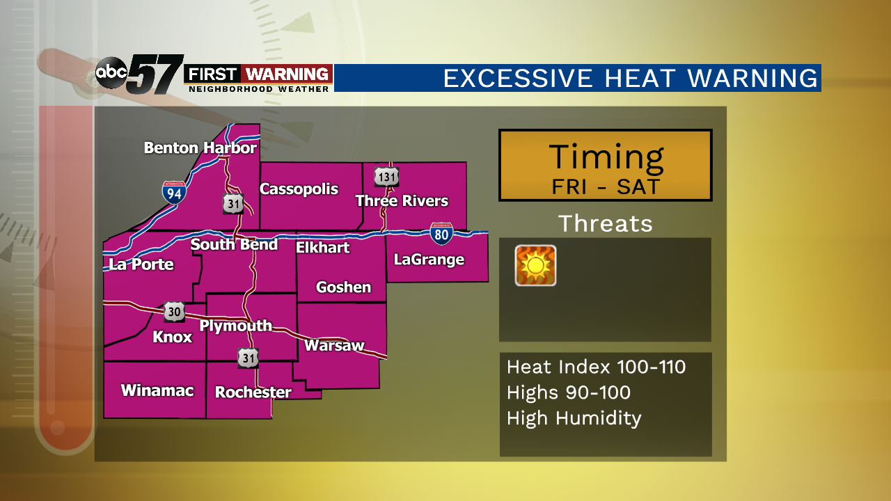
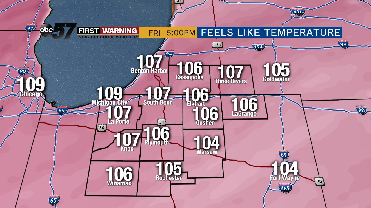
The extreme heat and humidity will peak Friday and last through Saturday. Highs in the mid-90s and a heat index will make it feel close to 110. Be proactive in reducing your exposure to the temperatures, especially during the hottest parts of the day in the late afternoon. The heat will break Sunday, the arrival of a cold front continues to trend earlier and this may bring showers and storms in the morning as relief arrives by the afternoon. Next week is mild with low humidity.
Tonight: Clearing, very humid, low of 77.
Friday: Extreme heat, mostly sunny, high of 96.
Saturday: Extreme heat, partly cloudy, high of 95.
Sunday: Showers & storms, high of 84.
Sign up for the ABC 57Newsletter