Dust off those shovels! Late February winter storm on the way


FIRST WARNING NEIGHBORHOOD WX FORECAST
Monday, February 24th, 2020
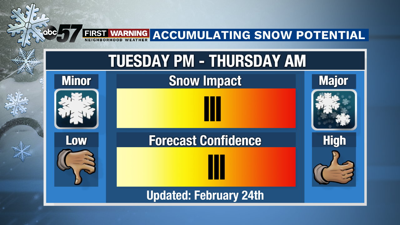
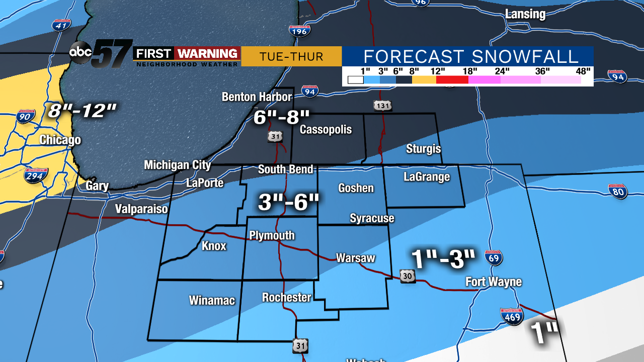
The active weather returns this week with precipitation in the forecast every single day. Late day light showers and drizzle are expected today with drizzly weather continuing into tonight. No impacts are expected Tuesday morning. Then things get interesting in the form of wintry weather by late Tuesday. Colder air will push in late Tuesday into Tuesday night, likely changing precipitation to all snow by Tuesday evening. Depending on your forecast model of choice, snow will fall on and off Tuesday evening thru Thursday morning as temperatures get much colder.
Today: Cloudy with late day showers and drizzle. High 43.
Tonight: Areas of drizzle and light showers. Low 33.
Tuesday: Cloudy with rain, possibly mixing with snow later in the day. High 39.
Wednesday: Cloudy with snow likely. High 34.