
-
3:14

The snow sticks around
-
1:10

Wintery weather starting in Michiana
-
3:11

Former players and coaches return to Notre Dame to honor Lou...
-
3:17

Notre Dame prepares for funeral of legendary coach Lou Holtz
-
0:56

Shipshewana on the Road takes over Elkhart
-
3:44

Large crowds expected at Notre Dame for Lou Holtz visitation
-
2:48

Storms arrive this evening, Snow Monday morning
-
4:33

Blustery and stormy today
-
0:39

Michiana Home Show continues to bring vendors to South Bend
-
0:58

Cookies and Canvas for the Heart raises awareness for children’s...
-
2:07

Most residents have power restored following high winds
-
0:44

26th annual St. Patrick’s Day Parade takes over Downtown South...

The first half of the week is uneventful. A weak system may bring some spotty showers early Tuesday morning otherwise a mix of sun and clouds with highs in the mid-40s. Beginning Wednesday the pattern turns wet. The first round of rain is like by Wednesday afternoon then widespread soaking rain Thursday into Friday. A rumble of thunder is even possible as temperatures spike to 60 Thursday. Temperatures crash to end next week.
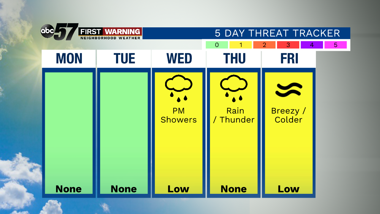
Tonight: Clear and quiet night. Low 28.
Monday: Partly cloudy. High 45.
Tuesday: Partly cloudy. High of 45.
Wednesday: Mostly cloudy. Rain showers by the afternoon. High of 45.
Sign up for the ABC 57 Newsletter