Dangerous heat, wildfires out West will impact Michiana weather


Whether it's in Michiana, across the United States or throughout the entire world, 2020's streak of heat is showing no signs of stopping.
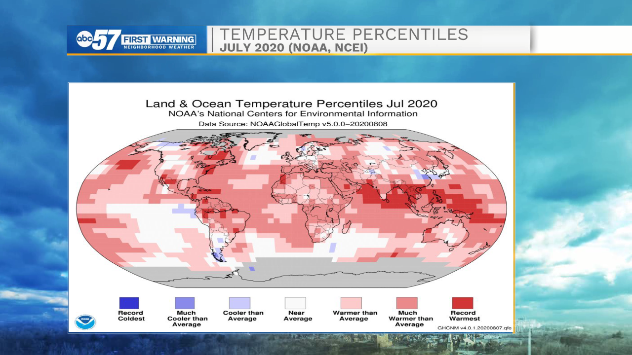
July 2020 is now officially the warmest July on record in the Northern Hemisphere. According to NOAA and the National Center for Environmental Information (NCEI), the month was the second warmest July on record across the globe.
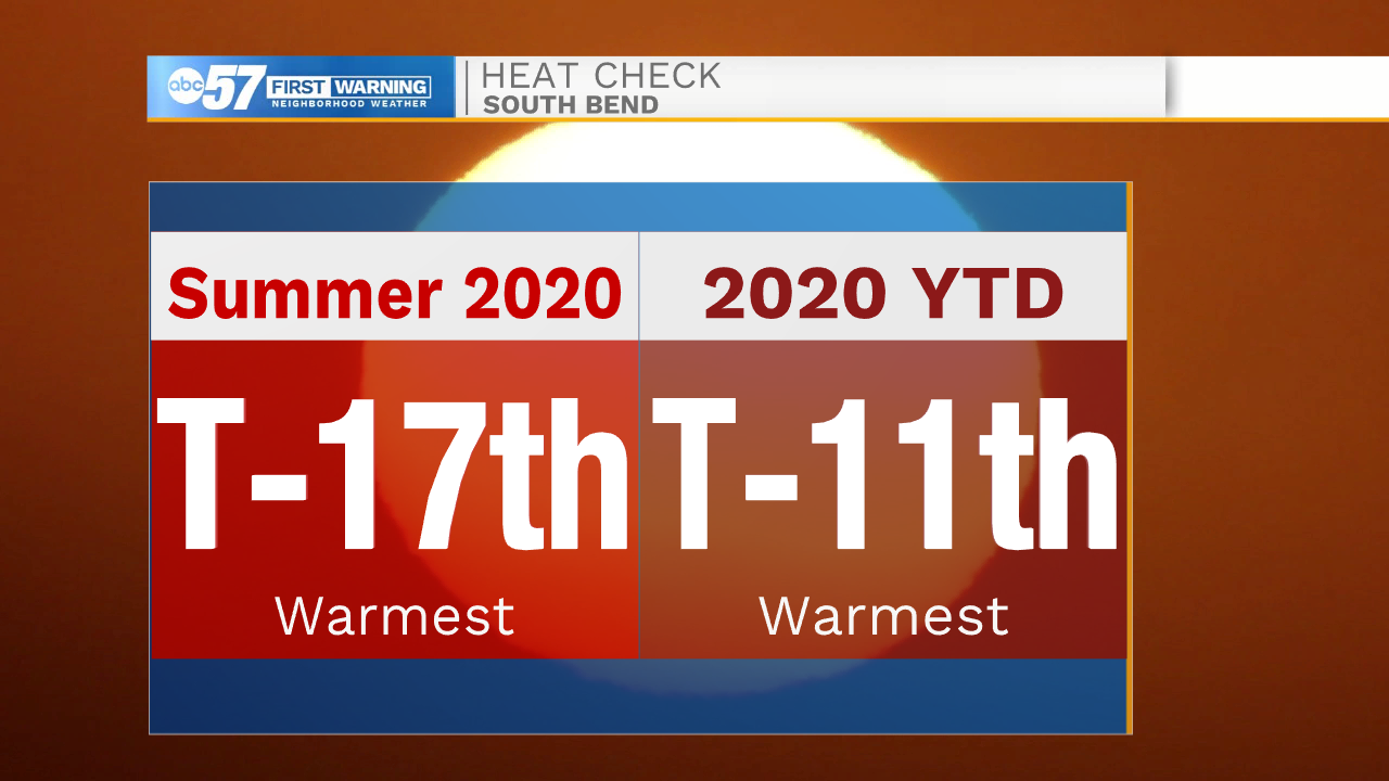
South Bend is part of the hot trend this year, too. The summer is currently tied for the 17th warmest on record. 2020 so far is even warmer, with this year currently sitting tied for 11th place for record warmth.
The western United States is in the midst of a long-duration heat wave as well. Over the weekend, Death Valley made history the thermometer at the Furnace Creek Visitors Center recorded a high temperature of 130 degrees. If verified (which is expected over the coming months), it would go down as the warmest temperature on Earth in over a century. It would also be tied for the third-warmest temperature ever reliably recorded on Earth. The record for warmest ever observed temperature is also in Death Valley, when, back on July 10. 1913, observers recorded a temperature of 134 degrees.
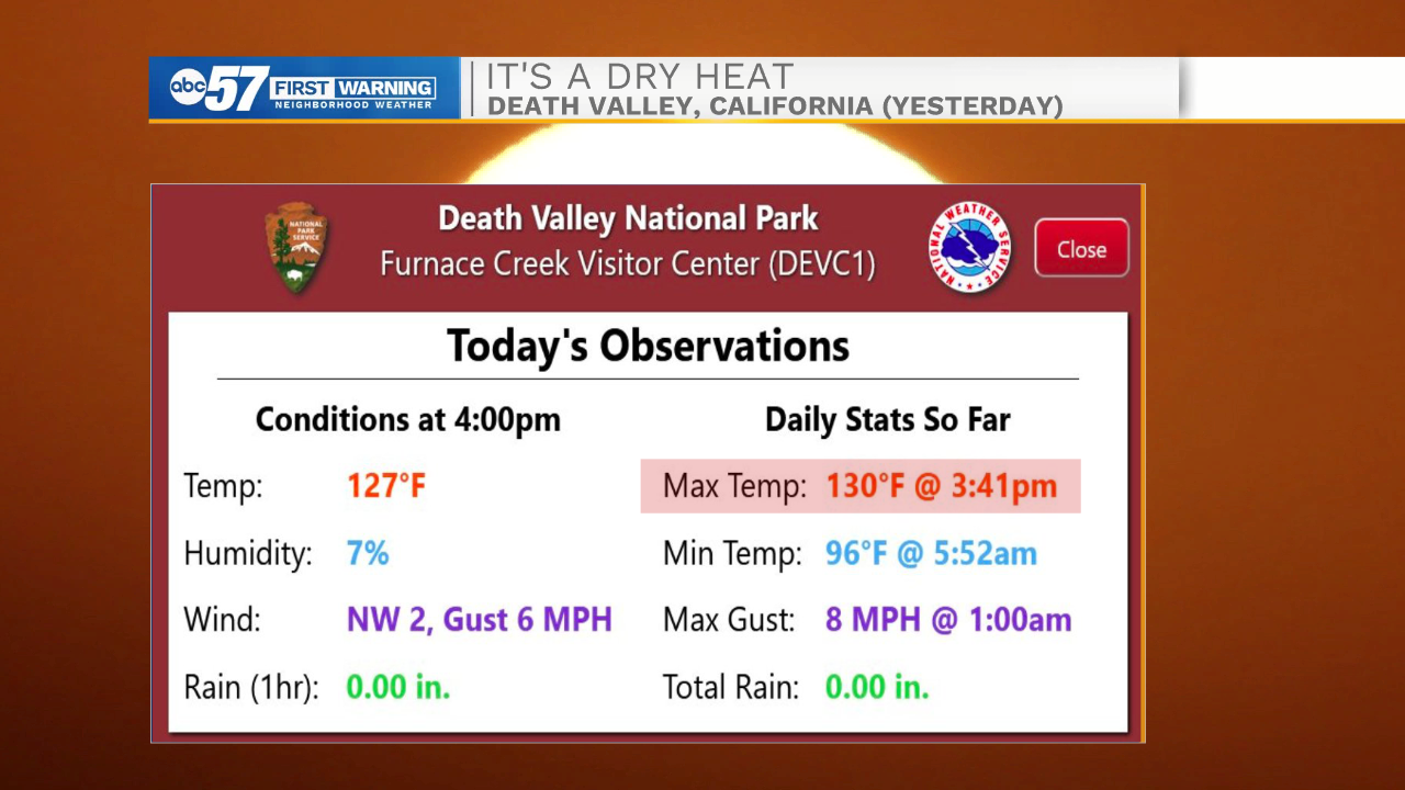
High temperatures in Death Valley could reach the 130s (that just doesn't look right as I type it) again on Monday.
Also rising with the extreme heat, along with the broken high temperature records, is the number of wildfires across the West.
As of Monday evening, 41 large fires are burning across 10 western states. Almost 450,000 acres are burning under active fires.
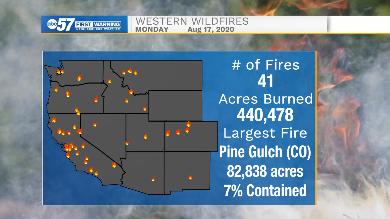
The Pine Gulch Fire, burning near Grand Junction, Colorado, is one of the largest fires currently active. Almost 83,000 acres have burned in the blaze, which is only 7 percent contained. Officials are very concerned about the weather for the next few days across western Colorado, with the potential for dry thunderstorms.
Another fire of concern is the Dome Fire, south of Las Vegas, which just crossed the 40,000 acre burned threshold Monday afternoon. It is not contained at all as of Monday afternoon.
Whether it's the threat of dry thunderstorms or more excessive heat over the next week, meteorologists expect the fires already out there to get worse and for more large fires to form heading into this weekend.
So, how does this impact Michiana beyond a conversation starter at the water cooler?
A very strong ridge of high pressure is trapping the heat across the West, causing many temperature records to fall in spots like Phoenix. This "heat dome" is not moving all that much. The jet stream (or storm track) is forced to move well north into Canada, and dips back stateside over the eastern half of the United States. This means Michiana will stay relatively mild over the next week. It also means that we're cut off from moisture from the Gulf of Mexico, and instead have to rely on the typically much drier air in Canada for any hope of rain. As a result, rain is going to continue to be hard to come by until the weekend.
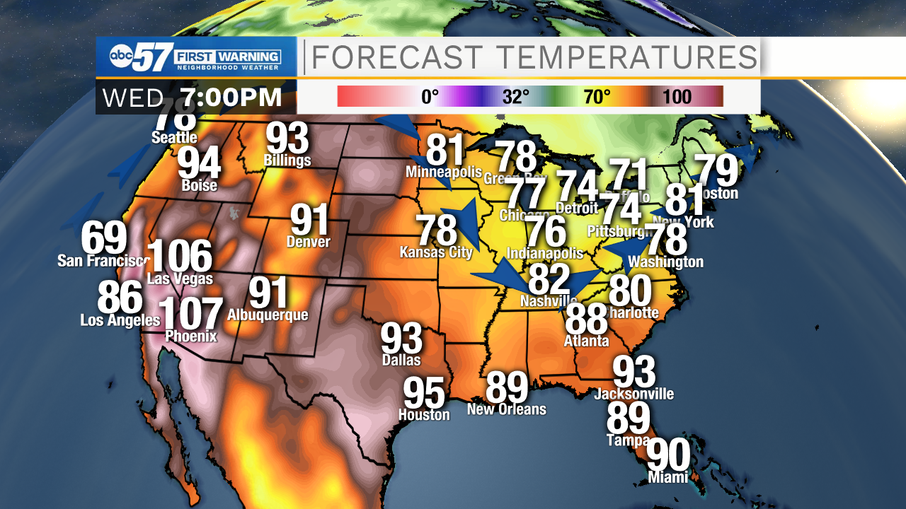
So, while we're not heading for highs in the hundreds any time soon, the heat out west is still playing a role in Michiana weather.