Cold today but warming up with a messy system this weekend

-
0:30

Prayer vigil held for domestic violence victim in South Bend
-
1:10

Bristol Town Council voting in favor tonight for the annexation...
-
0:52

Official ribbon cutting for The Delta neighborhood in Elkhart
-
1:08

Traveling or booking a trip soon? Here’s what to know
-
0:27

Elkhart Police Department investigating a hit and run on Cassopolis...
-
2:40

Recovery efforts continue after EF-1 tornado devastated Edwardsburg
-
1:22

The March rollercoaster continues
-
0:55

Mishawaka High School Theatre presents ’Chicago! Teen’
-
19:10

How public records requests increase government transparency
-
2:25

Local chef showcasing her food at Pacers game
-
3:46

Local farmers concerned war with Iran will impact fertilizer
-
2:56

The partial government shutdown is impacting travel across the...

Wednesday, January 8th, 2020
Everyone is colder today as temperatures stay below freezing behind the cold front. That has created light lake effect that will wrap up late afternoon.
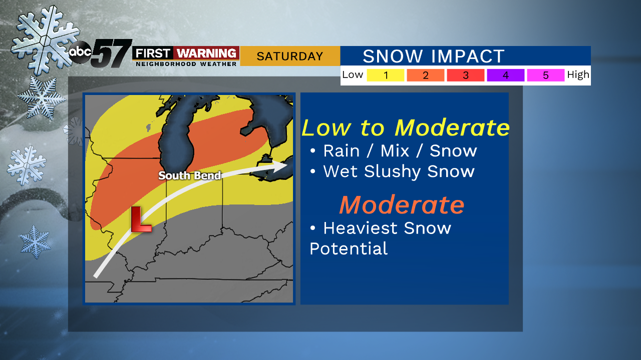
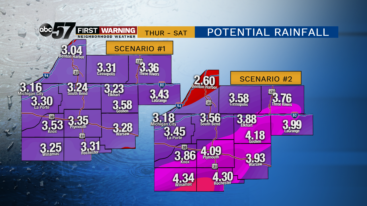
Temperatures rise into the 40s for Thursday and Friday, along with rain showers moving into the region. For Friday, we are going to be right on the cusp of the cold and warm air. So far, it looks like the warm air keeps it rain for Friday, then turning into a wintry mix overnight. That then transitions into mix and snow Saturday but how much snow we see will be dependent on how quickly the cold air moves into our area.
Today: Mostly cloudy. High of 28.
Tonight: Few clouds. Low of 22.
Thursday: Mostly cloudy, PM rain. High of 46.
Friday: Scattered rain showers. High of 50.