


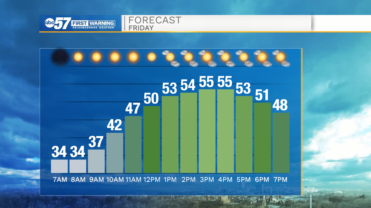
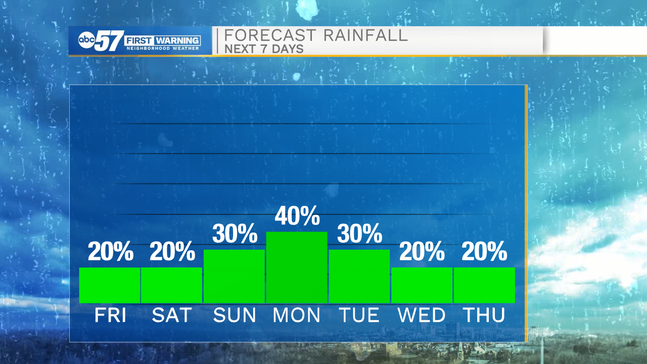
Temperatures this morning will drop to around freezing with areas of frost. Mostly sunny skies are expected this afternoon with high temperatures in the mid 50s. A few isolated rain showers are possible this afternoon, primarily in our northern Michiana counties. Tomorrow morning will be another cold one with lows dropping into the mid 30s. A round of light rain and drizzle are possible mid to late morning. Tomorrow afternoon looks dry and mostly cloudy with highs in the lower 60s. Increased cloud cover moves in Sunday with better chances for scattered rain showers.
Monday through Wednesday look cold, cloudy, and rainy. Right now our best chance of rain looks to arrive on Monday, and then turn isolated into Tuesday and Wednesday morning. High temperatures will start next week in the lower 50s and slowly warm into the mid 60s by Thursday. More rain chances are possible Thursday and Friday.
Today: Mostly sunny. High 55.
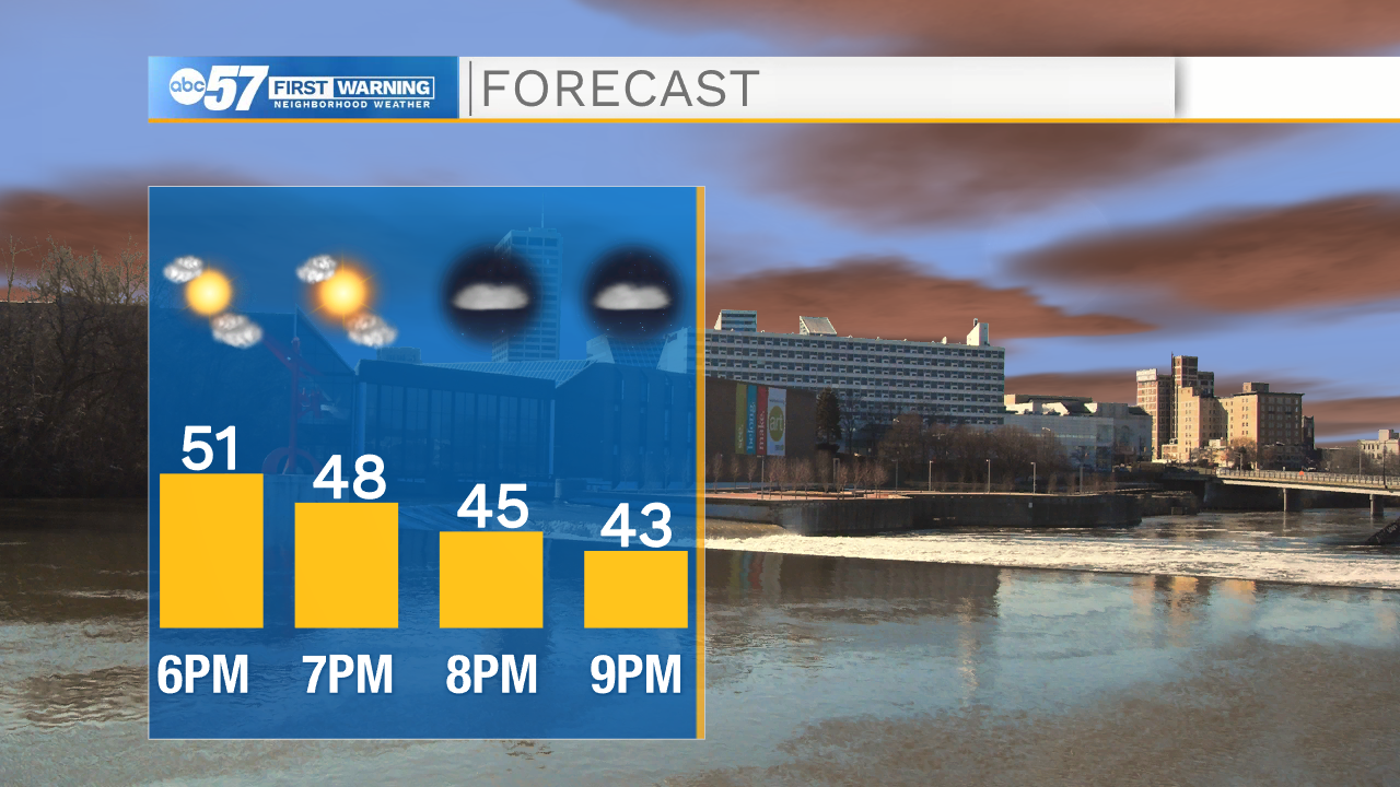
Tonight: Partly cloudy. Low 36.
Tomorrow: Mostly cloudy. High 60.
Sunday: Scattered showers. High 53.