
-
3:37

Indiana District 2 Candidates talk Iran, accountability and...
-
3:22

Elkhart County Sheriff Candidates debate ahead of May 5th Primary
-
2:52

Police say widely shared video of man held captive, beaten was...
-
4:14

Where do our local politicians stand on the war in Iran?
-
2:26

Notre Dame offensive line searching for continuity as Ashton...
-
3:48

ABC57 sits down with candidates running for Elkhart County Sheriff...
-
1:51

Charlie Partridge already making early impact on Notre Dame defensive...
-
3:12

County officials hopes to call further attention to littering...
-
6:06

Candidates for Indiana state senate speak following President...
-
0:57

Sunny and windy today
-
5:10

Pop-Up Kitty Cafe coming to Michigan City
-
2:51

Nappanee will soon be home to the World’s Largest Cabinet

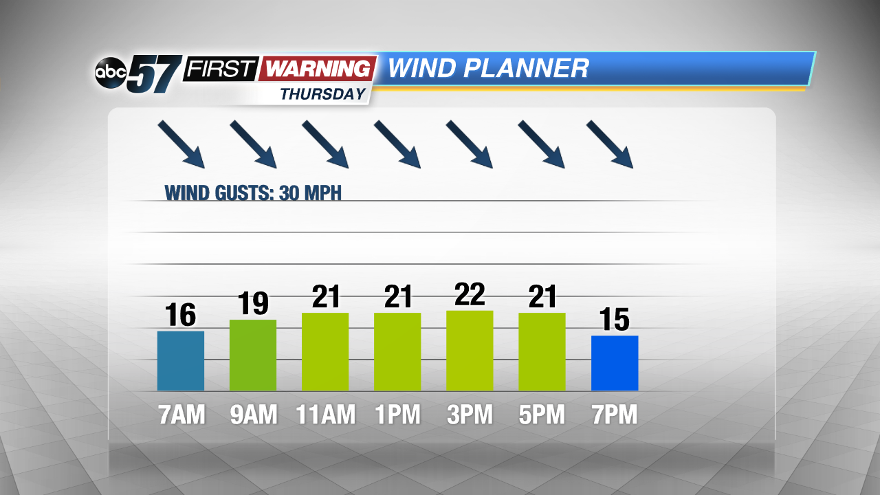
Cold weather ends the week, a few snow showers but little accumulation. Highs Thursday and Friday will struggle to break the freezing mark. The wind might be the biggest factor Thursday, as gusts could top 30 mph, another blustery day. The weekend begins to show some signs of milder weather, a slow but steady warm-up will continue through next week.
Tonight: Mostly cloudy, flurries, low of 24.
Thursday: Mostly cloudy and blustery, chance of snow, high of 30.
Friday: Partly to mostly sunny, highs of 34.
Saturday: Mostly sunny, highs in the low 40s.
Sign up for the ABC 57 Newsletter