Chances increasing for a white Christmas across Michiana

-
2:26

Epic Dance Studios Fundraiser Gala dances through the decades
-
1:58

The Elkhart community is set to mark three years since the tragic...
-
5:16

’Bridge Guy’ video released online, publisher unknown
-
1:00

29th Annual B100 Radiothon taking place Thursday and Friday
-
5:44

Fall of Duty
-
1:55

Temperatures going up along with our storm threat and wind gusts
-
1:20

Buttigieg makes social media announcement on political future...
-
1:48

Summer-like stretch ended by thunderstorms late Friday night
-
2:15

South Bend Police honors department members in 2024 awards ceremony
-
0:48

Women’s Impact Panel at Saint Mary’s College celebrates local...
-
3:07

Residents voice concerns over new sewer district
-
2:43

Fire crews spend hours working to put out flames at The Mill...

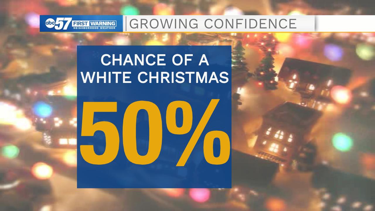
Last week, when we last checked our "white Christmas chances," things were looking pretty grim.
The "polar vortex" was behaving, temperatures were relatively minor, and our snowfall was basically non-existent.
Now, it seems like winter wants to wake up just in time for Christmas.
So, what's changed? It's pretty simple: our first shot of very cold air of the season will arrive next week.
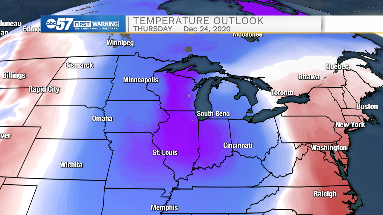
Note the timing here: The polar air arrives on Christmas Eve across the Midwest. This is one of the crucial elements needed to start up the "lake-effect snow machine."
While there is still time for the forecast to change, and it's too early to get specific, confidence is increasing that we'll see lake-effect snow close to Christmas across Michiana.
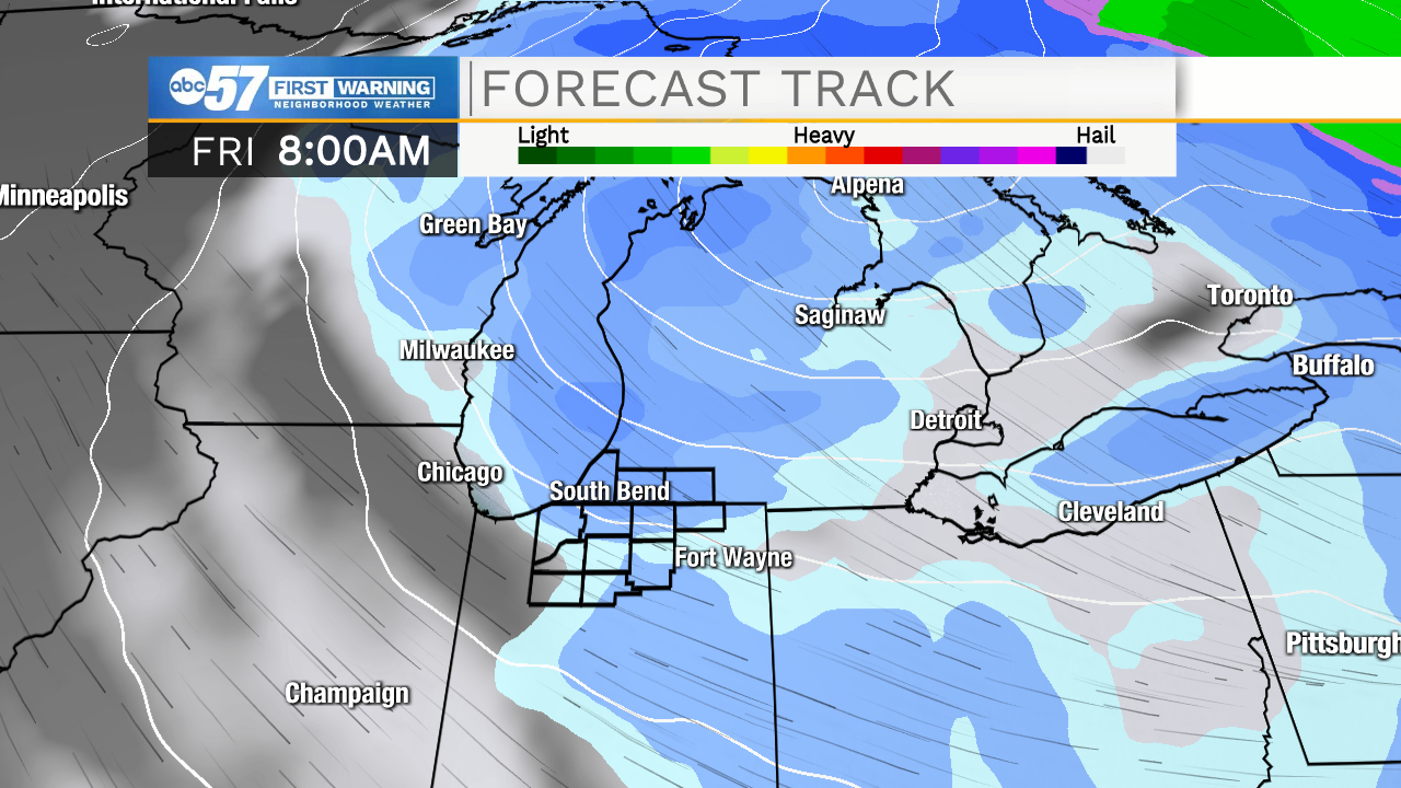
The question is, will the snow accumulate in time for us to officially record a white Christmas? Remember, snow depth measurements are taken in the morning!
So, with all this in mind, we've increased our chance of a white Christmas significantly to 50%.
Stay with ABC57 for the latest forecast updates, especially with potential snow on the way!