


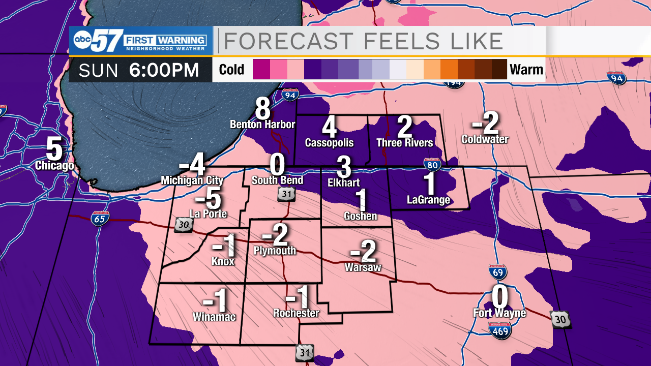
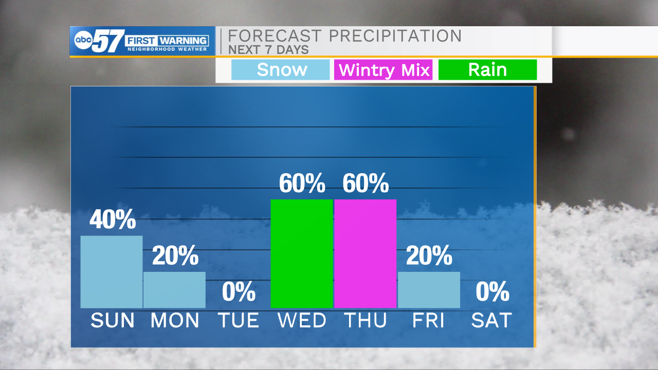
Isolated snow flurries will begin to fizzle out has we head into the evening hours. Temperatures tonight will drop near the single digits with feel like temperatures at 0 by tomorrow morning. If you are headed out the door early, make sure to bundle up. A few isolated light snow showers are possible tomorrow around lunchtime and could linger into the early evening. Overall impacts will be very low. Another short round of isolated flurries are possible Monday from mid-morning through lunchtime, after that our weather will stay quiet for a few days. Temperatures next week will rebound into the mid 30s by Tuesday and then the lower 50s on Wednesday. With the warmer air, rain chances make their way back into the forecast. That rain will turn to snow as a cold front slides through Thursday morning. A few inches of snow accumulation are possible. Temperatures will drop back into the 20s and 30s heading into next weekend.

Tonight: Mostly cloudy/cold. Low 10.
Tomorrow: Isolated lake effect snow. High 22.
Monday: AM flurries. High 28.
Tuesday: Partly cloudy. High 34.