
-
0:58

Chilly and sunny Tuesday ahead
-
0:41

Elkhart police investigating Monday night shooting
-
3:47

Elkhart Police Department accepting applications to Citizens...
-
0:52

A slight warm-up but chilly weather still dominates
-
1:09

Bitterly cold out the door
-
3:03

Looking to younger generations to keep Dyngus Day thriving
-
3:06

Even as rivers recede, Marshall County still dealing with flooding
-
3:29

Michigan fans gather in Indianapolis ahead of National Championship...
-
3:22

Hamlet local and tow truck driver describes US 30 crash site...
-
4:28

Dyngus Day celebrations highlight voter turnout, transparency
-
4:54

Now-disbanded St. Joseph County Metro Homicide Unit investigator...
-
0:52

Shots fired on Sunnymede Avenue Saturday, cars and homes struck

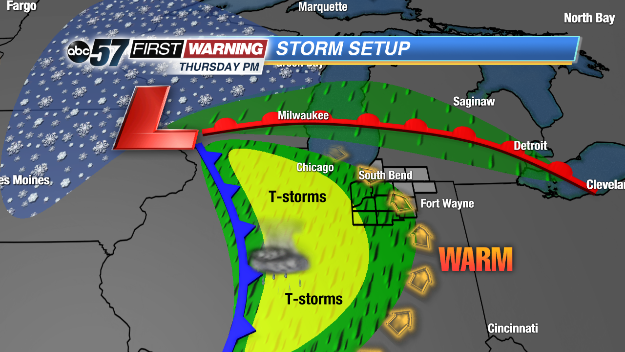
Temperatures take another dip Wednesday, with the first round of rain likely by the evening. A strong storm system then surges temperatures again Thursday with highs in the 60s. The roller coaster ride will bring a chance of thunderstorms Thursday evening. Temperatures fall again Friday, breezy with highs in the 50s falling into the 40s on Saturday.
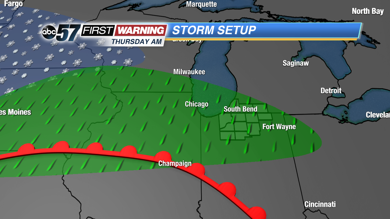
Tonight: Increasing clouds, low of 36.
Wednesday: Mostly cloudy, chance of rain, high of 46.
Thursday: Breezy, chance of evening rain/storms, high of 68.
Friday: Breezy, chance of AM rain, high of 54.
Sign up for the ABC 57 Newsletter