


Our weather looks to stay on the quiet side this evening, but the cold air will remain in place. If you are heading out for any Saturday evening plans make sure to bundle up. Temperatures tonight will fall back into the teens with wind chills hitting the single digits. A quick round of light snow showers will move through during the overnight, primarily impacting northern Michiana. This round of snow will be very low impact with up to a dusting in some areas. We will see a big swing in temperatures tomorrow as highs hit the upper 40s to lower 50s. Get outside tomorrow to enjoy the beautiful sunshine. Temperatures heading into the work week will hold in the 50s until Tuesday, then the 60s through Thursday. We are tracking some better rain chances for next Thursday and Friday.
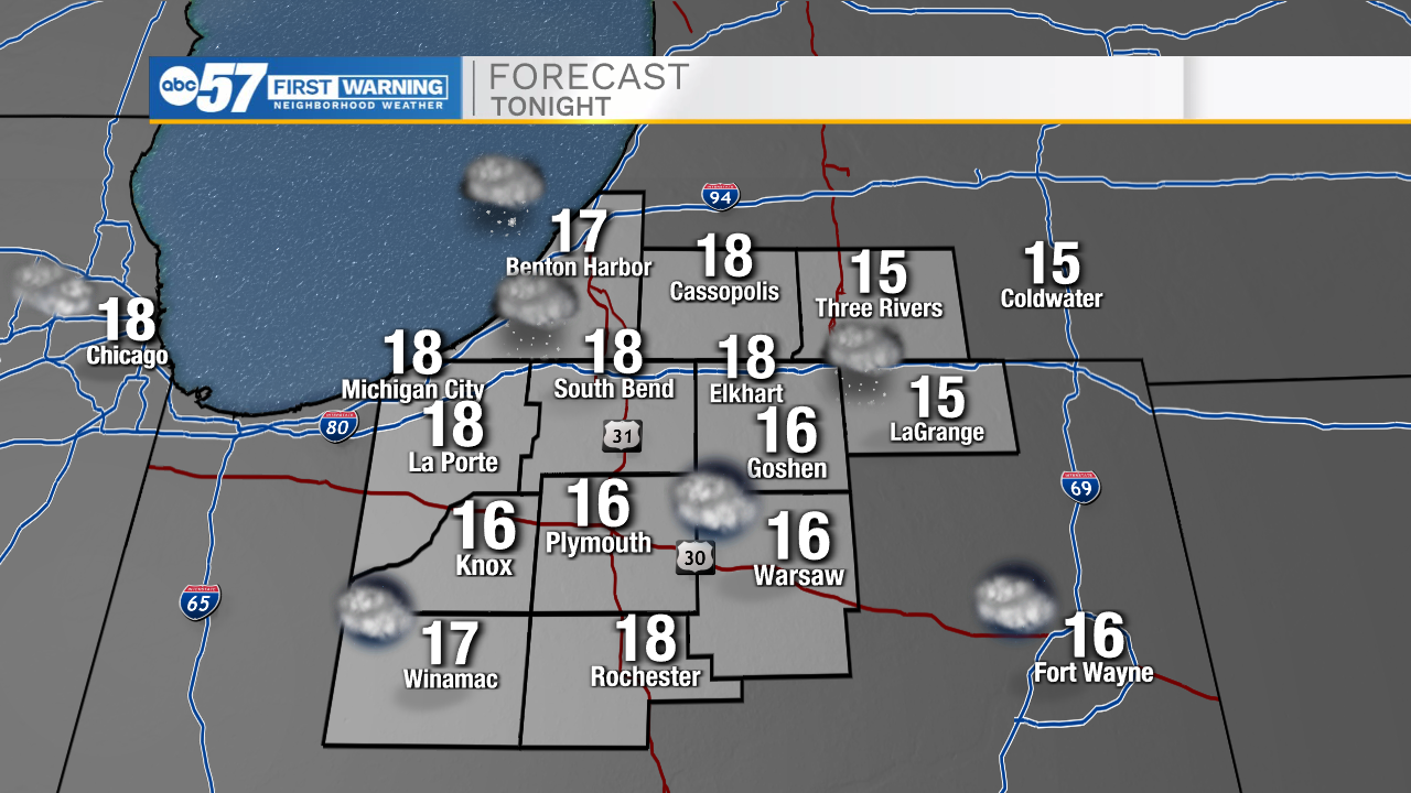

Tonight: Partly cloudy/Light snow. Low 18.
Tomorrow: AM clouds/PM sun. High 50.
Monday: Partly cloudy. High 55.
Tuesday: Partly cloudy. High 52.