Big changes ahead as arctic air set to establish itself
This winter hasn't exactly been impressive regarding cold. December finished way above normal, and January has gotten off to an incredibly warm start thus far.
That is set to change, though, as we head into the second half of the month.
It's what comes just beyond the 7-day forecast that will raise some eyebrows.
That really hasn't happened much at all this winter because our patterns haven't favored truly arctic air.
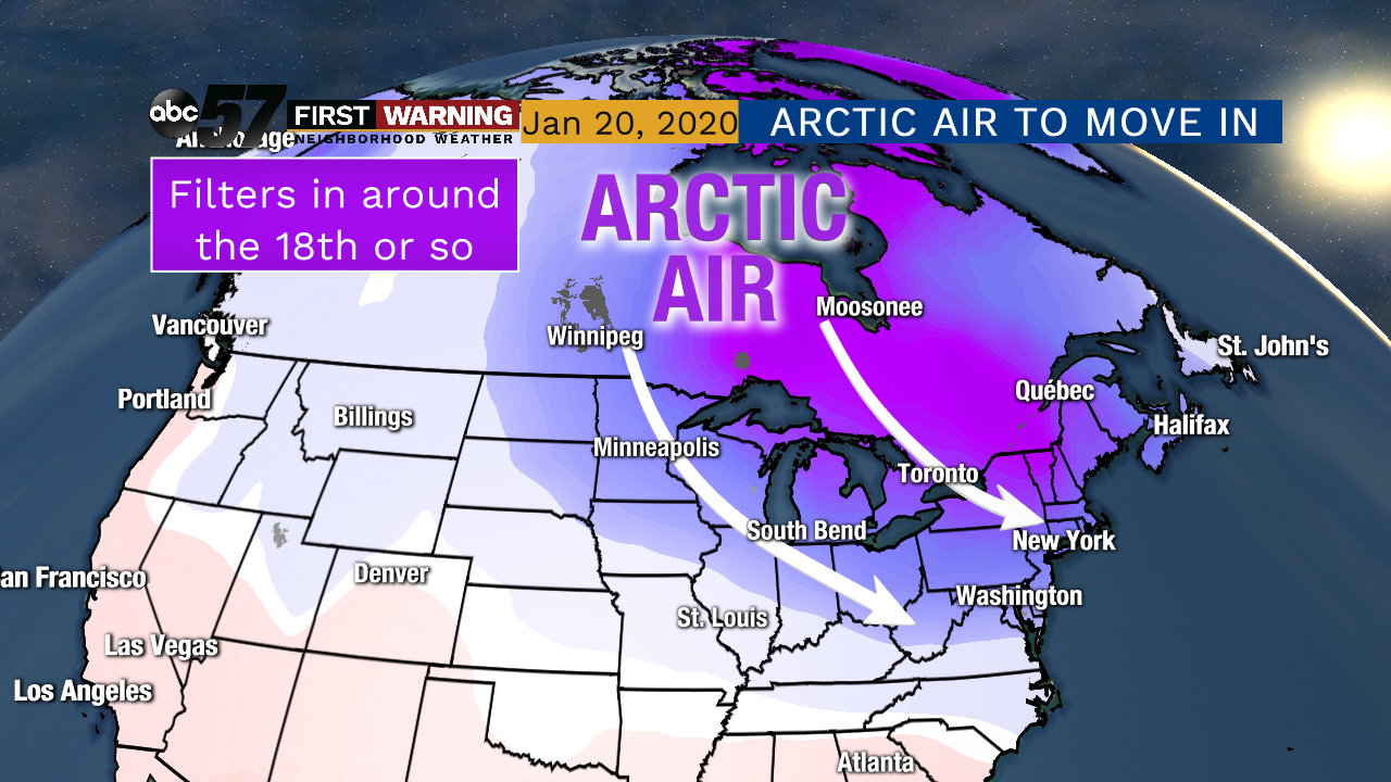
ACTUAL WINTER TO ARRIVE:
— Tyler Sebree (@TylerABC57) January 12, 2020
It's looking more and more like actual winter-like cold will move in around the 18th and remain in place for at least the following week. pic.twitter.com/msFb0rGWfI
And it won't just be here for a day or two before quickly departing. Nearly all forecast models show the below normal temperatures sticking around for quite some time.
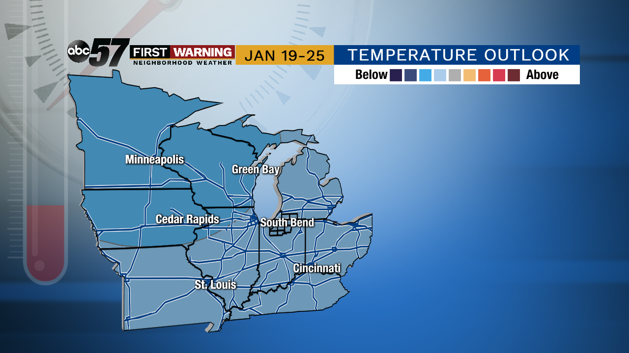 Temperature outlook for the period January 19-25.
It's important to remember that these outlooks don't say how much below normal we will be; just that we have a good shot at being colder than we should be. And our averages for this time of year are 31° for daytime highs and 18° for overnight lows.
That means a day with a high of 29° and a low of 16° would qualify as a day below normal just as a day with a high of 7° and a low of -11° would.
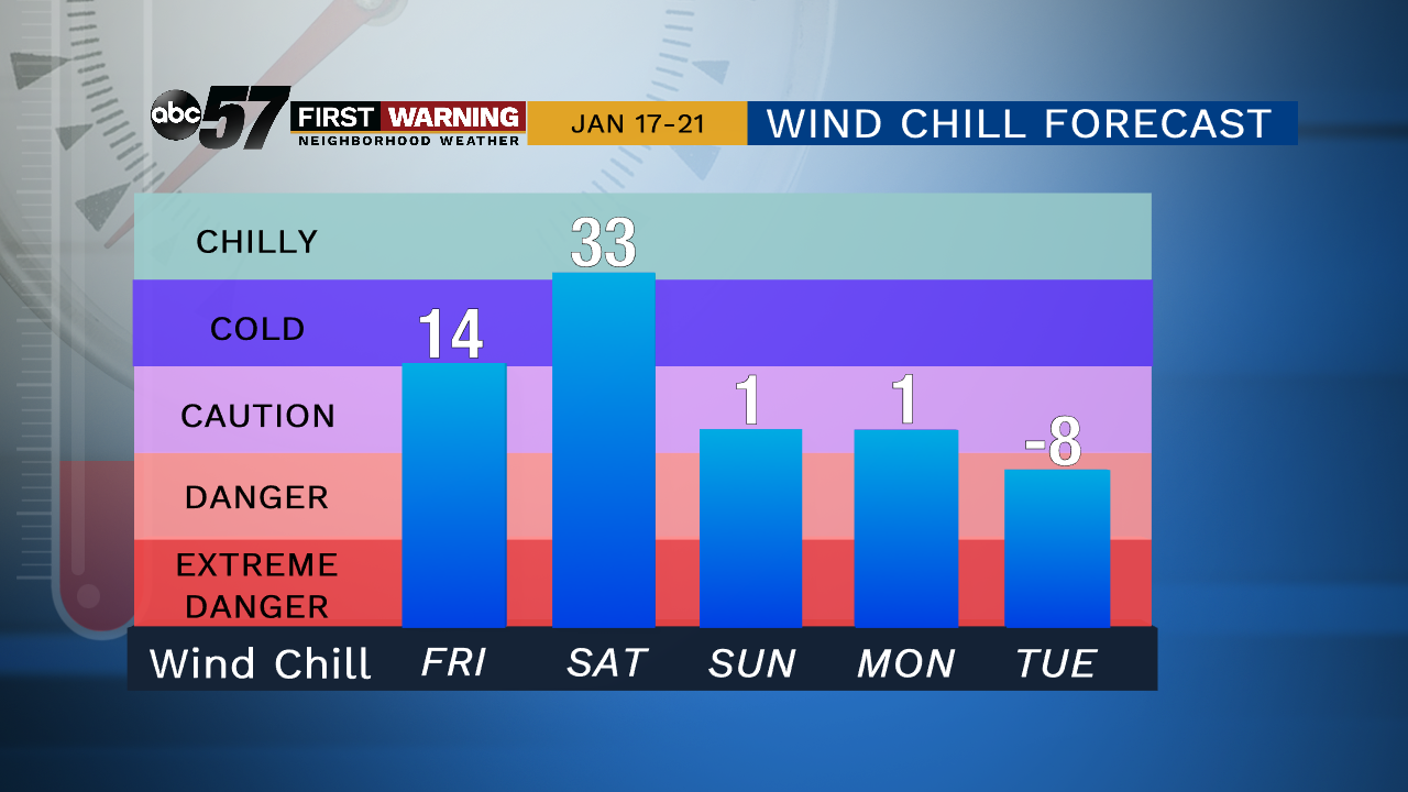 Potential wind chill temperatures during the period January 17-21.
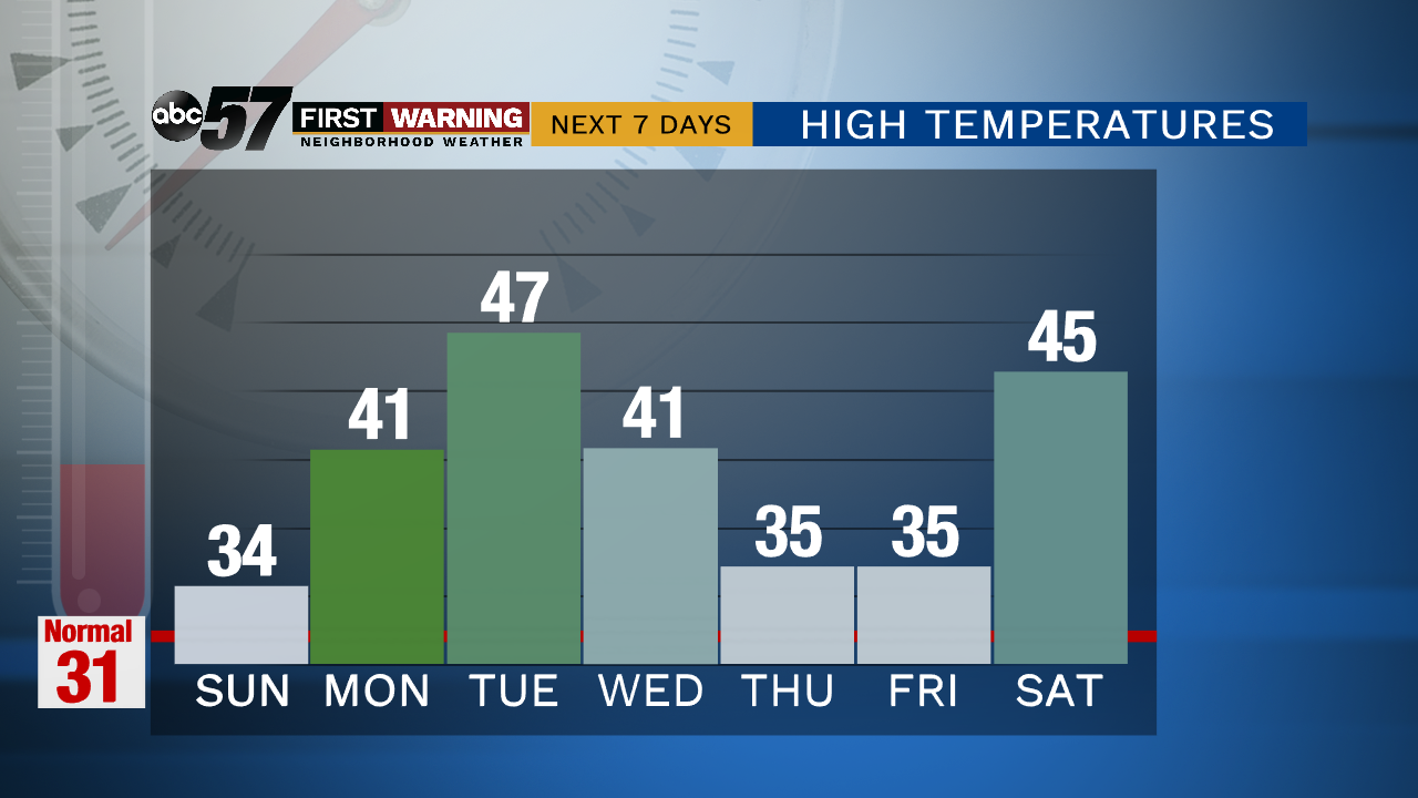
According to the latest data, we will likely have a string of days from the 19th thru perhaps the end of the month -- if not longer -- with highs in the upper teens and twenties.
Could a day in the 30s get tossed in the mix? Sure.
In terms of wind chills it's possible we could be dealing with wind chills flirting with zero, if not subzero levels depending on the final magnitude of the cold once it arrives.
That would certainly qualify as very cold to bitterly cold. Winter had to arrive at some point, right?
