
-
2:58

Thousands of people across Michiana experienced power outages...
-
1:13

Earl Wigfall holds Detective Trivia Night for Sheriff campaign
-
1:50

Preparations underway for South Bend’s annual St. Patrick’s...
-
0:24

CAVA set to open in Mishawaka
-
1:16

Groundbreaking project underway for housing development
-
0:52

Jefferson Boulevard renamed to kickoff St. Patrick’s Day festivities
-
0:35

Congressman Rudy Yakym on Iran conflict
-
3:22

A look at some of the big concerts coming to St. Joseph County...
-
1:50

Mild Sunday, snow Monday
-
4:37

Morris Performing Arts Center show season starts tonight
-
1:53

Thousands without power due to high wind gusts
-
2:49

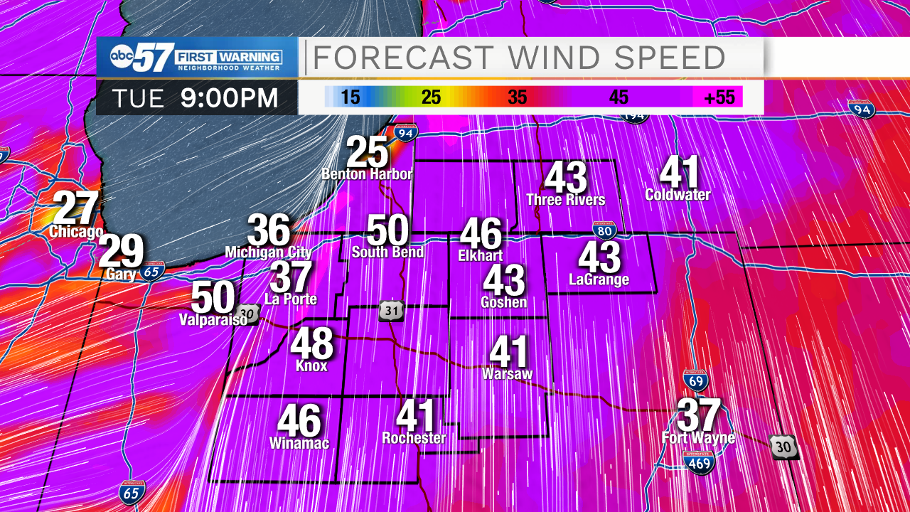
High Wind Warning today

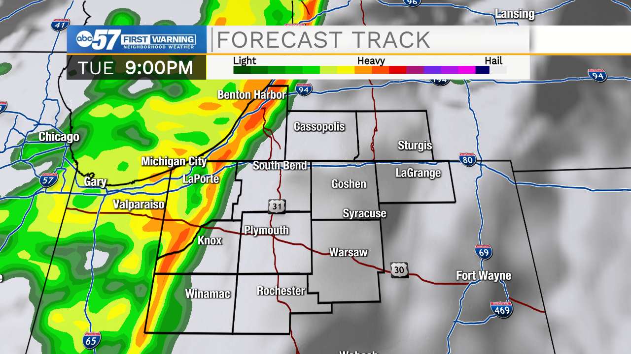
BIG CHANGES TONIGHT: Wind gusts top 40 mph this evening, as a strong cold front cuts through around 9:00 p.m. A line of rain, possibly thunderstorms arrive just ahead of the front, localized this is the highest damaging wind threat. The rain quickly clears and temperatures plummet into the upper 30s by Wednesday morning.
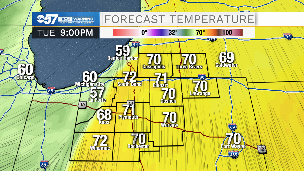
Wednesday is a return to fall. High temperatures in the mid-40s will be a shock to the system but it's closer to November norms than record heat in the 70s. The forecast is mostly fair and cool into the weekend with a chance of rain Saturday evening. Next week looks fair and milder, no 70s but highs in the mid-50s is mild for mid-November.
Tonight: Line of showers/storms, windy. Low 38.
Wednesday: Mostly sunny. High 46.
Thursday: Sunny. High 54.
Friday: Partly cloudy. High 44.