After a rainy start, Friday turns sunny and windy (again)

-
3:11

Former players and coaches return to Notre Dame to honor Lou...
-
3:17

Notre Dame prepares for funeral of legendary coach Lou Holtz
-
0:56

Shipshewana on the Road takes over Elkhart
-
3:44

Large crowds expected at Notre Dame for Lou Holtz visitation
-
2:48

Storms arrive this evening, Snow Monday morning
-
4:33

Blustery and stormy today
-
0:39

Michiana Home Show continues to bring vendors to South Bend
-
0:58

Cookies and Canvas for the Heart raises awareness for children’s...
-
2:07

Most residents have power restored following high winds
-
0:44

26th annual St. Patrick’s Day Parade takes over Downtown South...
-
2:42

Active weather arrives Sunday
-
3:22

Calm today, storms return Sunday

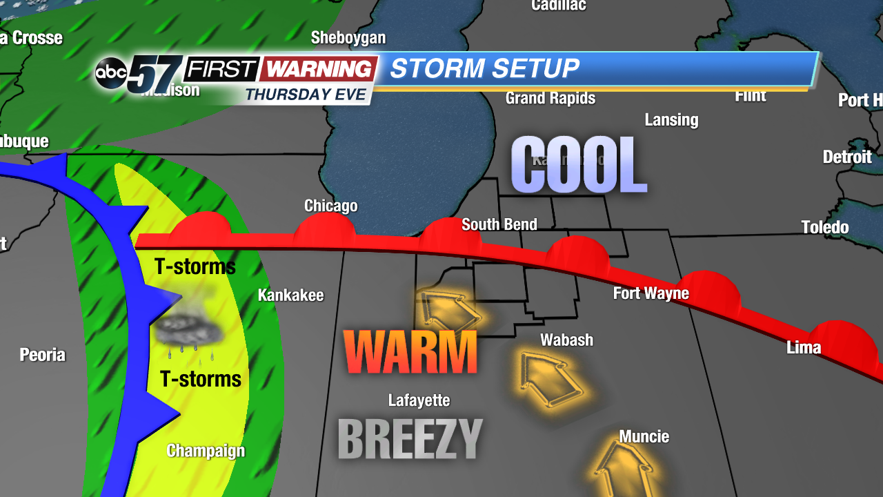
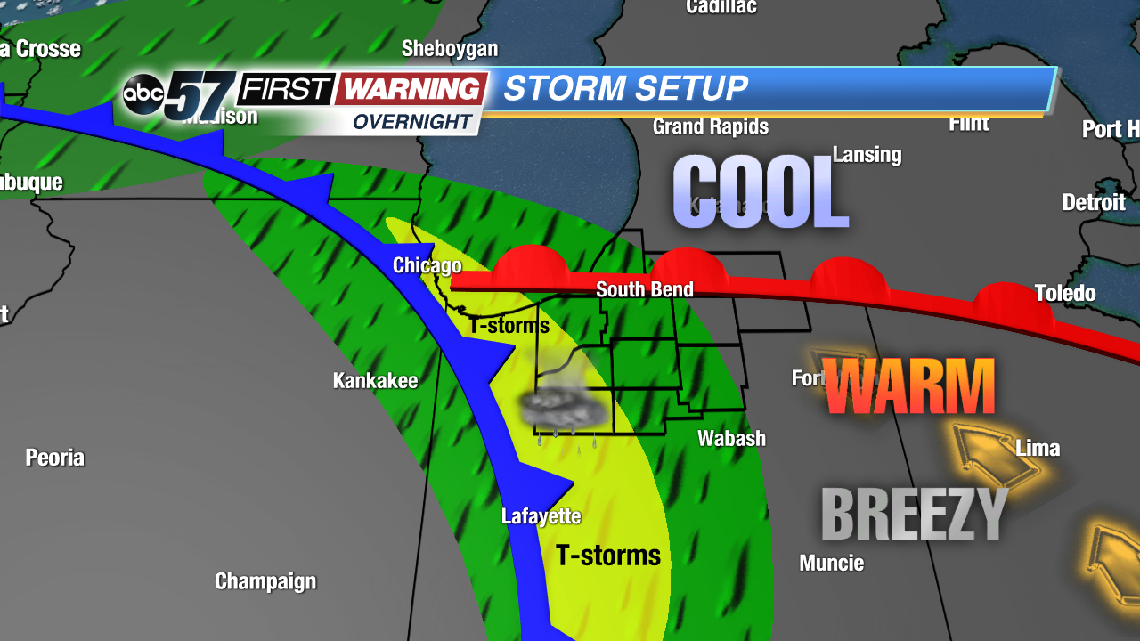
A sharp divide in temperatures, the split between the 70s in the south and 50s and 60s in the north. The surge of warm air will collapse as a front move through overnight. Rain and rumbles of thunder are likely into early Friday morning.
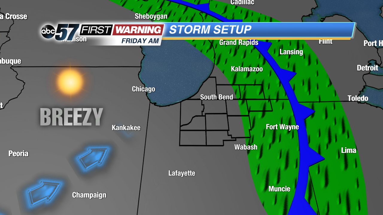
Friday starts rainy then as clouds clear into the afternoon the wind will gust again near 40 mph. The wind calms into Saturday, the nicest day of the weekend, sunny with highs in the mid-50s. Sunday will be soggy and damp with more rain and highs in the 40s. The rain clears into early Monday but there’s more wet weather next week.
Tonight: Mild and breezy evening, showers and storms after midnight, low 50.
Friday: Morning showers, clearing and winy afternoon, high of 58.
Saturday: Sunny, high of 56.
Sunday: Rainy, high of 48.