A warm Thursday brings a storm threat by the evening
Posted: May 15, 2019 4:36 PM EST

-
1:24

Happy feet hit the floor at 24th Annual Daddy Daughter Dance
-
3:35

New house bills could reorganize local school corporations
-
1:58

New era underway at Knollwood Country Club
-
3:51

Local Police Departments concerned over House Bill 1186
-
2:55

’Save Lakeside Woods’ successfully buys land back from developer,...
-
3:26

SBCSC announces community partnership to improve school literacy
-
2:21

Freezing rain reaches Michiana Wednesday night
-
2:25

Potential ice jamming in New Buffalo
-
2:31

The History Museum’s ’Worker’s Home’ brings 1950s African...
-
1:39

Cloudy and cooling down today with a wintry mix tomorrow
-
0:52

Mishawaka High School holds signing day for student athletes
-
2:47

Local Latin markets concerned about possible tariffs

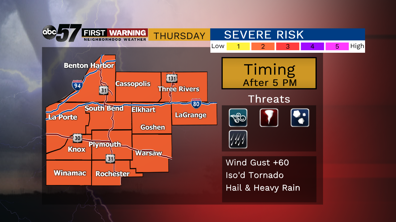
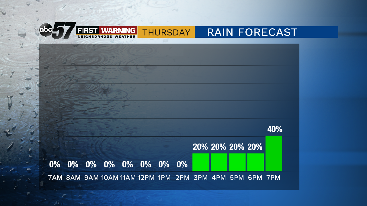
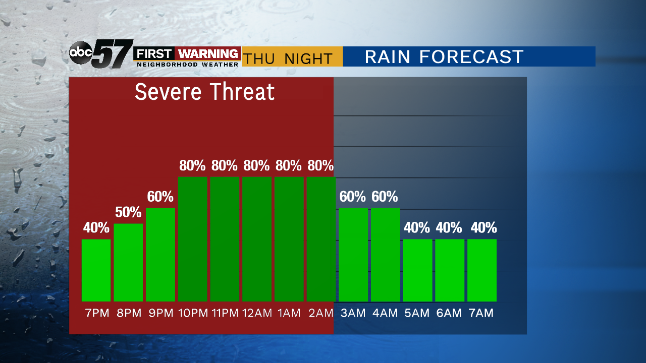
Temperatures continue to rise steadily Thursday with some added humidity, this will fuel thunderstorms Thursday evening into early Friday morning. The peak storm energy and other factors however may not align with arrival of storms from the west. There could be a few isolated severe cells in the evening leading up to heavy downpours overnight. Temperatures swing back-and-forth from mild Thursday, to cool Friday and surge back towards 80 Saturday and Sunday.
Tonight: Mostly clear, low of 52.
Thursday: Partly cloudy, chance of storms increasing, high of 78.
Friday: Morning showers, mostly cloudy, high of 66.
Saturday: Partly cloudy, high of 78.
Sign up for the ABC 57Newsletter