
-
0:30

Prayer vigil held for domestic violence victim in South Bend
-
1:10

Bristol Town Council voting in favor tonight for the annexation...
-
0:52

Official ribbon cutting for The Delta neighborhood in Elkhart
-
1:08

Traveling or booking a trip soon? Here’s what to know
-
0:27

Elkhart Police Department investigating a hit and run on Cassopolis...
-
2:40

Recovery efforts continue after EF-1 tornado devastated Edwardsburg
-
1:22

The March rollercoaster continues
-
0:55

Mishawaka High School Theatre presents ’Chicago! Teen’
-
19:10

How public records requests increase government transparency
-
2:25

Local chef showcasing her food at Pacers game
-
3:46

Local farmers concerned war with Iran will impact fertilizer
-
2:56

The partial government shutdown is impacting travel across the...

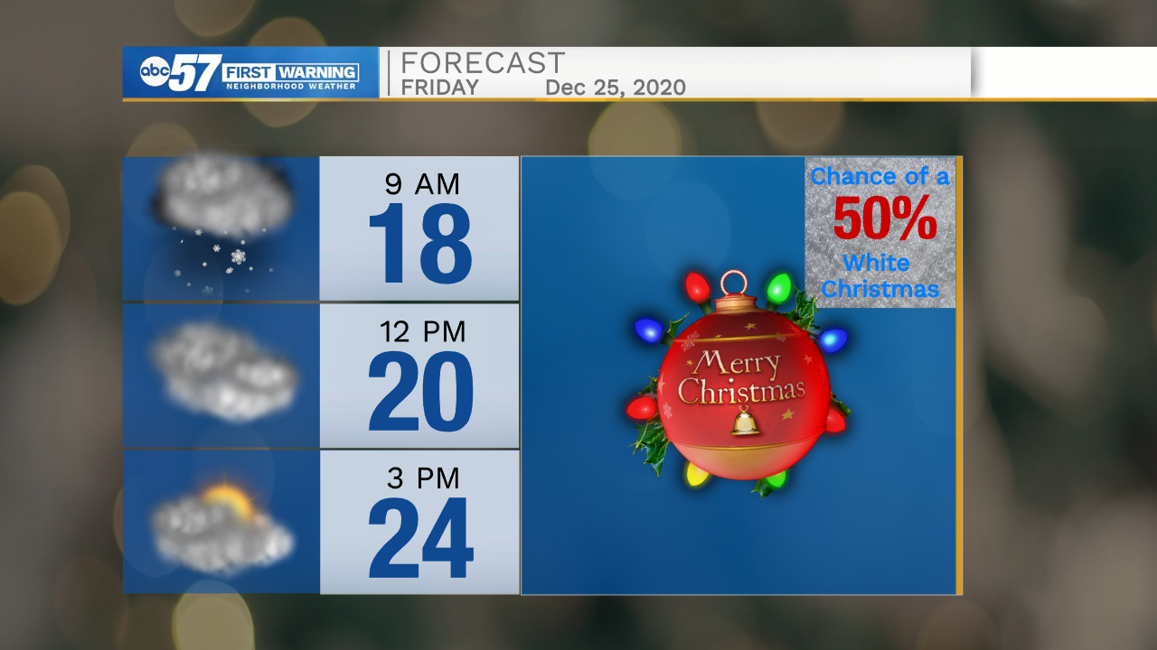
A sloppy start to Saturday, a wet snow-mix will transition to a rain-mix by midday. There could be brief accumulation but the result is mostly the same, a damp morning. The precipitation ends into the afternoon and temperatures warms near 40 by the end of the day. Sunday is quiet before another quick round of wintry weather Monday. The main focus will be on Christmas and what looks to be the coldest air of the season, increasing the likelihood of a White Christmas, due to lake effect snow showers.
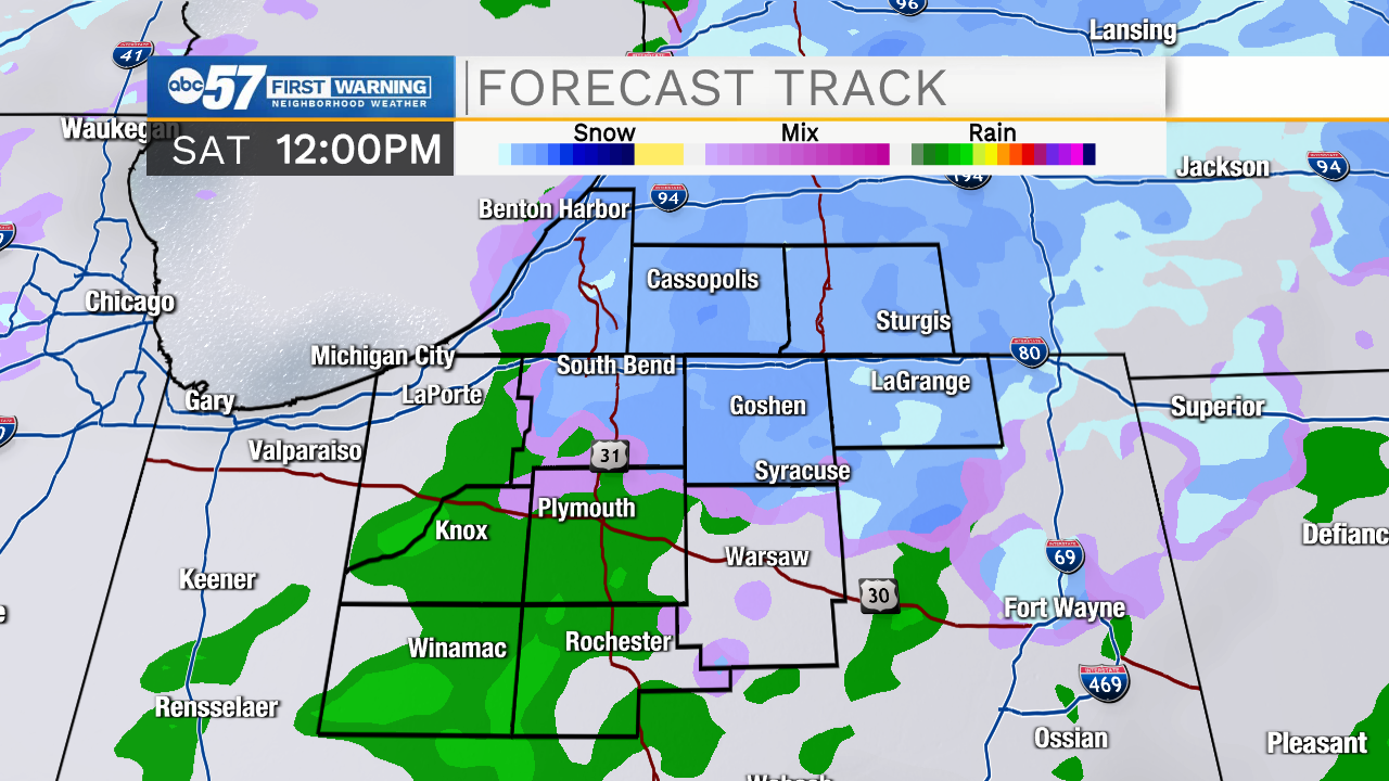
Tonight: Mostly cloudy. Low 32.
Saturday: Rain/snow showers. High 40.
Sunday: Partly cloudy. High 38.
Monday: Rain/snow showers. High 38.
Sign up for the ABC 57 Newsletter