A little warm-up midweek, may cause more slick spots
By:
Tom Coomes
Posted: Jan 11, 2022 5:51 PM EDT

-
0:59

Contract negotiations collapse, prompting NIPSCO to lock out...
-
0:58

Indiana Football trophies tour stops by IUSB
-
0:57

How the town of Bourbon shapes up one year after EF-1 tornado
-
0:54

School City of Mishawaka announce Teachers of the Year
-
1:36

Severe threat not over
-
2:19

St. Joseph County officials address fax service hack
-
1:28

Round two around midnight
-
1:53

Local churches gearing up for the easter holiday amid a possible...
-
1:48

Preparations underway as Indiana University football trophies...
-
3:09

Indiana Utility Regulatory Commission collecting consumer data...
-
1:18

St. Joseph County officials host Election 101 Workshop on voting...
-
5:36

Hannah Hidalgo wins Naismith Defensive Player of the Year

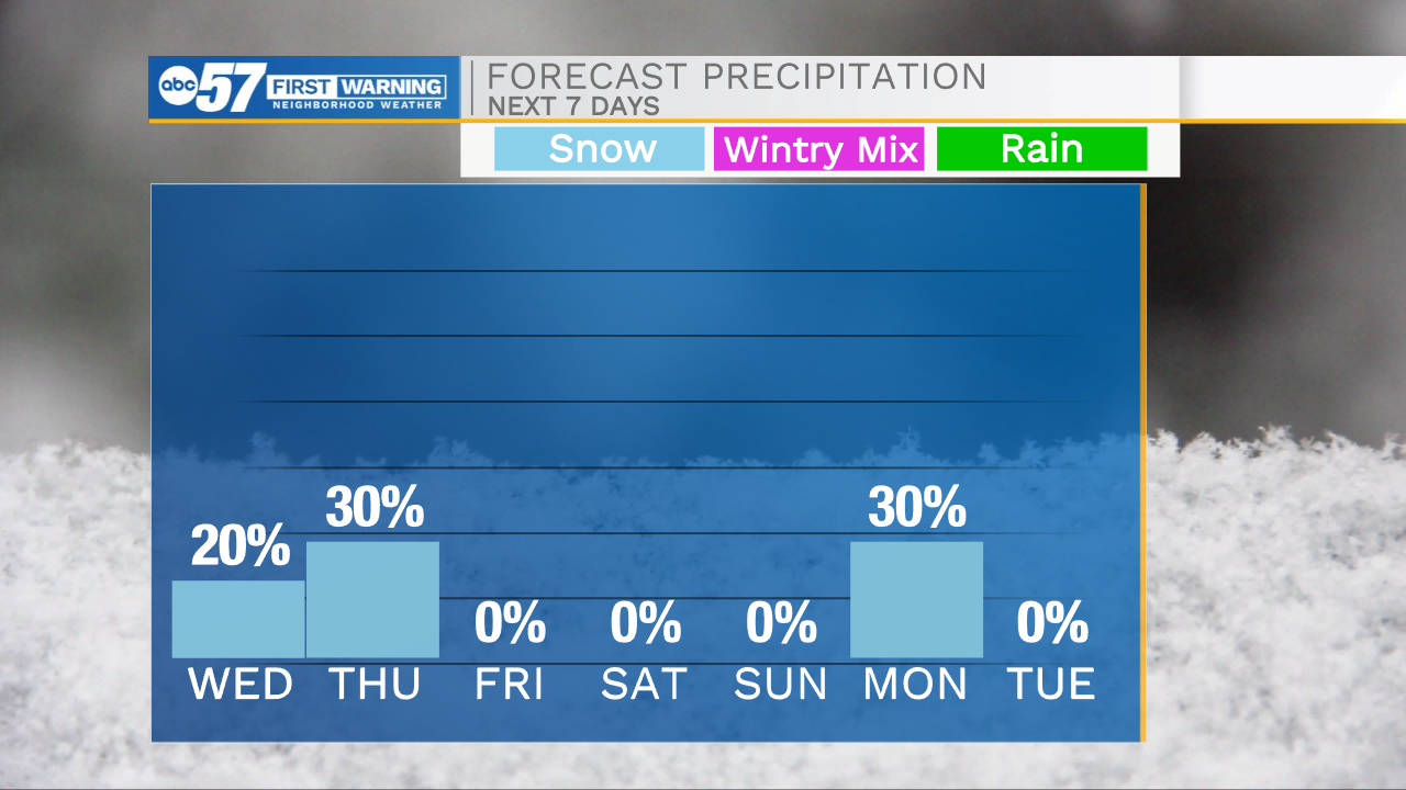
Temperatures rise above freezing Wednesday, before light rain/snow showers develop into the evening. The impact is low, but with a frozen ground, anything wet, will freeze, creating slick spots. Light snow is also possible Thursday morning, most likely flurries. The snowpack most likely maintains through the weekend as temperatures drop. The chance of snow this weekend is decreasing, and we may have to wait until Monday for a chance of snow.
Tonight: Partly cloudy, breezy. Low 26.
Wednesday: Mostly cloudy, evening rain/snow. High 38.
Thursday: AMFlurries. High 36.
Friday: Mostly cloudy. High 30
Sign up for the ABC 57 Newsletter